1900s (20th Century) Maps of Cherokee, California
Explore 8 historic maps of Cherokee from the 1900s (20th Century). These maps offer a rare glimpse into what life looked like during the 1900s — showing old roads, neighborhoods, homes, and landmarks that have changed or disappeared over time.
Whether you're researching your family's past, planning a metal detecting trip, or studying how Cherokee's landscape evolved across the 1900s, these high-resolution maps are a powerful tool for exploring the history of this region.
- Focus on a specific era: All maps on this page are from the 1900s, giving you a focused view of this time period.
- See what’s changed: Compare century-old streets, trails, and buildings to today's modern landscape using overlays and satellite layers.
- Research with precision: Use these maps for genealogy, historical research, land use analysis, or educational projects.
- View, download, or print: Maps are fully viewable online in high resolution, and can be downloaded or printed for your own records.
Start exploring Cherokee's history through authentic maps from the 1900s. This is your window into the past.
Cherokee, CA maps
(8)- 1947 Map of San Jose, 1948 Print
 1947 San Jose1948 Print · USGSNorthern California's heartland is captured here just after the war, showing the rapid growth of the Santa Clara and Central Valleys. Researchers can trace the legacy of rail and water at Castle Air Force Base, Stockton, and the Hetch Hetchy Aqueduct.
 - 1948 Map of Tuolumne, 1953 Print
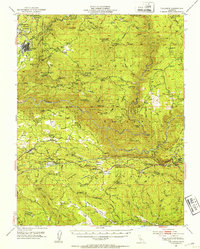 1948 Tuolumne1953 Print · USGSTuolumne County in the late 1940s reveals a rugged landscape of mining camps and early water infrastructure. Genealogists can trace family holdings like Murphy Ranch and Ralph Ranch alongside the historic Sierra RR and the Bret Harte Cabin.4 unique versions available
 - 1948 Map of Tuolumne, 1964 Print
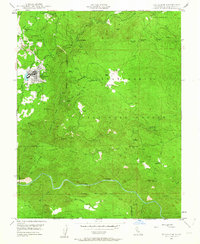 1948 Tuolumne1964 Print · USGSThe foothills of the Sierra Nevada come alive in the late 1940s, showing a landscape defined by gold mining and the deep canyons of the Tuolumne River. Genealogists and historians can trace family raches like Rogge Ranch or locate old operations such as the Providence Mine and Aqua Caliente Mine.3 unique versions available
 - 1949 Map of Tuolumne
 1949 Tuolumne1949 Print · USGSTuolumne and the Sierra foothills thrive as a timber and mining center in the late 1940s. Researchers can trace the narrow-gauge Westside Lumber Co RR and locate historic claims like the Columbus Mine or the Arastraville Sch.
 - 1956 Map of San Jose
 1956 San Jose1956 Print · USGSCentral California in the mid-fifties reveals the transition from sprawling orchards to growing urban hubs like San Jose and Stockton. Genealogists and historians can trace the rail-era landscape of the Mother Lode through Chinese Camp and Tuttletown, or follow the water through the Joaquin River and Calaveras Reservoir.
 - 1962 Map of San Jose
 1962 San Jose1962 Print · USGSCentral California in the early sixties showcases the expansion of the San Joaquin and Santa Clara valleys. Researchers can trace the rail-to-road transition along the Southern Pacific RR or locate landmarks like Castle USAF Base and Loma Prieta.4 unique versions available
 - 1966 Map of San Jose
 1966 San Jose1966 Print · USGSCentral California in the mid-1960s reveals a landscape of massive irrigation projects and expanding Cold War military footprints. Researchers can trace the rail-and-river network of the San Joaquin Valley or locate specialized sites like Castle Air Force Base and the Sharp General Depot (Military).
 - 1994 Map of Oakdale, 1995 Print
 1994 Oakdale1995 Print · USGSThe San Joaquin Valley meets the Sierra foothills in the mid-1990s, where massive reservoirs and canal networks fueled California's agricultural heartland. Researchers can trace the Hetch Hetchy Aqueduct, find the Sierra RR, and locate the Riverbank Army Ammunition Plant.2 unique versions available
End of results
Showing maps 1-8 of 8
Top cities near Cherokee
- Sonora historical maps
- Jamestown historical maps
- Sonora Meadows historical maps
- Groveland historical maps
Frequently asked questions
- What are the different types of historical maps available for Cherokee?
- What is the oldest map of Cherokee?
- Where can I purchase historical maps of Cherokee for my home or office?
- Where can I download high-res historical maps of Cherokee?
- Are there historical topographic maps available for Cherokee?
- Is there historical aerial imagery available for Cherokee?
- Where are historical maps of Cherokee sourced from?