1940s Maps of Crystal Falls, California
Explore 5 historic maps of Crystal Falls from the 1940s. These maps offer a rare glimpse into what life looked like during the 1940s — showing old roads, neighborhoods, homes, and landmarks that have changed or disappeared over time.
Whether you're researching your family's past, planning a metal detecting trip, or studying how Crystal Falls's landscape evolved across the 1940s, these high-resolution maps are a powerful tool for exploring the history of this region.
- Focus on a specific era: All maps on this page are from the 1940s, giving you a focused view of this time period.
- See what’s changed: Compare century-old streets, trails, and buildings to today's modern landscape using overlays and satellite layers.
- Research with precision: Use these maps for genealogy, historical research, land use analysis, or educational projects.
- View, download, or print: Maps are fully viewable online in high resolution, and can be downloaded or printed for your own records.
Start exploring Crystal Falls's history through authentic maps from the 1940s. This is your window into the past.
Crystal Falls, CA maps
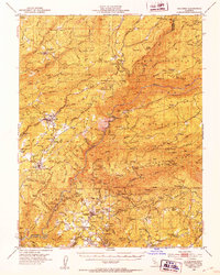
(5)- 1947 Map of Sacramento, 1948 Print
 1947 Sacramento1948 Print · USGSThe Sacramento Valley meets the high Sierra during a period of post-war expansion. Trace the historic river delta islands like Grand Island or locate early airfield footprints at McClellan Air Force Base and Mather Air Force Base.2 unique versions available
 - 1948 Map of Sacramento, 1951 Print
 1948 Sacramento1951 Print · USGSPost-war Northern California comes alive in this regional survey, capturing the era of expansion between the Central Valley and the High Sierra. Researchers can trace the rail networks of the Central California Traction and Sacramento Northern RR or locate landmarks like the State Capitol and University of California Davis.
 - 1948 Map of Columbia, 1953 Print
 1948 Columbia1953 Print · USGSTuolumne and Calaveras counties in the late 1940s reveal a landscape shaped by the gold rush and emerging state preservation. Genealogists can trace family homesteads near Columbia and Murphys, or locate industrial sites like the Sheep Ranch Mine and Experimental Mine.6 unique versions available
 - 1948 Map of Columbia SE, 1956 Print
 1948 Columbia SE1956 Print · USGSTuolumne County's mining history is preserved here in the years following the war, detailing a landscape shaped by gold extraction. Researchers can locate specific legacy sites like the Indian Girl Mine, the Belleview Sch, and the Phoenix Powerhouse.4 unique versions available
 - 1949 Map of Columbia SE
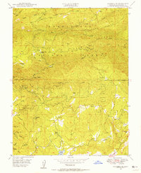
 1949 Columbia SE1949 Print · USGSThe Sierra Nevada foothills of Tuolumne County appear here in the late 1940s, a landscape still defined by its gold mining legacy and forest boundaries. Researchers can trace historic sites like American Camp Station, the Indian Girl Mine, and the Belleview Sch.
End of results
Showing maps 1-5 of 5
Top cities near Crystal Falls
- Sonora historical maps
- Jamestown historical maps
- Sonora Meadows historical maps
- Groveland historical maps
Frequently asked questions
- What are the different types of historical maps available for Crystal Falls?
- What is the oldest map of Crystal Falls?
- Where can I purchase historical maps of Crystal Falls for my home or office?
- Where can I download high-res historical maps of Crystal Falls?
- Are there historical topographic maps available for Crystal Falls?
- Is there historical aerial imagery available for Crystal Falls?
- Where are historical maps of Crystal Falls sourced from?