Old Maps of Spanish Hills, Camarillo for Metal Detecting
Plan your next treasure hunt with 15 historic maps of Spanish Hills. Find old homesites, ghost towns, trails, and gathering spots that may be lost to time — perfect for identifying promising metal detecting locations.
- Locate forgotten sites: Uncover places like long-lost settlements, abandoned rail lines, or gathering spots.
- Plan better hunts: Use map overlays combined with LiDAR or satellite views to narrow in on historically rich areas.
- Made for detectorists: Thousands of hobbyists use these maps to discover relics, coins, and hidden history.
Use these historic maps to boost your research and find new opportunities beneath the surface of Spanish Hills.
Spanish Hills, Camarillo maps
(15)- 1904 Map of Hueneme
 1904 Hueneme1904 Print · USGSCoastal Ventura County is shown here in the early 1900s, when ranching and rail transport shaped the fertile Oxnard Plain. Genealogists and historians can trace the early footprints of Oxnard, the port at Hueneme, and rural stops like Leesdale along the Southern Pacific R. R.5 unique versions available
 - 1942 Map of Hueneme
 1942 Hueneme1942 Print · USGSVentura County's coastal plain and agricultural heartland are shown here at the start of the 1940s. Genealogists and historians can trace early residential tracts at Silver Strand, the wartime growth of Port Hueneme, and the layout of Camarillo State Hospital.
 - 1943 Map of Hueneme
 1943 Hueneme1943 Print · USGSVentura County's coastal plains and ranch lands are captured here during the early 1940s. Genealogists and researchers can trace the rural school districts of Springville Sch, the vast grounds of Camarillo State Hospital, and early seaside developments like Silver Strand.
 - 1949 Map of Los Angeles
 1949 Los Angeles1949 Print · USGSSouthern California and the South Coast appear at the onset of the post-war boom, from the Channel Islands to the Mojave Desert. Trace early aviation sites like Lockheed Air Terminal and mining history at the Redrock Quicksilver Mine and Redrover Mine.2 unique versions available
 - 1950 Map of Camarillo, 1956 Print
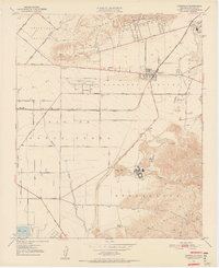 1950 Camarillo1956 Print · USGSVentura County at the dawn of the fifties reveals a thriving agricultural valley transitioning into a regional hub. Genealogists and historians can trace the footprint of Camarillo, the sprawling Camarillo State Hospital, and family landmarks like Broome Ranch.7 unique versions available
 - 1951 Map of Camarillo
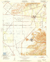 1951 Camarillo1951 Print · USGSVentura County's fertile coastal valleys are captured here in the early fifties during a period of significant institutional expansion. Researchers can trace the layout of the Camarillo State Hospital, the grounds of St Johns Seminary, and early rail operations along the Southern Pacific.
 - 1955 Map of Los Angeles
 1955 Los Angeles1955 Print · USGSThe mid-century transformation of Southern California comes into focus as the urban sprawl of Los Angeles meets the wilderness of the Santa Monica Mountains. Researchers can trace the development of post-war suburbs alongside historic landmarks like the Santa Barbara Lighthouse and early industrial sites such as the Good Luck Mine.
 - 1959 Map of Los Angeles
 1959 Los Angeles1959 Print · USGSCoastal California and the high desert met in a period of booming growth after the war. Researchers can trace early aviation and military history at the Point Mugu Air Missile Test Ctr or locate desert mining sites like the Double Eagle Mine.3 unique versions available
 - 1966 Map of Los Angeles
 1966 Los Angeles1966 Print · USGSSouthern California underwent a mid-century transformation as suburban grids reached the base of the San Gabriel Mountains. Researchers can trace the path of the Los Angeles Aqueduct or locate defense landmarks like Edwards Air Force Base.
 - 1975 Map of Los Angeles, 1977 Print
 1975 Los Angeles1977 Print · USGSSouthern California is captured in a period of significant growth during the mid-seventies, showing the urban sprawl from the coast to the high desert. Researchers can trace the development of the Pacific Coast Hwy and find aerospace landmarks like Edwards Air Force Base and the Flight Test Center (NASA).2 unique versions available
 - 1982 Map of Santa Barbara, 1983 Print
 1982 Santa Barbara1983 Print · USGSCoastal California in the early eighties exhibits a landscape of growing cities and massive military and academic footprints. Genealogists and historians can trace the Southern Pacific rail line through Santa Barbara or explore the boundaries of historic ranchos like Las Positas y Calera.3 unique versions available
 - 2012 Map of Camarillo, 2012 Print
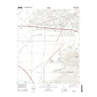
 2012 Camarillo2012 Print · USGSCovers Spanish Hills, including Oxnard, Thousand Oaks, and other nearby areas
 - 2015 Map of Camarillo, 2015 Print
 2015 Camarillo2015 Print · USGSCovers Spanish Hills, including Oxnard, Thousand Oaks, and other nearby areas
 - 2018 Map of Camarillo, 2018 Print
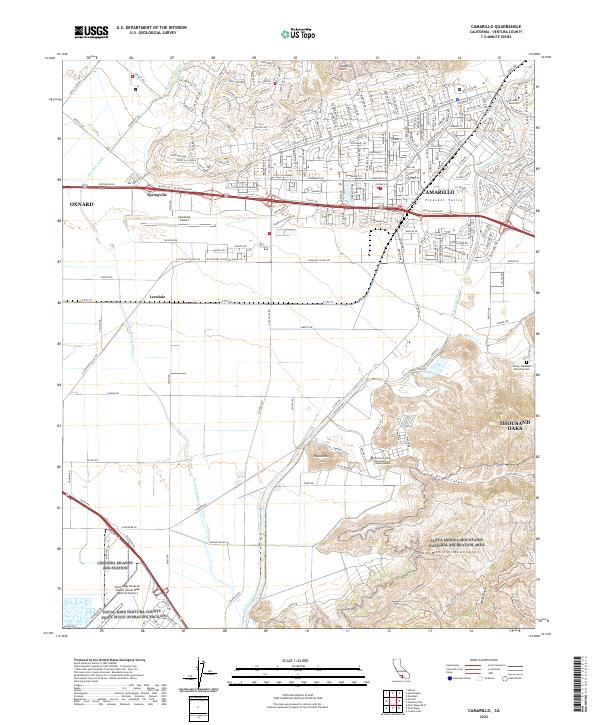
 2018 Camarillo2018 Print · USGSCovers Spanish Hills, including Oxnard, Thousand Oaks, and other nearby areas
 - 2022 Map of Camarillo, 2022 Print
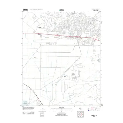
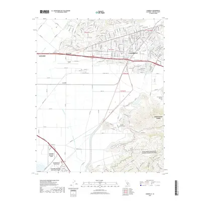
 2022 Camarillo2022 Print · USGSVentura County's coastal valley comes into focus in this contemporary survey of the corridor between Oxnard and Thousand Oaks. Researchers can trace the layout of Saint John's Seminary, the military grounds of Channel Islands ANG Station, and the slopes of the Santa Monica Mountains.
End of results
Showing maps 1-15 of 15
Frequently asked questions
- What are the different types of historical maps available for Spanish Hills?
- What is the oldest map of Spanish Hills?
- Where can I purchase historical maps of Spanish Hills for my home or office?
- Where can I download high-res historical maps of Spanish Hills?
- Are there historical topographic maps available for Spanish Hills?
- Is there historical aerial imagery available for Spanish Hills?
- Where are historical maps of Spanish Hills sourced from?