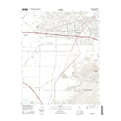
2015 Map of Camarillo
USGS Topo · Published 2015About this map
Camarillo serves as the focal point of this coastal California landscape, where the urban expansion of Oxnard and Thousand Oaks meets the productive agriculture of Pleasant Valley. The map documents a complex mix of mid-20th-century infrastructure and modern institutional growth, featuring the historic core of Old Town alongside the sprawling Camarillo Airport. The southern reaches are defined by the transition from flat valley floors to the foothills of the Santa Monica Mountains National Recreation Area, where California State University-Channel Islands occupies a prominent site near Round Mtn. Water management is central to the area's geography, with Calleguas Creek and Revolon Slough draining the plains. Significant military and industrial footprints are evident at the Point Mugu Naval Air Station and along the Union Pacific rail corridor that links these coastal communities.
Find a feature on this map
173 named features on this map. Tap any name to fly to it.
Don’t see what you’re looking for? This feature index may not catch every label — zoom into the map to look around manually.
Map Details
Editions of this 2015 Camarillo Map
This is the sole edition of this map. No revisions or reprints were ever made.
Other maps of this area

1900 · Triunfo Pass
USGS Topo · 1:62,500

1900 · Piru
USGS Topo · 1:62,500

1903 · Santa Paula
USGS Topo · 1:62,500

1903 · Camulos
USGS Topo · 1:125,000

1904 · Hueneme
USGS Topo · 1:62,500

1921 · Piru
USGS Topo · 1:62,500

1921 · Triunfo Pass
USGS Topo · 1:62,500

1941 · Piru
USGS Topo · 1:62,500

1942 · Santa Paula
USGS Topo · 1:62,500

1942 · Hueneme
USGS Topo · 1:62,500