Old Maps of Capay, California
Explore 17 old maps of Capay, spanning from 1905 to today. These high-resolution historic maps reveal how streets, neighborhoods, landmarks, and natural features evolved over time — perfect for genealogy, metal detecting, research, and local history exploration.
What you can do with these maps:
- See how Capay changed over time: Compare historical maps to modern-day views to trace roads, homesites, rail lines & more.
- View detailed metadata: Each map includes creators, publishers, year, scale, and archive source.
- Overlay maps with satellite & LiDAR: Visualize the past alongside modern tools to explore terrain & human change.
- Trusted historical sources: Maps sourced from the USGS, Library of Congress, and other archives.
- Access maps your way: View online, download high-res files, or order prints for personal or research use.
Start exploring old maps of Capay to uncover forgotten places, hidden landmarks, and the deep history beneath your feet.
Capay, CA maps
(17)- 1905 Map of Esparto, 1957 Print
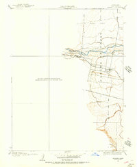 1905 Esparto1957 Print · USGSWestern Yolo County at the turn of the century shows a landscape being transformed by irrigation and rail. Trace the early layout of Esparto and Capay along the Southern Pacific line and the extensive network of the Adams Canal.
 - 1916 Map of Esparto
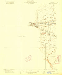 1916 Esparto1916 Print · USGSYolo County's western valley is captured here as a burgeoning rail and irrigation hub in the early 1900s. Genealogists and historians can trace the early layout of Esparto and Capay along the Southern Pacific line and the Adams Canal.2 unique versions available
 - 1924 Map of Capay
 1924 Capay1924 Print · USGSYolo County during the mid-1910s reveals a landscape of early irrigation and rail-dependent settlements. Researchers can trace the Southern Pacific line through Capay and Esparto or locate now-submerged sites like Monticello and the Scribner's Estate.
 - 1943 Map of Capay, 1945 Print
 1943 Capay1945 Print · USGSYolo and Napa counties are captured here in the mid-1940s, documenting the valley floor and ridge-lines before the creation of Lake Berryessa. Researchers can trace family ranch lands and lost school sites like Monticello, Oak Grove Sch, and Gunn Ranch.
 - 1945 Map of Capay
 1945 Capay1945 Print · USGSThe Berryessa and Capay valleys appear here in the final years before the creation of Lake Berryessa, documenting a lost agricultural landscape. Genealogists can trace family ranch holdings like Scott Ranch and Corbin Ranch alongside rural landmarks like Monticello and Apricot Sch.
 - 1947 Map of Santa Rosa
 1947 Santa Rosa1947 Print · USGSNorthern California in the late 1940s was a landscape of agricultural valleys and vital rail hubs. Trace the historic routes of the Northwestern Pacific through Healdsburg or explore the mid-century waterfronts of Vallejo and Benicia near Mare Island.
 - 1949 Map of Santa Rosa
 1949 Santa Rosa1949 Print · USGSThe North Bay and Wine Country appear here in the late 1940s, when the Northwestern Pacific RR still dominated regional transit. Genealogists and historians can trace old coastal outposts like Anchor Bay Settlement and the early layout of Santa Rosa.2 unique versions available
 - 1958 Map of Santa Rosa, 1968 Print
 1958 Santa Rosa1968 Print · USGSThe North Bay and Wine Country are captured in the mid-twentieth century as the region balanced its agricultural roots with a growing military and recreational footprint. Researchers can trace the Northwestern Pacific RR through the Russian River valley or locate landmarks like the Petaluma Adobe Historical Monument and The Geysers Resort.3 unique versions available
 - 1959 Map of Lake Berryessa, 1961 Print
 1959 Lake Berryessa1961 Print · USGSThe Yolo and Napa County borderlands are seen here just after the completion of the Monticello Dam. Researchers can trace early recreational sites like Spanish Flat Resort and the Southern Pacific rail line through Esparto.2 unique versions available
 - 1959 Map of Esparto, 1961 Print
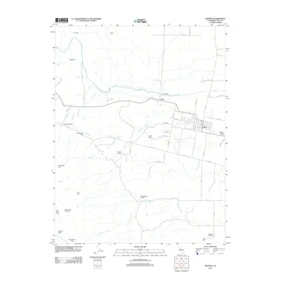
 1959 Esparto1961 Print · USGSThe Capay Valley in the late 1950s is captured here at the height of its rail-and-canal agricultural development. Researchers can trace family history through the Capay Cem, the local High School in Esparto, and landmarks like Corbin Ranch.5 unique versions available
 - 1962 Map of Santa Rosa
 1962 Santa Rosa1962 Print · USGSThe North Bay and Wine Country were entering a period of significant growth in the early sixties, anchored by established rail corridors and coastal maritime commerce. Genealogists and historians can trace the development of Santa Rosa, locate the Mare Island Naval Shipyard, and follow the Northwestern Pacific RR through the Cotati Valley.
 - 1964 Map of Santa Rosa
 1964 Santa Rosa1964 Print · USGSThe North Bay and Wine Country appear in the mid-fifties during a period of significant military and educational growth. Trace old rail lines like the Northwestern Pacific RR and explore historic sites from Petaluma to the Benicia Arsenal.
 - 1972 Map of Healdsburg, 1975 Print
 1972 Healdsburg1975 Print · USGSNorthern California wine country and the lower Lake County basins appear here during the early seventies. Trace the Northwestern Pacific rail line and discover foothill communities like Middletown and Loch Lomond.2 unique versions available
 - 2012 Map of Esparto, 2012 Print
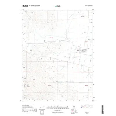
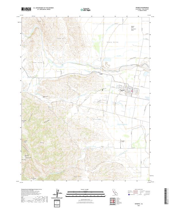
 2012 Esparto2012 Print · USGSCovers Capay, including Esparto, Yolo County, and other nearby areas
 - 2015 Map of Esparto, 2015 Print
 2015 Esparto2015 Print · USGSCovers Capay, including Esparto, Yolo County, and other nearby areas
 - 2018 Map of Esparto, 2018 Print
 2018 Esparto2018 Print · USGSCovers Capay, including Esparto, Yolo County, and other nearby areas
 - 2021 Map of Esparto, 2021 Print
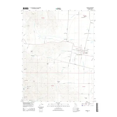
 2021 Esparto2021 Print · USGSYolo County's agricultural heartland and the western valley edge are documented here in the early twenty-first century. Researchers can trace the irrigation networks of Winters Canal and Hungry Hollow Canal or locate local landmarks like Capay Cem and Ala Doble Airport.
End of results
Showing maps 1-17 of 17
Top cities near Capay
Frequently asked questions
- What are the different types of historical maps available for Capay?
- What is the oldest map of Capay?
- Where can I purchase historical maps of Capay for my home or office?
- Where can I download high-res historical maps of Capay?
- Are there historical topographic maps available for Capay?
- Is there historical aerial imagery available for Capay?
- Where are historical maps of Capay sourced from?