Old Maps of Yolo County, California
Explore 243 old maps of Yolo County, spanning from 1902 to today. These high-resolution historic maps reveal how streets, neighborhoods, landmarks, and natural features evolved over time — perfect for genealogy, metal detecting, research, and local history exploration.
What you can do with these maps:
- See how Yolo County changed over time: Compare historical maps to modern-day views to trace roads, homesites, rail lines & more.
- View detailed metadata: Each map includes creators, publishers, year, scale, and archive source.
- Overlay maps with satellite & LiDAR: Visualize the past alongside modern tools to explore terrain & human change.
- Trusted historical sources: Maps sourced from the USGS, Library of Congress, and other archives.
- Access maps your way: View online, download high-res files, or order prints for personal or research use.
Start exploring old maps of Yolo County to uncover forgotten places, hidden landmarks, and the deep history beneath your feet.
Yolo County, CA maps
(243)- 1902 Map of Napa
 1902 Napa1902 Print · USGSThe Napa Valley and Carquinez Strait are captured at the turn of the century, showing a landscape defined by maritime military posts and early vineyards. Genealogists and historians can trace the Mare Island Navy Yard, the Insane Asylum, and rail stops at Zinfandel and Rutherford.6 unique versions available
 - 1905 Map of Harrington, 1956 Print
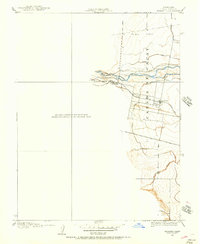
 1905 Harrington1956 Print · USGSThe Sacramento Valley at the start of the twentieth century was a landscape of rail-dependent agriculture and seasonal creeks. Genealogists and historians can trace the early layout of Harrington and the path of the Southern Pacific Railroad as it crosses from Colusa into Yolo County.
 - 1905 Map of Esparto, 1957 Print
 1905 Esparto1957 Print · USGSWestern Yolo County at the turn of the century shows a landscape being transformed by irrigation and rail. Trace the early layout of Esparto and Capay along the Southern Pacific line and the extensive network of the Adams Canal.
 - 1907 Map of Dunnigan
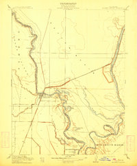
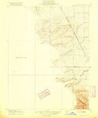
 1907 Dunnigan1907 Print · USGSThe Sacramento Valley in the early 1900s is defined by its busy river landings and the emerging rail corridor. Genealogists can trace family footprints at Zamora Blacks Station P O or follow the river to Cranmore Landing and Derby Camp.3 unique versions available
 - 1907 Map of Woodland
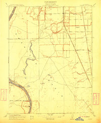
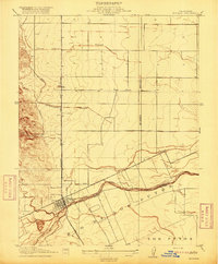
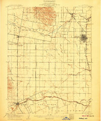 1907 Woodland1907 Print · USGSYolo County at the turn of the century reveals a landscape defined by early irrigation and the expansion of the Southern Pacific Railroad. Genealogists can trace family locations near Woodland, Madison, and the rural Union School.2 unique versions available
 - 1907 Map of Davisville
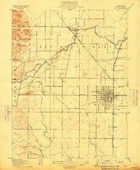
 1907 Davisville1907 Print · USGSYolo and Sacramento counties are captured here at a pivot point for river transit and rail growth. Researchers can trace early rural life via the Lisbon School, Taylor Monument Datey's Ferry, and the original footprint of Davisville.2 unique versions available
 - 1908 Map of Vacaville
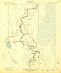
 1908 Vacaville1908 Print · USGSNorthern California's agricultural heartland is captured here at the start of the century, centered on the rail corridors of the Southern Pacific. Genealogists can trace early homesteads and rail stops like Elmira, Maine Prairie, and the Cement Mill.3 unique versions available
 - 1908 Map of Courtland
 1908 Courtland1908 Print · USGSThe Sacramento Delta at the dawn of the twentieth century was a landscape of fertile river islands and vital waterborne transit. Genealogists and historians can trace the early footprints of Courtland, Clarksburg, and Freeport, or locate landmarks like the Free County Ferry and Indian Mound.3 unique versions available
 - 1910 Map of Knights Landing
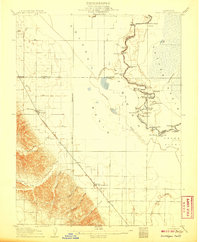
 1910 Knights Landing1910 Print · USGSIn the early 1900s, the Sacramento Valley landscape was a network of winding river bends and sloughs centered on the rail-and-river hub of Knights Landing. You can trace old waterways and rail lines like the Southern Pacific Branch and search for family landmarks near Mc Griff Lakes or Mary Lake.2 unique versions available
 - 1910 Map of Vernon
 1910 Vernon1910 Print · USGSThe river-and-rail economy of Sutter County comes alive in the early 1900s at the confluence of the Sacramento and Feather rivers. Researchers can trace the landing sites at Vernon Landing, early post offices like Vernon Verona P. O., and rural schoolhouses such as Lee School.2 unique versions available
 - 1915 Map of Yolo
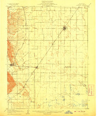
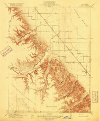
 1915 Yolo1915 Print · USGSThe Yolo County plains are shown here at a time of rapid agricultural growth, as rail lines and irrigation canals reshaped the valley. Trace the early layout of Woodland and the vanished rail sidings at Mill Spur and Elvaton.
 - 1915 Map of Swingle
 1915 Swingle1915 Print · USGSThe rail-driven landscape around Davis is captured here during the early twentieth century, showing the critical junction of two Southern Pacific lines. Researchers can trace early settlements and rail stops like Swingle, Briggston, and Webster along the banks of Putah Creek.
 - 1915 Map of Ronda
 1915 Ronda1915 Print · USGSThe Sacramento Valley comes alive in this early century survey of the Yolo and Sutter county lines. Researchers can trace the shifting riverbank at Rough and Ready Landing or follow the Southern Pacific (Woodland Line) through Ronda.
 - 1915 Map of Kirkville
 1915 Kirkville1915 Print · USGSThe Sacramento River valley at the turn of the century was a landscape of winding oxbows and essential steamboat stops. Genealogists can trace family-named river points like Poffenberger's Landing, Miller's Landing, and the early settlement at Kirkville.
 - 1915 Map of Elkhorn Weir
 1915 Elkhorn Weir1915 Print · USGSThe Sacramento Valley in the early 1900s was a landscape defined by the river and its vast basins. Genealogists and historians can trace early landings and river crossings at Datey's Ferry, Mound Ranch, and the Elkhorn Weir.
 - 1915 Map of Merritt
 1915 Merritt1915 Print · USGSYolo County was a burgeoning agricultural hub in the early twentieth century, defined by its complex network of sloughs and canals. Researchers can trace the early irrigation patterns of Putah Creek and locate vanished rail sidings like Elston Spur and the settlement of Plainfield.
 - 1916 Map of Grays Bend
 1916 Grays Bend1916 Print · USGSYolo County at the start of the twentieth century shows a landscape transitioning through large-scale drainage and rail expansion. Genealogists can trace family-named sites like Langenour and Curtis along the Sacramento and Woodland rail line.
 - 1916 Map of Jacobs Corner
 1916 Jacobs Corner1916 Print · USGSYolo County agriculture is in full bloom during the early twentieth century as irrigation canals reshape the valley. Trace the early water systems and rail stops at Madison, Citrona, and the Southern Pacific (Clear Lake Branch) railroad.
 - 1916 Map of Cache Slough
 1916 Cache Slough1916 Print · USGSThe California Delta at the turn of the century is captured in this survey of the marshlands between Solano and Yolo counties. Researchers can trace the original paths of Cache Slough and Miner Slough or locate the Oakland Antioch and Eastern rail line.
 - 1916 Map of Harrington
 1916 Harrington1916 Print · USGSColusa and Yolo counties appear here in the early twentieth century as a rail-centered agricultural corridor. Genealogists and historians can trace the path of the Southern Pacific Woodland Line through the settlement of Harrington and along Petroleum Creek.3 unique versions available
 - 1916 Map of Hershey
 1916 Hershey1916 Print · USGSCentral Valley agriculture and rail transport meet in the early twentieth century near the Colusa-Yolo border. Researchers can trace the early layout of Dunnigan and the shipping point at Hershey along the Southern Pacific (Woodland Line).
 - 1916 Map of Lovdal
 1916 Lovdal1916 Print · USGSNear the confluence of the American and Sacramento Rivers in the early 1900s, this area shows a landscape defined by levees and early rail lines. Genealogists and historians can locate the Lisbon School, the Washington Broderick P O, and industry at the Brickyard.
 - 1916 Map of Zamora
 1916 Zamora1916 Print · USGSYolo County at the turn of the century shows a landscape of developing rail towns and irrigation basins. You can trace the Southern Pacific line through Zamora, Bretona, and Wycoff, or locate landmarks like Cottonwood Spring and Oat Valley.2 unique versions available
 - 1916 Map of Vorden
 1916 Vorden1916 Print · USGSThe Sacramento River delta was a bustling network of river landings and island farms in the early twentieth century. Genealogists and historians can trace the foundations of Courtland, Vorden, and Paintersville, or locate river infrastructure like Pier 13 and the ferry.
 - 1916 Map of Winters
 1916 Winters1916 Print · USGSThe agricultural plains of Yolo County are captured here in the early twentieth century as the irrigation and rail networks were maturing. Local historians can trace the original Southern Pacific rail line, the rural Union School, and the early layout of Winters along the banks of Putah Creek.
Showing maps 1-25 of 243
Top cities of Yolo County
- Davis historical maps
- Woodland historical maps
- West Sacramento historical maps
- Winters historical maps
- Esparto historical maps
- El Macero historical maps
Frequently asked questions
- What are the different types of historical maps available for Yolo County?
- What is the oldest map of Yolo County?
- Where can I purchase historical maps of Yolo County for my home or office?
- Where can I download high-res historical maps of Yolo County?
- Are there historical topographic maps available for Yolo County?
- Is there historical aerial imagery available for Yolo County?
- Where are historical maps of Yolo County sourced from?