Old Maps of Winters, California
Explore 29 old maps of Winters, spanning from 1907 to today. These high-resolution historic maps reveal how streets, neighborhoods, landmarks, and natural features evolved over time — perfect for genealogy, metal detecting, research, and local history exploration.
What you can do with these maps:
- See how Winters changed over time: Compare historical maps to modern-day views to trace roads, homesites, rail lines & more.
- View detailed metadata: Each map includes creators, publishers, year, scale, and archive source.
- Overlay maps with satellite & LiDAR: Visualize the past alongside modern tools to explore terrain & human change.
- Trusted historical sources: Maps sourced from the USGS, Library of Congress, and other archives.
- Access maps your way: View online, download high-res files, or order prints for personal or research use.
Start exploring old maps of Winters to uncover forgotten places, hidden landmarks, and the deep history beneath your feet.
Winters, CA maps
(29)- 1907 Map of Woodland
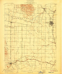 1907 Woodland1907 Print · USGSYolo County at the turn of the century reveals a landscape defined by early irrigation and the expansion of the Southern Pacific Railroad. Genealogists can trace family locations near Woodland, Madison, and the rural Union School.2 unique versions available
 - 1916 Map of Winters
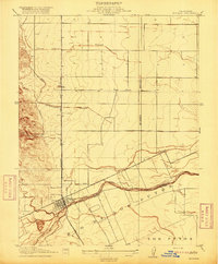 1916 Winters1916 Print · USGSThe agricultural plains of Yolo County are captured here in the early twentieth century as the irrigation and rail networks were maturing. Local historians can trace the original Southern Pacific rail line, the rural Union School, and the early layout of Winters along the banks of Putah Creek.
 - 1924 Map of Capay
 1924 Capay1924 Print · USGSYolo County during the mid-1910s reveals a landscape of early irrigation and rail-dependent settlements. Researchers can trace the Southern Pacific line through Capay and Esparto or locate now-submerged sites like Monticello and the Scribner's Estate.
 - 1941 Map of Woodland
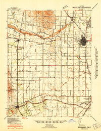 1941 Woodland1941 Print · USGSYolo County is captured here at the height of its pre-war agricultural expansion, dominated by an intricate network of irrigation canals and rail lines. Researchers can trace rural schoolhouse locations like Clover School and Gordon School or identify early landmarks such as the Yolo Fliers Club and the Airplane Beacon.
 - 1943 Map of Capay, 1945 Print
 1943 Capay1945 Print · USGSYolo and Napa counties are captured here in the mid-1940s, documenting the valley floor and ridge-lines before the creation of Lake Berryessa. Researchers can trace family ranch lands and lost school sites like Monticello, Oak Grove Sch, and Gunn Ranch.
 - 1945 Map of Capay
 1945 Capay1945 Print · USGSThe Berryessa and Capay valleys appear here in the final years before the creation of Lake Berryessa, documenting a lost agricultural landscape. Genealogists can trace family ranch holdings like Scott Ranch and Corbin Ranch alongside rural landmarks like Monticello and Apricot Sch.
 - 1947 Map of Santa Rosa
 1947 Santa Rosa1947 Print · USGSNorthern California in the late 1940s was a landscape of agricultural valleys and vital rail hubs. Trace the historic routes of the Northwestern Pacific through Healdsburg or explore the mid-century waterfronts of Vallejo and Benicia near Mare Island.
 - 1947 Map of Sacramento, 1948 Print
 1947 Sacramento1948 Print · USGSThe Sacramento Valley meets the high Sierra during a period of post-war expansion. Trace the historic river delta islands like Grand Island or locate early airfield footprints at McClellan Air Force Base and Mather Air Force Base.2 unique versions available
 - 1948 Map of Sacramento, 1951 Print
 1948 Sacramento1951 Print · USGSPost-war Northern California comes alive in this regional survey, capturing the era of expansion between the Central Valley and the High Sierra. Researchers can trace the rail networks of the Central California Traction and Sacramento Northern RR or locate landmarks like the State Capitol and University of California Davis.
 - 1949 Map of Santa Rosa
 1949 Santa Rosa1949 Print · USGSThe North Bay and Wine Country appear here in the late 1940s, when the Northwestern Pacific RR still dominated regional transit. Genealogists and historians can trace old coastal outposts like Anchor Bay Settlement and the early layout of Santa Rosa.2 unique versions available
 - 1953 Map of Winters, 1954 Print
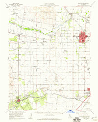
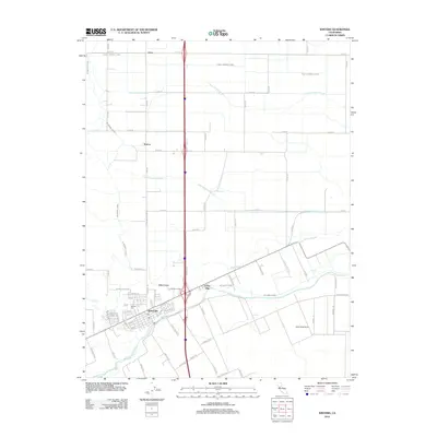
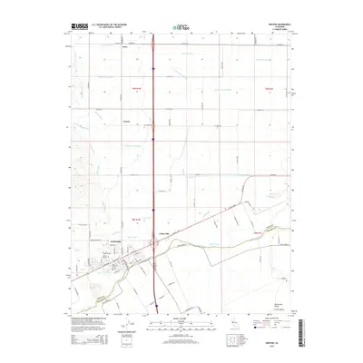
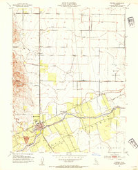 1953 Winters1954 Print · USGSThe Yolo-Solano border comes alive in this mid-century survey of the agricultural valley floor and rising foothills. Local historians can trace the Southern Pacific rail line through Arroz or locate rural landmarks like Buckeye School and Putah Creek.6 unique versions available
 - 1953 Map of Woodland, 1959 Print
 1953 Woodland1959 Print · USGSWoodland and the Central Valley are captured here in the early fifties as the region's agricultural and rail infrastructure matured. Genealogists can locate family landmarks like the Cottonwood Cemetery and numerous rural schools including Fairfield Sch and Wolfskill Sch.2 unique versions available
 - 1956 Map of Sacramento
 1956 Sacramento1956 Print · USGSMid-century California unfolds from the delta to the high Sierra, capturing a landscape of growing valley cities and burgeoning military airbases. Genealogists and historians can trace the rail lines and river towns from Woodland to Lodi, or explore the foothill settlements of Placerville and Jackson.2 unique versions available
 - 1957 Map of Sacramento, 1966 Print
 1957 Sacramento1966 Print · USGSIn the mid-twentieth century, the California heartland was a hub of river transport, rail lines, and military airbases. Genealogists and historians can trace the development of Gold Country towns like Angels Camp and Sonora or follow the path of the Southern Pacific RR through the growing suburbs of Sacramento.4 unique versions available
 - 1958 Map of Santa Rosa, 1968 Print
 1958 Santa Rosa1968 Print · USGSThe North Bay and Wine Country are captured in the mid-twentieth century as the region balanced its agricultural roots with a growing military and recreational footprint. Researchers can trace the Northwestern Pacific RR through the Russian River valley or locate landmarks like the Petaluma Adobe Historical Monument and The Geysers Resort.3 unique versions available
 - 1959 Map of Lake Berryessa, 1961 Print
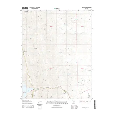
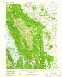 1959 Lake Berryessa1961 Print · USGSThe Yolo and Napa County borderlands are seen here just after the completion of the Monticello Dam. Researchers can trace early recreational sites like Spanish Flat Resort and the Southern Pacific rail line through Esparto.2 unique versions available
 - 1959 Map of Monticello Dam, 1961 Print
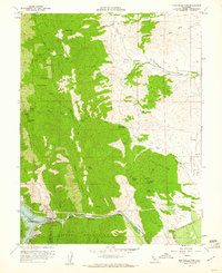 1959 Monticello Dam1961 Print · USGSThe foothills of the Vaca Mountains meet the Sacramento Valley in the late fifties as Lake Berryessa forms behind the new Monticello Dam. Local researchers can trace family lands like Cowell Ranch and investigate early energy sites like the Gas Well clusters on the eastern plains.4 unique versions available
 - 1962 Map of Santa Rosa
 1962 Santa Rosa1962 Print · USGSThe North Bay and Wine Country were entering a period of significant growth in the early sixties, anchored by established rail corridors and coastal maritime commerce. Genealogists and historians can trace the development of Santa Rosa, locate the Mare Island Naval Shipyard, and follow the Northwestern Pacific RR through the Cotati Valley.
 - 1964 Map of Santa Rosa
 1964 Santa Rosa1964 Print · USGSThe North Bay and Wine Country appear in the mid-fifties during a period of significant military and educational growth. Trace old rail lines like the Northwestern Pacific RR and explore historic sites from Petaluma to the Benicia Arsenal.
 - 1972 Map of Healdsburg, 1975 Print
 1972 Healdsburg1975 Print · USGSNorthern California wine country and the lower Lake County basins appear here during the early seventies. Trace the Northwestern Pacific rail line and discover foothill communities like Middletown and Loch Lomond.2 unique versions available
 - 1994 Map of Sacramento
 1994 Sacramento1994 Print · USGSThe Sacramento valley was a landscape of massive flood control and military aviation during the mid-nineties. Researchers can trace the complex network of the Yolo Bypass and the Sacramento River alongside McClellan Air Force Base and Zamora.2 unique versions available
 - 2012 Map of Monticello Dam, 2012 Print
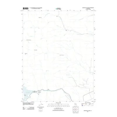 2012 Monticello Dam2012 Print · USGSCovers Winters, including Solano County, Yolo County, and other nearby areas
 - 2012 Map of Winters, 2012 Print
 2012 Winters2012 Print · USGSCovers Winters, including Norton, El Rio Villa, and other nearby areas
 - 2015 Map of Winters, 2015 Print
 2015 Winters2015 Print · USGSCovers Winters, including Norton, El Rio Villa, and other nearby areas
 - 2015 Map of Monticello Dam, 2015 Print
 2015 Monticello Dam2015 Print · USGSCovers Winters, including Solano County, Yolo County, and other nearby areas
Showing maps 1-25 of 29
Top cities near Winters
- Fairfield historical maps
- Vacaville historical maps
- Davis historical maps
- Woodland historical maps
- Dixon historical maps
- Esparto historical maps
Frequently asked questions
- What are the different types of historical maps available for Winters?
- What is the oldest map of Winters?
- Where can I purchase historical maps of Winters for my home or office?
- Where can I download high-res historical maps of Winters?
- Are there historical topographic maps available for Winters?
- Is there historical aerial imagery available for Winters?
- Where are historical maps of Winters sourced from?