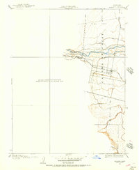
1905 Map of Esparto
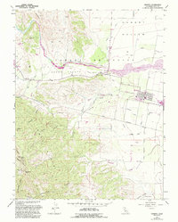
USGS Topo · Published 1957About this map
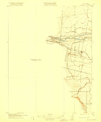
Cañada De Capay and the surrounding agricultural landscape of western Yolo County are captured here at the start of the 20th century. The settlement of Esparto serves as a central hub, situated where the Southern Pacific railroad line intersects with the Clear Lake Br. roadway. The irrigation infrastructure that drove the region's development is prominently featured, including the Adams Canal, Capay Canal, and a Brush Dam located along Cache Creek. North of the creek, the terrain transitions into the appropriately named Hungry Hollow. This 1905 survey, conducted under geographer E. M. Douglas, provides a detailed look at the water-management systems and transportation corridors that transformed this valley into a productive farming district. Further south, the meandering course of Cottonwood Slough illustrates the natural drainage patterns of the valley before further modernization took hold.
Find a feature on this map
13 named features on this map. Tap any name to fly to it.
Don’t see what you’re looking for? This feature index may not catch every label — zoom into the map to look around manually.
Map Details
Editions of this 1905 Esparto Map
This is the sole edition of this map. No revisions or reprints were ever made.
Historical Maps of Esparto Through Time
7 maps found