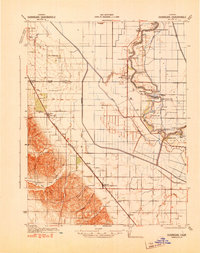
1941 Map of Dunnigan
USGS Topo · Published 1941About this map
The Sacramento River defines the eastern geography of this Yolo County region, winding through a complex series of sharp river bends including Steiner Bend and Ministerial Bend. This 1941 survey, revised from aerial photography by the 82nd Observation Squadron, documents a transition from the river-based commerce of the 19th century to a modern rail-and-road corridor. Steamboat landings like Millers Landing and Howells Landing dot the riverbanks, while the Southern Pacific railroad line to the west anchors settlements like Dunnigan and Zamora Blacks Station P O. The agricultural landscape is clearly partitioned by the Mt Diablo Meridian, with rural infrastructure evidenced by Salem Sch and Johns District Sch. Between the tracks and the water, large drainage features like Sycamore Slough cut across the flat valley floor toward the foothills of Oat Valley.
Find a feature on this map
49 named features on this map. Tap any name to fly to it.
Don’t see what you’re looking for? This feature index may not catch every label — zoom into the map to look around manually.
Map Details
Editions of this 1941 Dunnigan Map
This is the sole edition of this map. No revisions or reprints were ever made.
Other maps of this area

1888 · Marysville
USGS Topo · 1:125,000

1891 · Marysville
USGS Topo · 1:125,000

1894 · Marysville
USGS Topo · 1:125,000

1895 · Marysville
USGS Topo · 1:125,000

1905 · Harrington
USGS Topo · 1:24,000

1905 · Esparto
USGS Topo · 1:24,000

1907 · Dunnigan
USGS Topo · 1:62,500

1907 · Colusa
USGS Topo · 1:62,500

1907 · Woodland
USGS Topo · 1:62,500

1907 · Davisville
USGS Topo · 1:62,500