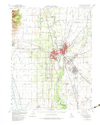
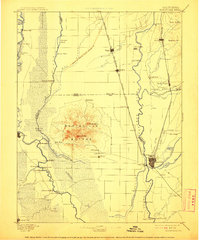
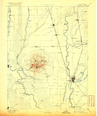
1895 Map of Marysville
USGS Topo · Published 1895About this map
The Marysville Buttes rise abruptly from the surrounding floor of the Sacramento Valley, forming a circular volcanic monument at the center of this late 19th-century landscape. This survey documents the complex hydrological network of the Sacramento River and Feather River, where numerous sloughs and seasonal waterways like Butte Sink and Jack Slough defined the region's agricultural and transit boundaries. The area's dependence on river travel is evident through the many river crossings such as Princeton Ferry, Moons Ferry, and Dunns Ferry, alongside riverbank settlements like Grimes Landing and Starrs Landing.
Find a feature on this map
73 named features on this map. Tap any name to fly to it.
Don’t see what you’re looking for? This feature index may not catch every label — zoom into the map to look around manually.
Map Details
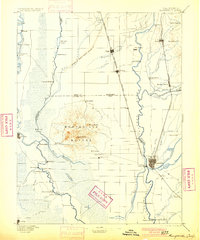
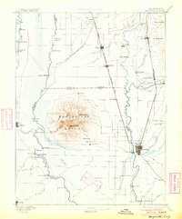
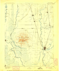
Editions of this 1895 Marysville Map
6 editions found
Historical Maps of Yuba City Through Time
5 maps found