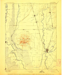
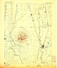
1895 Map of Marysville
USGS Topo · Published 1911About this map
The Marysville Buttes rise abruptly from the surrounding valley floor, serving as the central landmark for this late-19th-century survey of the Sacramento Valley. The landscape is defined by its complex hydraulic history, evident in the Levees of Spring Valley Mining Co and the intricate network of watercourses including the Sacramento River, Feather River, and the marshy Butte Sink. This was an era of intense river commerce and emerging rail connectivity, where ferries were essential for regional travel.
Find a feature on this map
76 named features on this map. Tap any name to fly to it.
Don’t see what you’re looking for? This feature index may not catch every label — zoom into the map to look around manually.
Map Details
Editions of this 1895 Marysville Map
6 editions found

Other maps of this area

1888 · Marysville
USGS Topo · 1:125,000

1888 · Smartsville
USGS Topo · 1:125,000

1888 · Bidwell Bar
USGS Topo · 1:125,000

1891 · Bidwell Bar
USGS Topo · 1:125,000

1891 · Chico
USGS Topo · 1:125,000

1891 · Sacramento
USGS Topo · 1:125,000

1891 · Marysville
USGS Topo · 1:125,000

1891 · Smartsville
USGS Topo · 1:125,000

1892 · Sacramento
USGS Topo · 1:125,000

1892 · Smartsville
USGS Topo · 1:125,000