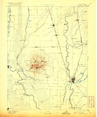
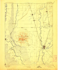
1895 Map of Marysville
USGS Topo · Published 1920About this map
The Marysville Buttes dominate the central valley landscape, rising sharply above the fertile floodplains of the Sacramento River and Feather River. This late nineteenth-century survey captures a region defined by its complex hydrology and the engineering efforts to manage it, most notably the Levees of Spring Valley Mining Co near Biggs. The twin settlements of Marysville and Yuba City serve as the primary hubs at the confluence of the Feather and Yuba River, surrounded by a network of landings and ferries such as Dunns Ferry and Starrs Landing that facilitated the transport of agricultural goods.
Find a feature on this map
76 named features on this map. Tap any name to fly to it.
Don’t see what you’re looking for? This feature index may not catch every label — zoom into the map to look around manually.
Map Details
Editions of this 1895 Marysville Map
6 editions found

Other maps of this area

1888 · Marysville
USGS Topo · 1:125,000

1888 · Smartsville
USGS Topo · 1:125,000

1888 · Bidwell Bar
USGS Topo · 1:125,000

1891 · Bidwell Bar
USGS Topo · 1:125,000

1891 · Chico
USGS Topo · 1:125,000

1891 · Sacramento
USGS Topo · 1:125,000

1891 · Marysville
USGS Topo · 1:125,000

1891 · Smartsville
USGS Topo · 1:125,000

1892 · Sacramento
USGS Topo · 1:125,000

1892 · Smartsville
USGS Topo · 1:125,000