Old Maps of Alamosa County, Colorado for Hiking & Exploration
Hike through history with 176 historic maps of Alamosa County. Explore old trails, ghost towns, and forgotten backroads — perfect for outdoor adventurers and local explorers.
- Rediscover forgotten places: Map out old mining camps, roads, and footpaths that no longer exist on modern maps.
- Layer with modern tools: Combine with LiDAR or satellite views to plan hikes through historical terrain.
- Made for exploration: Popular among hikers, overlanders, and local history lovers.
Use these maps to find adventure and explore the hidden past of Alamosa County.
Alamosa County, CO maps
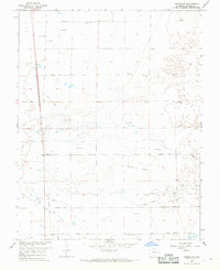
(176)- 1889 Map of Huerfano Park, 1961 Print
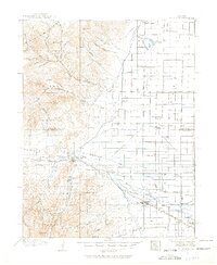
 1889 Huerfano Park1961 Print · USGSHuerfano County and the high peaks of the Sangre de Cristos are captured here in the late nineteenth century. Trace the early tracks of the Denver and Rio Grande Railroad and locate vanished outposts like Sharpsdale and Malachite.
 - 1892 Map of Huerfano Park
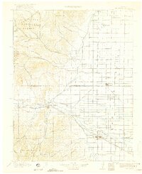
 1892 Huerfano Park1892 Print · USGSSouthern Colorado mountain life is captured here in the late nineteenth century, showing the early settlements and rail lines of the Huerfano region. Researchers can trace the path of the Denver and Rio Grande Railroad and locate vanished stops at Malachite, Sharpsdale, and Placer.5 unique versions available
 - 1915 Map of Del Norte, 1957 Print
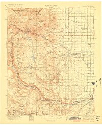
 1915 Del Norte1957 Print · USGSThe San Luis Valley was a thriving agricultural and rail hub during the early twentieth century. Researchers can trace the legacy of early settlements and rural schoolhouses like La Garita School, Swede Lane School, and the Denver and Rio Grande rail line.
 - 1917 Map of Del Norte
 1917 Del Norte1917 Print · USGSThe San Luis Valley thrives in the mid-1910s as irrigation transforms the high desert into a productive agricultural hub. Researchers can locate dozens of country schools like Eureka School and trace the Denver and Rio Grande rail corridor through Monte Vista.3 unique versions available
 - 1922 Map of Conejos
 1922 Conejos1922 Print · USGSThe high San Juan peaks meet the irrigated Luis Valley in the early 1920s, showing a landscape defined by mountain ranching and rail. Trace the Denver and Rio Grande Railroad through the mountains or locate old local landmarks like Bowen Church, Antonito, and the Hot Creek School.4 unique versions available
 - 1945 Map of Durango
 1945 Durango1945 Print · USGSSouthwest Colorado and Northern New Mexico at mid-century are defined by the high peaks of the San Juan Range and the tribal lands of the Southern Ute. Genealogists and historians can trace the paths of the D & R G W RR and locate local landmarks like Animas City and the Blanco Basin School.3 unique versions available
 - 1953 Map of Durango, 1963 Print
 1953 Durango1963 Print · USGSThe high peaks of the San Juan Mountains and the Colorado mining country are shown here as they appeared in the early fifties. Genealogists and local historians can trace the rail lines of the D & R G W RR and locate historic mining camps like Silverton, Ouray, and Old Ophir.
 - 1954 Map of Durango
 1954 Durango1954 Print · USGSSouthern Colorado in the mid-1950s was defined by high-altitude mining towns and the expansion of water storage in the San Luis Valley. Trace the narrow-gauge Denver & Rio Grande Western RR as it connects Durango to mountain outposts like Silverton and Creede.2 unique versions available
 - 1954 Map of Trinidad, 1963 Print
 1954 Trinidad1963 Print · USGSSouthern Colorado is captured here during the mid-fifties, showing the vital rail-and-river connections between the San Luis Valley and the eastern foothills. Researchers can trace the Denver and Rio Grande Western line and locate rural landmarks like Malachite School and San Luis.2 unique versions available
 - 1955 Map of Trinidad, 1976 Print
 1955 Trinidad1976 Print · USGSSouthern Colorado during the mid-fifties is defined by the high-altitude agriculture of the San Luis Valley and the peaks of the Culebra Range. Genealogists can trace early settlements and rural schoolhouses like Medina Plaza, San Luis, and the Trujillo Creek School.
 - 1958 Map of Trinidad
 1958 Trinidad1958 Print · USGSSouthern Colorado in the late fifties was a landscape of high-altitude agriculture and coal production, centered on the San Luis Valley. Local historians can trace old community centers like the Malachite School or follow the mining and rail activity near Walsenburg and the Allen Mine.
 - 1959 Map of Trinidad
 1959 Trinidad1959 Print · USGSThe San Luis Valley and the high Sangre de Cristo peaks are documented here in the late fifties, during a period of steady ranching and rail activity. Genealogy researchers can locate family-named landmarks and rural institutions like Trujillo Creek School and the historic San Luis settlement.
 - 1961 Map of Durango
 1961 Durango1961 Print · USGSThe high San Juan country in the early sixties is shown here as a network of historic mining towns and early reservoir projects. Genealogists and researchers can trace the Denver & Rio Grande Western RR as it connects Durango, Silverton, and Arboles.
 - 1963 Map of Durango
 1963 Durango1963 Print · USGSThe San Juan Mountains and San Luis Valley are captured here in the early 1950s as mining, rail, and tribal lands shaped the region. Researchers can trace the Denver & Rio Grande Western RR through high-country towns like Telluride and Silverton, or locate landmarks such as the Asiatic Mine.
 - 1965 Map of Medano Ranch, 1968 Print
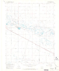
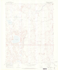 1965 Medano Ranch1968 Print · USGSThe San Luis Valley landscape in the mid-sixties reveals a complex network of artesian wells and terminal lakes. Genealogists and researchers can trace water rights and land use at Medano Ranch and locate early access routes like the Jeep Trail near San Luis Lake.
 - 1965 Map of Blanca, 1968 Print
 1965 Blanca1968 Print · USGSThe San Luis Valley landscape comes into focus during the mid-sixties, centered on the railroad town of Blanca. Researchers can trace irrigation patterns and early transport hubs like the Denver and Rio Grande Western rail line and the Blanca Municipal Airport.3 unique versions available
 - 1965 Map of Zapata Ranch, 1968 Print
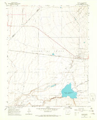
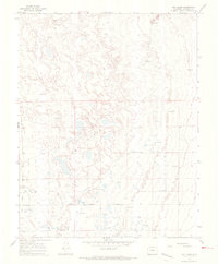
 1965 Zapata Ranch1968 Print · USGSAlamosa County, Colorado, is shown in the mid-1960s as a landscape defined by the shifting sands and high-altitude ranching. Researchers can locate Zapata Ranch, trace the high waters of Zapata Lake, and find the remote Cem near the mountain front.4 unique versions available
 - 1965 Map of Baldy, 1968 Print
 1965 Baldy1968 Print · USGSThe San Luis Valley in the mid-1960s is defined here by its wetland conservation and artesian water systems. Researchers can trace the Denver and Rio Grande Western rail line through Baldy or locate the historic Grant Boundary.2 unique versions available
 - 1965 Map of Lasauses, 1968 Print
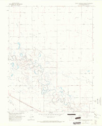
 1965 Lasauses1968 Print · USGSThe San Luis Valley in the mid-1960s shows a landscape of high-altitude hydrology where the Rio Grande meets the Conejos River. Genealogists and historians can locate the Lasauses settlement, the Becker Cem, and several flowing wells along the Trinchera Creek.3 unique versions available
 - 1965 Map of Dry Lakes, 1968 Print
 1965 Dry Lakes1968 Print · USGSAlamosa County during the mid-1960s reveals a unique hydrological landscape where artesian water supports a sparse high-desert economy. Genealogists and historians can trace property boundaries and land use near Fourmile Road or locate the numerous Flowing Wells that sustain the area around Dry Lakes.2 unique versions available
 - 1965 Map of Twin Peaks, 1968 Print
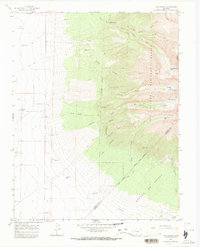 1965 Twin Peaks1968 Print · USGSAlamosa and Costilla counties meet along the high ridges of the Sangre de Cristo Range during the mid-sixties. Genealogists and hikers can trace early regional markers like the Pioneer Urraca Cem, the Swab Mine, and remote waters such as Lake Como.3 unique versions available
 - 1966 Map of Durango
 1966 Durango1966 Print · USGSSouthwestern Colorado and the New Mexico borderlands are shown here in the mid-1960s, a time when the narrow-gauge rail network still tied the high peaks to the valley floor. Researchers can trace the Denver & Rio Grande Western Railroad between settlements like Silverton, Antonito, and Pagosa Springs.2 unique versions available
 - 1966 Map of Homelake, 1968 Print
 1966 Homelake1968 Print · USGSThe Rio Grande basin in the mid-1960s shows a complex network of historic irrigation and rail infrastructure. Genealogists and historians can trace family-named sites and landmarks like the Homelake State Veterans Center, Sugar Junction, and the San Luis Valley Airport.
 - 1966 Map of Mount Pleasant School, 1968 Print
 1966 Mount Pleasant School1968 Print · USGSAlamosa County’s San Luis Valley was a hub of intensive irrigation and rail transport in the mid-1960s. Researchers can trace the path of the Denver and Rio Grande Western railroad and locate rural landmarks like Mount Pleasant School and the Costilla Canal.
 - 1966 Map of Hooper SE, 1968 Print
 1966 Hooper SE1968 Print · USGSAlamosa County appears in the mid-1960s as a landscape of grid-patterned roads and intensive water management. Researchers can trace the path of the Old Railroad Grade or locate historic water sources like the Costilla Canal and numerous Flowing Wells.
Showing maps 1-25 of 176
Top cities of Alamosa County
Frequently asked questions
- What are the different types of historical maps available for Alamosa County?
- What is the oldest map of Alamosa County?
- Where can I purchase historical maps of Alamosa County for my home or office?
- Where can I download high-res historical maps of Alamosa County?
- Are there historical topographic maps available for Alamosa County?
- Is there historical aerial imagery available for Alamosa County?
- Where are historical maps of Alamosa County sourced from?