1960s Maps of Alamosa County, Colorado
Explore 28 historic maps of Alamosa County from the 1960s. These maps offer a rare glimpse into what life looked like during the 1960s — showing old roads, neighborhoods, homes, and landmarks that have changed or disappeared over time.
Whether you're researching your family's past, planning a metal detecting trip, or studying how Alamosa County's landscape evolved across the 1960s, these high-resolution maps are a powerful tool for exploring the history of this region.
- Focus on a specific era: All maps on this page are from the 1960s, giving you a focused view of this time period.
- See what’s changed: Compare century-old streets, trails, and buildings to today's modern landscape using overlays and satellite layers.
- Research with precision: Use these maps for genealogy, historical research, land use analysis, or educational projects.
- View, download, or print: Maps are fully viewable online in high resolution, and can be downloaded or printed for your own records.
Start exploring Alamosa County's history through authentic maps from the 1960s. This is your window into the past.
Alamosa County, CO maps
(28)- 1961 Map of Durango
 1961 Durango1961 Print · USGSThe high San Juan country in the early sixties is shown here as a network of historic mining towns and early reservoir projects. Genealogists and researchers can trace the Denver & Rio Grande Western RR as it connects Durango, Silverton, and Arboles.
 - 1963 Map of Durango
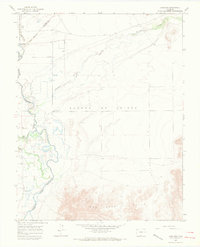
 1963 Durango1963 Print · USGSThe San Juan Mountains and San Luis Valley are captured here in the early 1950s as mining, rail, and tribal lands shaped the region. Researchers can trace the Denver & Rio Grande Western RR through high-country towns like Telluride and Silverton, or locate landmarks such as the Asiatic Mine.
 - 1965 Map of Medano Ranch, 1968 Print
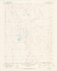
 1965 Medano Ranch1968 Print · USGSThe San Luis Valley landscape in the mid-sixties reveals a complex network of artesian wells and terminal lakes. Genealogists and researchers can trace water rights and land use at Medano Ranch and locate early access routes like the Jeep Trail near San Luis Lake.
 - 1965 Map of Blanca, 1968 Print
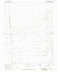
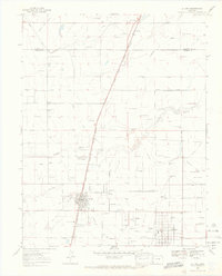
 1965 Blanca1968 Print · USGSThe San Luis Valley landscape comes into focus during the mid-sixties, centered on the railroad town of Blanca. Researchers can trace irrigation patterns and early transport hubs like the Denver and Rio Grande Western rail line and the Blanca Municipal Airport.3 unique versions available
 - 1965 Map of Zapata Ranch, 1968 Print
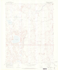
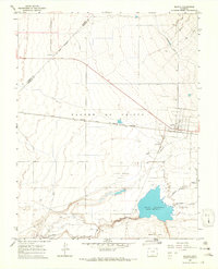
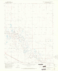
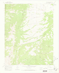
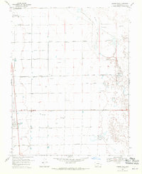
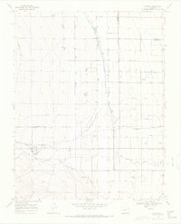
 1965 Zapata Ranch1968 Print · USGSAlamosa County, Colorado, is shown in the mid-1960s as a landscape defined by the shifting sands and high-altitude ranching. Researchers can locate Zapata Ranch, trace the high waters of Zapata Lake, and find the remote Cem near the mountain front.4 unique versions available
 - 1965 Map of Baldy, 1968 Print
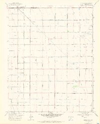
 1965 Baldy1968 Print · USGSThe San Luis Valley in the mid-1960s is defined here by its wetland conservation and artesian water systems. Researchers can trace the Denver and Rio Grande Western rail line through Baldy or locate the historic Grant Boundary.2 unique versions available
 - 1965 Map of Lasauses, 1968 Print
 1965 Lasauses1968 Print · USGSThe San Luis Valley in the mid-1960s shows a landscape of high-altitude hydrology where the Rio Grande meets the Conejos River. Genealogists and historians can locate the Lasauses settlement, the Becker Cem, and several flowing wells along the Trinchera Creek.3 unique versions available
 - 1965 Map of Dry Lakes, 1968 Print
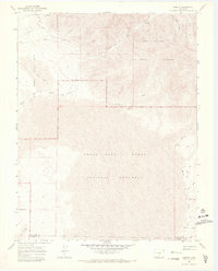
 1965 Dry Lakes1968 Print · USGSAlamosa County during the mid-1960s reveals a unique hydrological landscape where artesian water supports a sparse high-desert economy. Genealogists and historians can trace property boundaries and land use near Fourmile Road or locate the numerous Flowing Wells that sustain the area around Dry Lakes.2 unique versions available
 - 1965 Map of Twin Peaks, 1968 Print
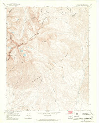
 1965 Twin Peaks1968 Print · USGSAlamosa and Costilla counties meet along the high ridges of the Sangre de Cristo Range during the mid-sixties. Genealogists and hikers can trace early regional markers like the Pioneer Urraca Cem, the Swab Mine, and remote waters such as Lake Como.3 unique versions available
 - 1966 Map of Durango
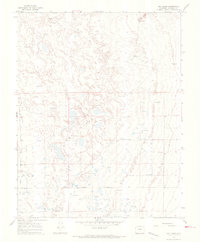
 1966 Durango1966 Print · USGSSouthwestern Colorado and the New Mexico borderlands are shown here in the mid-1960s, a time when the narrow-gauge rail network still tied the high peaks to the valley floor. Researchers can trace the Denver & Rio Grande Western Railroad between settlements like Silverton, Antonito, and Pagosa Springs.2 unique versions available
 - 1966 Map of Homelake, 1968 Print
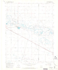 1966 Homelake1968 Print · USGSThe Rio Grande basin in the mid-1960s shows a complex network of historic irrigation and rail infrastructure. Genealogists and historians can trace family-named sites and landmarks like the Homelake State Veterans Center, Sugar Junction, and the San Luis Valley Airport.
 - 1966 Map of Mount Pleasant School, 1968 Print
 1966 Mount Pleasant School1968 Print · USGSAlamosa County’s San Luis Valley was a hub of intensive irrigation and rail transport in the mid-1960s. Researchers can trace the path of the Denver and Rio Grande Western railroad and locate rural landmarks like Mount Pleasant School and the Costilla Canal.
 - 1966 Map of Hooper SE, 1968 Print
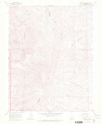
 1966 Hooper SE1968 Print · USGSAlamosa County appears in the mid-1960s as a landscape of grid-patterned roads and intensive water management. Researchers can trace the path of the Old Railroad Grade or locate historic water sources like the Costilla Canal and numerous Flowing Wells.
 - 1966 Map of Alamosa East, 1968 Print
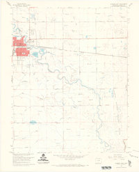 1966 Alamosa East1968 Print · USGSAlamosa and the surrounding San Luis Valley are captured here in the mid-sixties, showcasing a landscape defined by the Rio Grande and a complex network of irrigation ditches. Researchers can trace the path of the Denver and Rio Grande Western railroad and locate local landmarks like the Boyd Sch and Adams Lake.3 unique versions available
 - 1966 Map of Alamosa West, 1969 Print
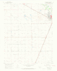 1966 Alamosa West1969 Print · USGSThe high plains of Alamosa County come into sharp focus in the mid-1960s, showing a landscape defined by industrial rail and irrigation. Trace the Denver and Rio Grande Western tracks through La Fruto and Henry, or locate family landmarks like Waverly Sch.3 unique versions available
 - 1967 Map of Mosca Pass, 1970 Print
 1967 Mosca Pass1970 Print · USGSThe Sangre de Cristo high country during the late sixties features a network of pack trails and alpine reservoirs. Trace historical routes through Mosca Pass and locate isolated landmarks like Singing River Ranch and Montez Reservoir.3 unique versions available
 - 1967 Map of Blanca Peak, 1971 Print
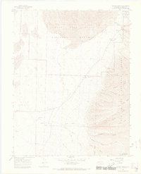
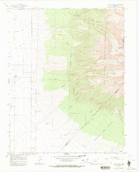
 1967 Blanca Peak1971 Print · USGSHigh in the southern Rockies during the late sixties, this survey captures the towering terrain where three counties meet. Trace high-altitude mining efforts and mountain landmarks like Blanca Peak, Mount Lindsey, and Arrowhead Ranch.7 unique versions available
 - 1967 Map of Medano Pass, 1971 Print
 1967 Medano Pass1971 Print · USGSThe high Sangre de Cristo crest is captured in the late sixties, where the boundaries of two national forests meet at Medano Pass. You can trace old-timer routes like the Pack Trail and find high-country Prospects near Medano Lake.4 unique versions available
 - 1967 Map of Liberty, 1971 Print
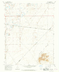
 1967 Liberty1971 Print · USGSThe foothills of the Sangre de Cristo Range come into focus in the late 1960s as high-desert dunes meet alpine forests. Genealogists and historians can locate the foothill settlements of Duncan and Liberty, or trace old routes like Medano Pass Road and the path to Indian Spring.3 unique versions available
 - 1967 Map of Sand Camp, 1971 Print
 1967 Sand Camp1971 Print · USGSThe San Luis Valley in the late sixties reveals a landscape shaped by massive dunes and Spanish land grant boundaries. Researchers can trace the hydrologic history of the region through Antelope Springs, Sand Creek, and the isolated Sand Camp Flowing Well.3 unique versions available
 - 1968 Map of Hooper East, 1970 Print
 1968 Hooper East1970 Print · USGSThe high San Luis Valley comes into focus in the late sixties, showing the agricultural grid between Hooper and Mosca. Genealogists and historians can trace the irrigation systems and family-named routes like Streator Lane and the local Landing Strip.2 unique versions available
 - 1968 Map of Deadman Camp, 1970 Print
 1968 Deadman Camp1970 Print · USGSSaguache County ranching and water rights take center stage in this late-sixties study of the San Luis Valley. Genealogists and historians can trace irrigation networks like the Farmers Union Canal and remote sites such as Deadman Camp or the White Ranch.2 unique versions available
 - 1968 Map of La Jara, 1970 Print
 1968 La Jara1970 Print · USGSThe high San Luis Valley irrigation network is captured here in the late sixties as the rail-centered towns of La Jara and Sanford thrived. Genealogists and researchers can locate the County Hospital, Fish Hatchery, and the La Jara Drive-in Theatre.3 unique versions available
 - 1968 Map of Center South, 1970 Print
 1968 Center South1970 Print · USGSThe San Luis Valley agricultural grid comes alive in the late sixties, showcasing a highly organized system of irrigation and rural settlement. Genealogists and historians can trace family locations near Sargent High Sch or the crossroads at Ansel and Dunul.2 unique versions available
 - 1968 Map of Capulin, 1971 Print
 1968 Capulin1971 Print · USGSConejos and Alamosa Counties in the late sixties reveal a complex web of high-desert water management centered on the village of Capulin. Genealogists and historians can trace local family lineages through St Josephs Cem or locate the former communities of Morgan and Morganville.3 unique versions available
Showing maps 1-25 of 28
Top cities of Alamosa County
Frequently asked questions
- What are the different types of historical maps available for Alamosa County?
- What is the oldest map of Alamosa County?
- Where can I purchase historical maps of Alamosa County for my home or office?
- Where can I download high-res historical maps of Alamosa County?
- Are there historical topographic maps available for Alamosa County?
- Is there historical aerial imagery available for Alamosa County?
- Where are historical maps of Alamosa County sourced from?