Old Maps of Pagosa Junction, Colorado for Academic Research
Study the evolution of Pagosa Junction with 16 high-resolution historic maps. Whether you're teaching, researching, or modeling changes in land use, these maps provide essential visual documentation of urban, environmental, and geographic change.
- Analyze long-term change: Track patterns in development, transportation, and natural features.
- Ideal for environmental or urban studies: Support academic projects with primary historical map data.
- Use in the classroom or lab: Educators and researchers rely on these maps to bring historical context to life.
These maps are a powerful tool for teaching, research, and visualizing how Pagosa Junction has changed over the decades.
Pagosa Junction, CO maps
(16)- 1924 Map of Pagosa Springs, 1958 Print
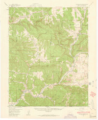
 1924 Pagosa Springs1958 Print · USGSArchuleta County comes into focus in the 1920s as a vital mountain corridor defined by the San Juan and Piedra rivers. Genealogists and historians can trace the Denver and Rio Grande Western rail line and discover remote schoolhouses like Stollsteimer School and O'Neal Park School.2 unique versions available
 - 1927 Map of Pagosa Springs
 1927 Pagosa Springs1927 Print · USGSThe high country of the San Juan Mountains comes into focus in the 1920s as ranching and rail reach into the river valleys. Genealogists and historians can trace the Denver and Rio Grande Western line through Pagosa Junction and locate old rural hubs like Yellowjacket School.3 unique versions available
 - 1945 Map of Durango
 1945 Durango1945 Print · USGSSouthwest Colorado and Northern New Mexico at mid-century are defined by the high peaks of the San Juan Range and the tribal lands of the Southern Ute. Genealogists and historians can trace the paths of the D & R G W RR and locate local landmarks like Animas City and the Blanco Basin School.3 unique versions available
 - 1953 Map of Durango, 1963 Print
 1953 Durango1963 Print · USGSThe high peaks of the San Juan Mountains and the Colorado mining country are shown here as they appeared in the early fifties. Genealogists and local historians can trace the rail lines of the D & R G W RR and locate historic mining camps like Silverton, Ouray, and Old Ophir.
 - 1954 Map of Durango
 1954 Durango1954 Print · USGSSouthern Colorado in the mid-1950s was defined by high-altitude mining towns and the expansion of water storage in the San Luis Valley. Trace the narrow-gauge Denver & Rio Grande Western RR as it connects Durango to mountain outposts like Silverton and Creede.2 unique versions available
 - 1957 Map of Pagosa Junction, 1959 Print
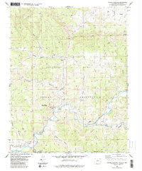
 1957 Pagosa Junction1959 Print · USGSThe Colorado and New Mexico borderlands come to life in the late fifties, where the D & R G W RR tracks the San Juan River. Researchers can trace the layout of small settlements like Pagosa Junction and Trujillo or locate family landmarks near Villareal.4 unique versions available
 - 1961 Map of Durango
 1961 Durango1961 Print · USGSThe high San Juan country in the early sixties is shown here as a network of historic mining towns and early reservoir projects. Genealogists and researchers can trace the Denver & Rio Grande Western RR as it connects Durango, Silverton, and Arboles.
 - 1963 Map of Durango
 1963 Durango1963 Print · USGSThe San Juan Mountains and San Luis Valley are captured here in the early 1950s as mining, rail, and tribal lands shaped the region. Researchers can trace the Denver & Rio Grande Western RR through high-country towns like Telluride and Silverton, or locate landmarks such as the Asiatic Mine.
 - 1966 Map of Durango
 1966 Durango1966 Print · USGSSouthwestern Colorado and the New Mexico borderlands are shown here in the mid-1960s, a time when the narrow-gauge rail network still tied the high peaks to the valley floor. Researchers can trace the Denver & Rio Grande Western Railroad between settlements like Silverton, Antonito, and Pagosa Springs.2 unique versions available
 - 1983 Map of Durango
 1983 Durango1983 Print · USGSSouthwestern Colorado at the start of the 1980s shows a landscape where high-mountain wilderness meets the agricultural plateaus of the Southern Ute. Genealogists and historians can trace the Durango & Silverton Narrow Gauge Railroad or locate sites like Southern Ute Agency and Pagosa Junction.
 - 1984 Map of Pagosa Junction
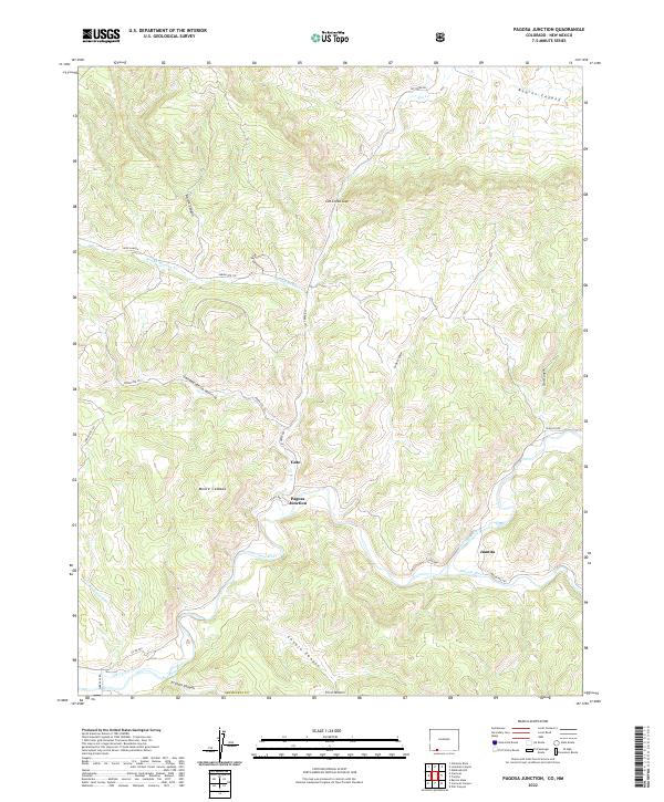
 1984 Pagosa Junction1984 Print · USGSThe Colorado-New Mexico borderlands in the mid-1980s reveal a landscape of reservation boundaries and river-cut canyons. Genealogists and historians can trace the Old Grade along the San Juan River and find markers for Pagosa Junction and Monte Camado.2 unique versions available
 - 2011 Map of Pagosa Junction, 2011 Print
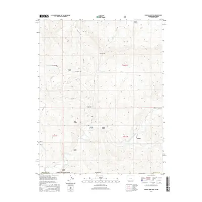
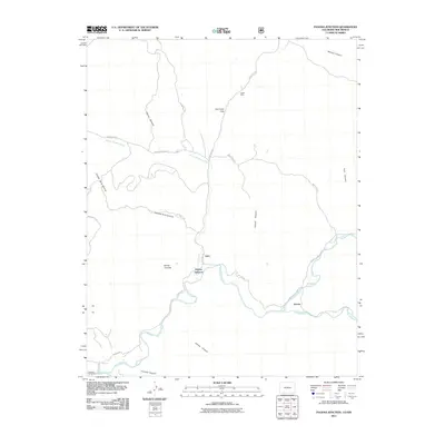 2011 Pagosa Junction2011 Print · USGSCovers Pagosa Junction, including Gato, Juanita, and other nearby areas
 - 2013 Map of Pagosa Junction, 2013 Print
 2013 Pagosa Junction2013 Print · USGSCovers Pagosa Junction, including Gato, Juanita, and other nearby areas
 - 2016 Map of Pagosa Junction, 2016 Print
 2016 Pagosa Junction2016 Print · USGSCovers Pagosa Junction, including Gato, Juanita, and other nearby areas
 - 2019 Map of Pagosa Junction, 2019 Print
 2019 Pagosa Junction2019 Print · USGSCovers Pagosa Junction, including Gato, Juanita, and other nearby areas
 - 2022 Map of Pagosa Junction, 2022 Print
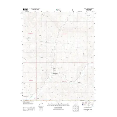
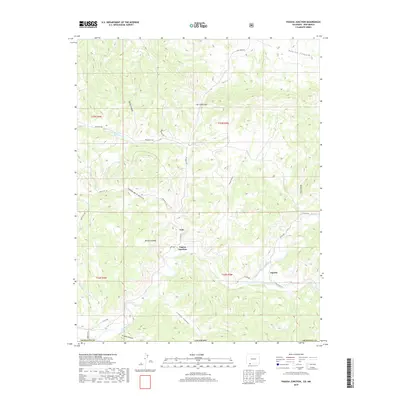
 2022 Pagosa Junction2022 Print · USGSThe river valleys of southern Archuleta County are captured here in the early 2020s, where the high desert terrain meets the state line. Genealogists and researchers can trace the vicinity of Pagosa Junction, Gato, and the Old Carr Ditch along the river banks.
End of results
Showing maps 1-16 of 16
Top cities near Pagosa Junction
Frequently asked questions
- What are the different types of historical maps available for Pagosa Junction?
- What is the oldest map of Pagosa Junction?
- Where can I purchase historical maps of Pagosa Junction for my home or office?
- Where can I download high-res historical maps of Pagosa Junction?
- Are there historical topographic maps available for Pagosa Junction?
- Is there historical aerial imagery available for Pagosa Junction?
- Where are historical maps of Pagosa Junction sourced from?