1900s (20th Century) Maps of Central Boulder - University Hill, Boulder
Explore 21 historic maps of Central Boulder - University Hill from the 1900s (20th Century). These maps offer a rare glimpse into what life looked like during the 1900s — showing old roads, neighborhoods, homes, and landmarks that have changed or disappeared over time.
Whether you're researching your family's past, planning a metal detecting trip, or studying how Central Boulder - University Hill's landscape evolved across the 1900s, these high-resolution maps are a powerful tool for exploring the history of this region.
- Focus on a specific era: All maps on this page are from the 1900s, giving you a focused view of this time period.
- See what’s changed: Compare century-old streets, trails, and buildings to today's modern landscape using overlays and satellite layers.
- Research with precision: Use these maps for genealogy, historical research, land use analysis, or educational projects.
- View, download, or print: Maps are fully viewable online in high resolution, and can be downloaded or printed for your own records.
Start exploring Central Boulder - University Hill's history through authentic maps from the 1900s. This is your window into the past.
Central Boulder - University Hill, Boulder maps
(21)- 1902 Map of Boulder, 1957 Print
 1902 Boulder1957 Print · USGSThe Front Range foothills hum with mining and rail activity at the turn of the century. Genealogy researchers can trace families in old mining camps like Gold Hill, Wallstreet, and Sunshine, or follow the winding Colorado and Northwestern RR.
 - 1904 Map of Boulder
 1904 Boulder1904 Print · USGSThe Front Range foothills hum with mining activity at the start of the twentieth century, as narrow-gauge rails climb the canyons. Genealogists and historians can trace defunct rail stops and mining camps like Salina, Wallstreet, and Gold Hill Sta..6 unique versions available
 - 1906 Map of Blackhawk
 1906 Blackhawk1906 Print · USGSThe Front Range foothills and mining districts come alive in this early century survey, showing the transition from mountain ranching to industrial rail. Genealogists and historians can trace family holdings like Winiger Ranch, find the Pine Glade School, and follow the Denver Northwestern and Pacific RR.5 unique versions available
 - 1942 Map of Eldorado Springs
 1942 Eldorado Springs1942 Print · USGSJust before the mid-century, the mountain interface west of Boulder was a landscape of remote ranches and rugged rail lines. Trace the early settlement of Eldorado Springs and find vanished landmarks like the Pine Grove Sch and the Coal Creek Store.4 unique versions available
 - 1944 Map of Eldorado Springs
 1944 Eldorado Springs1944 Print · USGSThe Front Range foothills in the 1940s reveal a landscape of mountain ranches and deep canyons just south of Boulder. Genealogists and hikers can trace old homesteads like Walker Ranch, the winding Denver and Salt Lake RR, and early landmarks such as the Copeland Mine.2 unique versions available
 - 1953 Map of Denver, 1964 Print
 1953 Denver1964 Print · USGSDenver and the Colorado Front Range are captured here during a decade of post-war growth and military expansion. Researchers can trace the sprawling rail lines of the Union Pacific, locate the State Capitol, and explore historic mountain mining hubs like Central City.6 unique versions available
 - 1954 Map of Greeley, 1966 Print
 1954 Greeley1966 Print · USGSNorthern Colorado transitions from high-alpine peaks to the irrigated South Platte valley during this mid-century period of growth. Genealogists and historians can trace rail-connected hubs like Greeley and Longmont alongside landmarks like Horsetooth Reservoir and Estes Park.3 unique versions available
 - 1957 Map of Denver
 1957 Denver1957 Print · USGSDenver and the Colorado Front Range are seen here during a mid-century period of intense military and urban expansion. Trace the footprints of the Rocky Mountain Arsenal, the early United States Air Force Academy, and the Lowry AF Base.
 - 1957 Map of Greeley
 1957 Greeley1957 Print · USGSNorthern Colorado in the mid-fifties is captured here as the agricultural plains of Weld County meet the high peaks of the Front Range. Genealogists and historians can trace rail-linked towns like Keenesburg and Roggen or locate early water features such as Boyd Lake and Fossil Creek Reservoir.
 - 1957 Map of Boulder, 1959 Print
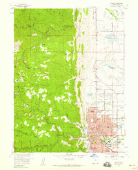 1957 Boulder1959 Print · USGSBoulder and the Front Range foothills are shown during a time of mid-century expansion and active mining heritage. Trace the development of the University of Colorado and find numerous historic mines like the Sun and Moon Mine or Emancipation Mine.3 unique versions available
 - 1957 Map of Boulder, 1960 Print
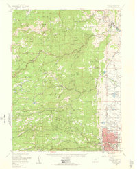 1957 Boulder1960 Print · USGSBoulder and the surrounding mountain canyons are captured in the late fifties, showing a landscape defined by mining history and early settlement. Trace the footprints of old camps like Gold Hill and Wallstreet, or locate the historic Bunce School and Gresham (Site).3 unique versions available
 - 1958 Map of Greeley
 1958 Greeley1958 Print · USGSNorthern Colorado and the high peaks of the Front Range appear here in the mid-fifties as the region's agricultural and rail networks were fully established. Genealogists can locate family homes near Virginia Dale, Waverly, or Kuner, and trace the path of the Union Pacific Railroad through Greeley.
 - 1958 Map of Denver
 1958 Denver1958 Print · USGSDenver and the Colorado Front Range are captured here during the mid-century suburban boom. Trace the footprints of military installations like Buckley Air Force Base alongside the established rail networks of the Colorado & Southern Ry.
 - 1960 Map of Denver
 1960 Denver1960 Print · USGSDenver and the Colorado Front Range are seen here at a pivotal moment of postwar expansion into the plains and foothills. Researchers can trace the mid-century rail network of the Denver & Rio Grande Western RR and locate historic institutional landmarks like Buckley Field and the Colorado School of Mines.
 - 1961 Map of Greeley
 1961 Greeley1961 Print · USGSNorthern Colorado's transition from high mountain peaks to irrigated plains is captured here just as the post-war population boom reached the Front Range. Researchers can trace early water infrastructure and rail lines like the Great Western RR connecting sugar beet hubs from Fort Collins to Greeley.
 - 1964 Map of Greeley
 1964 Greeley1964 Print · USGSThe Front Range corridor and high peaks of the Rockies appear here in the mid-1960s, showing the intersection of mountain wilderness and plains agriculture. Trace the rail routes of the Great Western RR or locate landmarks like Longs Peak and Horsetooth Reservoir.
 - 1965 Map of Greeley
 1965 Greeley1965 Print · USGSNorthern Colorado in the mid-sixties shows a landscape defined by high mountain summits and the growing irrigation networks of the plains. Genealogists and historians can trace rail-side towns like Wellington or follow the early tracks of the Union Pacific Railroad past Longs Peak.
 - 1965 Map of Eldorado Springs, 1967 Print
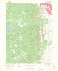 1965 Eldorado Springs1967 Print · USGSThe Front Range foothills come into sharp focus in the mid-sixties, showing the intersection of mountain topography and burgeoning civic infrastructure. Trace the winding Denver and Rio Grande Western rail line through Crescent Village or find family roots near Eldorado Springs and Plainview.8 unique versions available
 - 1966 Map of Boulder, 1968 Print
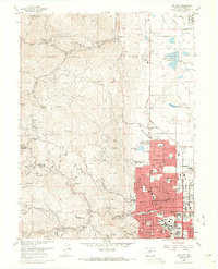 1966 Boulder1968 Print · USGSThe mid-sixties city of Boulder and its rugged western foothills are documented here during a decade of rapid growth. Trace the development of the University of Colorado campus and find historic mining sites like the Poorman Mine or early settlements such as Salina.5 unique versions available
 - 1983 Map of Denver West
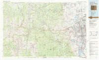 1983 Denver West1983 Print · USGSThe Front Range and Denver's western suburbs meet in the early 1980s, documenting the era's growth from the mountain peaks to the valley floor. Genealogists and historians can trace the foundations of Lakewood and Golden, or locate high-altitude landmarks like the Moffat Tunnel and Mount Olivet Cem.2 unique versions available
 - 1984 Map of Estes Park
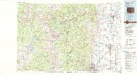 1984 Estes Park1984 Print · USGSThe northern Front Range and high peaks come into focus during the mid-eighties, showing the intersection of mountain wilderness and urban expansion. Trace the rail lines of the Union Pacific, the shores of Lake Granby, and historic mountain towns like Gold Hill or Eldora.3 unique versions available
End of results
Showing maps 1-21 of 21
Frequently asked questions
- What are the different types of historical maps available for Central Boulder - University Hill?
- What is the oldest map of Central Boulder - University Hill?
- Where can I purchase historical maps of Central Boulder - University Hill for my home or office?
- Where can I download high-res historical maps of Central Boulder - University Hill?
- Are there historical topographic maps available for Central Boulder - University Hill?
- Is there historical aerial imagery available for Central Boulder - University Hill?
- Where are historical maps of Central Boulder - University Hill sourced from?