1900s (20th Century) Maps of Turret, Colorado
Explore 10 historic maps of Turret from the 1900s (20th Century). These maps offer a rare glimpse into what life looked like during the 1900s — showing old roads, neighborhoods, homes, and landmarks that have changed or disappeared over time.
Whether you're researching your family's past, planning a metal detecting trip, or studying how Turret's landscape evolved across the 1900s, these high-resolution maps are a powerful tool for exploring the history of this region.
- Focus on a specific era: All maps on this page are from the 1900s, giving you a focused view of this time period.
- See what’s changed: Compare century-old streets, trails, and buildings to today's modern landscape using overlays and satellite layers.
- Research with precision: Use these maps for genealogy, historical research, land use analysis, or educational projects.
- View, download, or print: Maps are fully viewable online in high resolution, and can be downloaded or printed for your own records.
Start exploring Turret's history through authentic maps from the 1900s. This is your window into the past.
Turret, CO maps
(10)- 1954 Map of Pueblo, 1966 Print
 1954 Pueblo1966 Print · USGSMid-century Colorado comes alive in this survey of the Front Range and the high plains as the region expanded after the war. Genealogists and historians can trace family roots through rural landmarks like Hanover Church, Pioneer Cemetery, and the Grandview School.3 unique versions available
 - 1956 Map of Cameron Mountain, 1959 Print
 1956 Cameron Mountain1959 Print · USGSThe Arkansas River valley near Salida and Cleora is shown here in the mid-fifties as the local mining and rail economy thrived. Researchers can trace the DENVER AND RIO GRANDE WESTERN line, the remote Oklahoma A & M Engineering Camp, and the Golden Wonder Mine.4 unique versions available
 - 1957 Map of Pueblo
 1957 Pueblo1957 Print · USGSMid-century Colorado comes alive as the Front Range urban centers expand alongside massive Cold War military installations. Genealogists and historians can trace the foundations of Stone City, rural sites like Hanover School, and the industrial Canon Imperial Mine.
 - 1958 Map of Pueblo
 1958 Pueblo1958 Print · USGSColorado's Front Range and Arkansas River Valley come alive in the late fifties, showing the transition from historic mining districts to major military and rail hubs. Genealogists and historians can trace family roots in ranching communities and find landmarks like Cripple Creek, Manitou, and the Hanover School.
 - 1962 Map of Pueblo
 1962 Pueblo1962 Print · USGSThe Front Range and high plains meet in the early sixties as military installations and industrial mining shape the corridor from Colorado Springs to Pueblo. Genealogists can trace family names through rural landmarks like the Columbine School, Hanover Church, and Fairview Cem.
 - 1966 Map of Pueblo
 1966 Pueblo1966 Print · USGSThe Front Range and Arkansas River Valley are captured here in the mid-1960s, showing a landscape shaped by mining, military expansion, and rail. Researchers can locate numerous country schools and mines, such as the Lytle School, Pioneer Cem, and Empire Zinc Mine.
 - 1983 Map of Cameron Mountain
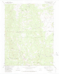 1983 Cameron Mountain1983 Print · USGSHigh-country mining and timber lands at the border of Chaffee, Park, and Fremont counties are documented here in the early 1980s. Local researchers can trace old mining sites like the Marble Quarry or locate landmarks such as Bassam Guard Station and Manoa Springs.
 - 1983 Map of Pikes Peak
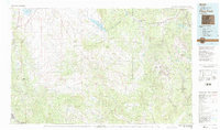 1983 Pikes Peak1983 Print · USGSIn the early eighties, the high-altitude mining districts of Teller County remained deeply etched into the mountain landscape. Researchers can trace the legacy of the Gold Belt through sites like the Stratton Mine and vanished rail stops near Cripple Creek or Altman.
 - 1989 Map of Pueblo
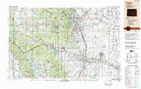 1989 Pueblo1989 Print · USGSIn the late eighties, the Colorado Front Range balanced its deep mining history with massive military expansion and water development. Researchers can trace the rail lines of the AT & SF RR or locate remote high-altitude settlements like Rosita and Querida.
 - 1994 Map of Cameron Mountain, 1998 Print
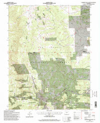 1994 Cameron Mountain1998 Print · USGSThe high country of Chaffee and Park counties is mapped here during the mid-nineties, showing a landscape shaped by mining and forest management. Researchers can locate the Gold Bug Mine, the settlement of Whitehorn, and the remote Bassam Guard Station.
End of results
Showing maps 1-10 of 10
Top cities near Turret
- Salida historical maps
- Buena Vista historical maps
- Poncha Springs historical maps
- Howard historical maps
- Nathrop historical maps
- Smeltertown historical maps
Frequently asked questions
- What are the different types of historical maps available for Turret?
- What is the oldest map of Turret?
- Where can I purchase historical maps of Turret for my home or office?
- Where can I download high-res historical maps of Turret?
- Are there historical topographic maps available for Turret?
- Is there historical aerial imagery available for Turret?
- Where are historical maps of Turret sourced from?