Old Maps of Clear Creek County, Colorado
Explore 112 old maps of Clear Creek County, spanning from 1899 to today. These high-resolution historic maps reveal how streets, neighborhoods, landmarks, and natural features evolved over time — perfect for genealogy, metal detecting, research, and local history exploration.
What you can do with these maps:
- See how Clear Creek County changed over time: Compare historical maps to modern-day views to trace roads, homesites, rail lines & more.
- View detailed metadata: Each map includes creators, publishers, year, scale, and archive source.
- Overlay maps with satellite & LiDAR: Visualize the past alongside modern tools to explore terrain & human change.
- Trusted historical sources: Maps sourced from the USGS, Library of Congress, and other archives.
- Access maps your way: View online, download high-res files, or order prints for personal or research use.
Start exploring old maps of Clear Creek County to uncover forgotten places, hidden landmarks, and the deep history beneath your feet.
Clear Creek County, CO maps
(112)- 1899 Map of West Denver
 1899 West Denver1899 Print · USGSThe Denver metropolitan area and its western foothills appear in the late Victorian era as a burgeoning rail and irrigation hub. Researchers can trace the early footprints of Denver, Golden, and Littleton, alongside industrial sites like the Louisville Coal Mine and the grounds of Fort Logan.
 - 1903 Map of Georgetown, 1957 Print
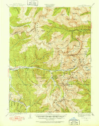
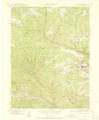
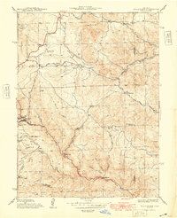
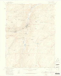
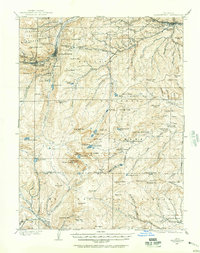 1903 Georgetown1957 Print · USGSMining operations and mountain railroads define the Clear Creek valley at the dawn of the twentieth century. Trace the iconic Georgetown Loop railroad and locate historic mining centers like Silver Plume, Lamartine, and the Stanley Mines.
 - 1905 Map of Central City
 1905 Central City1905 Print · USGSThe Colorado Front Range is captured here at the peak of its early mining era, showing the dense network of gulches and camps. Trace historic mining operations at Central City, follow the high-mountain route of the Denver Northwestern and Pacific RR, or locate vanished settlements like Baltimore and Perigo.
 - 1905 Map of Georgetown
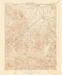
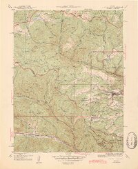
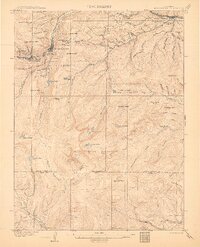 1905 Georgetown1905 Print · USGSThe Clear Creek valley was a hive of industrial activity at the start of the twentieth century, anchored by the rail connection between Georgetown and Silver Plume. Trace the famous Georgetown Loop and find high-altitude mining sites at Lamartine and Freeland.5 unique versions available
 - 1906 Map of Blackhawk
 1906 Blackhawk1906 Print · USGSThe Front Range foothills and mining districts come alive in this early century survey, showing the transition from mountain ranching to industrial rail. Genealogists and historians can trace family holdings like Winiger Ranch, find the Pine Glade School, and follow the Denver Northwestern and Pacific RR.5 unique versions available
 - 1910 Map of Central City, 1957 Print
 1910 Central City1957 Print · USGSThe Colorado high country at the start of the century reveals a landscape defined by mining booms and engineering marvels. Trace the intricate rail networks of the Colorado Southern RR or locate family roots in the historic camps of Nevadaville and Central City.2 unique versions available
 - 1912 Map of Central City
 1912 Central City1912 Print · USGSThe Colorado Front Range mining districts were in full operation during this era of deep-shaft extraction and mountain railroading. Researchers can trace the industrial footprint of Central City, locate the Boulder County Mine, and follow the path of the Colorado and Southern RR through the gulches.4 unique versions available
 - 1924 Map of Montezuma
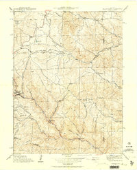
 1924 Montezuma1924 Print · USGSHigh Colorado peaks and mining camps define the landscape during the 1920s and 1930s. Genealogists and historians can trace the foundations of Montezuma and Keystone, and locate historic operations like the Hamill Mine and Waldorf Mine.2 unique versions available
 - 1924 Map of Fraser, 1957 Print
 1924 Fraser1957 Print · USGSGrand County's high-country rail and ranching corridors come alive in this mid-twenties survey of the Fraser Valley. Researchers can trace the original Denver and Salt Lake RR route, locate the Pole Creek School, and study the early layout of West Portal near the Moffat Tunnel.2 unique versions available
 - 1926 Map of Fraser
 1926 Fraser1926 Print · USGSThe high Rockies come alive in the mid-twenties as the Moffat Tunnel and Denver and Salt Lake Railroad reshape the landscape. Researchers can trace early infrastructure like the Lumber Flume and the isolated Pole Creek School.4 unique versions available
 - 1926 Map of Montezuma
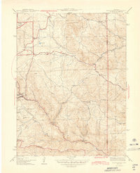
 1926 Montezuma1926 Print · USGSThe Continental Divide during the 1920s reveals a high-country landscape defined by its mining heritage and high mountain passes. Researchers can trace the rugged operations at the Waldorf Mine and Stevens Mine or locate the early mountain settlements of Montezuma and Swandyke.3 unique versions available
 - 1933 Map of Montezuma, 1956 Print
 1933 Montezuma1956 Print · USGSThe mining districts of the high Rockies are caught in a period of transition in the 1930s. Researchers can locate remote industrial sites like the Waldorf Mine and follow early mountain routes over Loveland Pass and Argentine Pass.3 unique versions available
 - 1942 Map of Central City, 1955 Print
 1942 Central City1955 Print · USGSGilpin County’s gold mining heartland is captured here during the early Forties, centered on the intense industrial activity around Central City. Researchers can trace the era's mining infrastructure through features like The Glory Hole, Pittsburg Mine, and the Bald Mtn Cem.5 unique versions available
 - 1942 Map of Black Hawk, 1957 Print
 1942 Black Hawk1957 Print · USGSThe Colorado high country around Gilpin and Jefferson counties comes into sharp focus during the early 1940s. Genealogists and historians can trace the mining-era roots of Black Hawk and Central City, while finding local landmarks like the Mountain House Sch and Summit Mine.4 unique versions available
 - 1944 Map of Black Hawk
 1944 Black Hawk1944 Print · USGSThe mining heart of Gilpin County is frozen in time during the mid-1940s, showing the early layouts of two famous gold-rush towns. Genealogists and historians can trace family-named terrain and remote sites like the Summit Mine, Bay State Sch, and Russell Gulch.2 unique versions available
 - 1944 Map of Central City
 1944 Central City1944 Print · USGSMid-century Colorado mining country is documented here, centering on the historic Gilpin County district during the 1940s. Genealogists and historians can trace the foundations of Central City, locate the massive Glory Hole, and find smaller settlements like Nevadaville and Apex.2 unique versions available
 - 1948 Map of Black Hawk
 1948 Black Hawk1948 Print · USGSThe Gilpin County mining districts are captured here in the late 1940s as the high-country landscape balanced industrial roots with modern road expansion. Researchers can trace the steep streets of Black Hawk or locate remote landmarks like the Summit Mine and the Mountain House Sch.
 - 1953 Map of Denver, 1964 Print
 1953 Denver1964 Print · USGSDenver and the Colorado Front Range are captured here during a decade of post-war growth and military expansion. Researchers can trace the sprawling rail lines of the Union Pacific, locate the State Capitol, and explore historic mountain mining hubs like Central City.6 unique versions available
 - 1957 Map of Denver
 1957 Denver1957 Print · USGSDenver and the Colorado Front Range are seen here during a mid-century period of intense military and urban expansion. Trace the footprints of the Rocky Mountain Arsenal, the early United States Air Force Academy, and the Lowry AF Base.
 - 1957 Map of Meridian Hill, 1959 Print
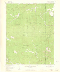 1957 Meridian Hill1959 Print · USGSThe Colorado high country in the late fifties was a mix of working ranches and new mountain retreats. Genealogists and historians can trace old property lines at Singing River Ranch, identify early campgrounds like Brook Forest, and locate landmarks such as Lions Head.7 unique versions available
 - 1957 Map of Mount Evans, 1959 Print
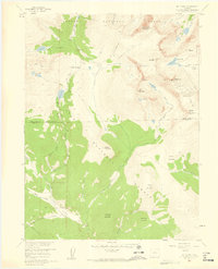 1957 Mount Evans1959 Print · USGSThe Front Range high peaks are captured here in the late fifties, showing the divide between the Arapaho and Pike National Forests. Researchers can trace historic access routes like Guanella Pass and the Pack Trail, or locate the Shelter Cabin near Summit Lake.5 unique versions available
 - 1957 Map of Byers Peak, 1959 Print
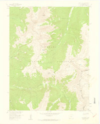 1957 Byers Peak1959 Print · USGSThe high alpine terrain of the Arapaho National Forest is captured here in the late fifties as water and mining interests shaped the landscape. Trace the Continental Divide through Jones Pass or locate high-altitude sites like the Bobtail Mine and Butler Lake.7 unique versions available
 - 1957 Map of Georgetown, 1959 Print
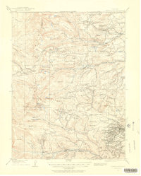
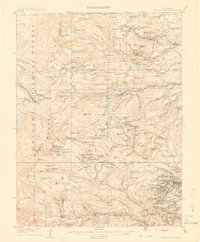
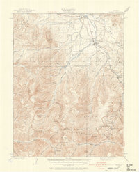
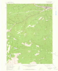
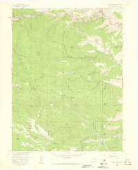
 1957 Georgetown1959 Print · USGSThe silver-mining heights of Clear Creek County appear in the mid-fifties just as mountain recreation began to grow. Trace the historic Georgetown Loop, locate family sites at Alvarado Cem, and find dozens of named mines like the Seven-Thirty Mine.7 unique versions available
 - 1957 Map of Idaho Springs, 1959 Print
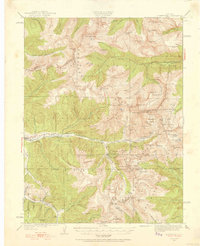
 1957 Idaho Springs1959 Print · USGSIdaho Springs and the surrounding high country are shown here in the late fifties, during a peak era of mining and mountain recreation. Researchers can locate dozens of named claims and shafts like the Lamartine Mine or trace family sites at Doolittle Ranch and the Idaho Springs Cem.6 unique versions available
 - 1957 Map of Squaw Pass, 1959 Print
 1957 Squaw Pass1959 Print · USGSThe high country west of Denver comes to life in this mid-century survey of the Front Range foothills and peaks. Genealogists and local historians can locate early homesteads and ranching hubs like Evans Ranch Hdqrs, the Beaver Brook School, and Brookvale.6 unique versions available
Showing maps 1-25 of 112
Top cities of Clear Creek County
- Idaho Springs historical maps
- Georgetown historical maps
- Empire historical maps
- Silver Plume historical maps
Frequently asked questions
- What are the different types of historical maps available for Clear Creek County?
- What is the oldest map of Clear Creek County?
- Where can I purchase historical maps of Clear Creek County for my home or office?
- Where can I download high-res historical maps of Clear Creek County?
- Are there historical topographic maps available for Clear Creek County?
- Is there historical aerial imagery available for Clear Creek County?
- Where are historical maps of Clear Creek County sourced from?