1950s Maps of Clear Creek County, Colorado
Explore 18 historic maps of Clear Creek County from the 1950s. These maps offer a rare glimpse into what life looked like during the 1950s — showing old roads, neighborhoods, homes, and landmarks that have changed or disappeared over time.
Whether you're researching your family's past, planning a metal detecting trip, or studying how Clear Creek County's landscape evolved across the 1950s, these high-resolution maps are a powerful tool for exploring the history of this region.
- Focus on a specific era: All maps on this page are from the 1950s, giving you a focused view of this time period.
- See what’s changed: Compare century-old streets, trails, and buildings to today's modern landscape using overlays and satellite layers.
- Research with precision: Use these maps for genealogy, historical research, land use analysis, or educational projects.
- View, download, or print: Maps are fully viewable online in high resolution, and can be downloaded or printed for your own records.
Start exploring Clear Creek County's history through authentic maps from the 1950s. This is your window into the past.
Clear Creek County, CO maps
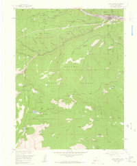
(18)- 1953 Map of Denver, 1964 Print
 1953 Denver1964 Print · USGSDenver and the Colorado Front Range are captured here during a decade of post-war growth and military expansion. Researchers can trace the sprawling rail lines of the Union Pacific, locate the State Capitol, and explore historic mountain mining hubs like Central City.6 unique versions available
 - 1957 Map of Denver
 1957 Denver1957 Print · USGSDenver and the Colorado Front Range are seen here during a mid-century period of intense military and urban expansion. Trace the footprints of the Rocky Mountain Arsenal, the early United States Air Force Academy, and the Lowry AF Base.
 - 1957 Map of Meridian Hill, 1959 Print
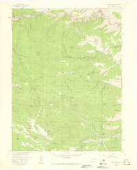
 1957 Meridian Hill1959 Print · USGSThe Colorado high country in the late fifties was a mix of working ranches and new mountain retreats. Genealogists and historians can trace old property lines at Singing River Ranch, identify early campgrounds like Brook Forest, and locate landmarks such as Lions Head.7 unique versions available
 - 1957 Map of Mount Evans, 1959 Print
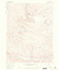
 1957 Mount Evans1959 Print · USGSThe Front Range high peaks are captured here in the late fifties, showing the divide between the Arapaho and Pike National Forests. Researchers can trace historic access routes like Guanella Pass and the Pack Trail, or locate the Shelter Cabin near Summit Lake.5 unique versions available
 - 1957 Map of Byers Peak, 1959 Print
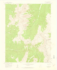 1957 Byers Peak1959 Print · USGSThe high alpine terrain of the Arapaho National Forest is captured here in the late fifties as water and mining interests shaped the landscape. Trace the Continental Divide through Jones Pass or locate high-altitude sites like the Bobtail Mine and Butler Lake.7 unique versions available
 - 1957 Map of Georgetown, 1959 Print
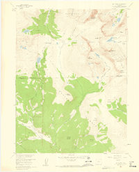
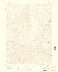
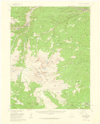
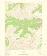
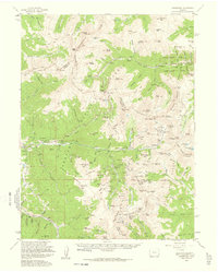
 1957 Georgetown1959 Print · USGSThe silver-mining heights of Clear Creek County appear in the mid-fifties just as mountain recreation began to grow. Trace the historic Georgetown Loop, locate family sites at Alvarado Cem, and find dozens of named mines like the Seven-Thirty Mine.7 unique versions available
 - 1957 Map of Idaho Springs, 1959 Print
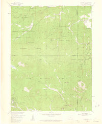
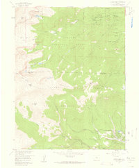
 1957 Idaho Springs1959 Print · USGSIdaho Springs and the surrounding high country are shown here in the late fifties, during a peak era of mining and mountain recreation. Researchers can locate dozens of named claims and shafts like the Lamartine Mine or trace family sites at Doolittle Ranch and the Idaho Springs Cem.6 unique versions available
 - 1957 Map of Squaw Pass, 1959 Print
 1957 Squaw Pass1959 Print · USGSThe high country west of Denver comes to life in this mid-century survey of the Front Range foothills and peaks. Genealogists and local historians can locate early homesteads and ranching hubs like Evans Ranch Hdqrs, the Beaver Brook School, and Brookvale.6 unique versions available
 - 1957 Map of Berthoud Pass, 1959 Print
 1957 Berthoud Pass1959 Print · USGSThe high Divide during the late fifties captures a landscape of early ski culture and mountain engineering. Researchers can trace the Jones Pass Tunnel, locate the First Creek Ski Cabin, and explore the terrain around Berthoud Pass and the Urad Mine.7 unique versions available
 - 1957 Map of Harris Park, 1959 Print
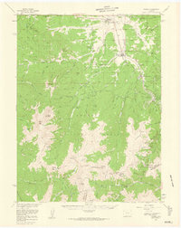
 1957 Harris Park1959 Print · USGSThe Clear Creek and Park County borderlands are shown here in the late fifties, during an era of active forest management and mountain recreation. Researchers can trace the layout of early settlements and camps like Harris Park, Camp Rock, and the Royal Ranch.8 unique versions available
 - 1957 Map of Georgetown, 1960 Print
 1957 Georgetown1960 Print · USGSGeorgetown and the high peaks of the Front Range are captured here during a period of transition between its mining peak and modern recreation. Researchers can trace the heritage of the silver boom through Silver Plume, the Lamartine Tunnel, and the Old RR Grade.5 unique versions available
 - 1957 Map of Fraser, 1960 Print
 1957 Fraser1960 Print · USGSGrand County high country comes alive in this late 1950s survey of the mountain corridor. Local historians can trace the Denver and Rio Grande Western rail line and locate landmarks like the Hideaway Park Cem and the early Ski Area at Berthoud Pass.4 unique versions available
 - 1958 Map of Denver
 1958 Denver1958 Print · USGSDenver and the Colorado Front Range are captured here during the mid-century suburban boom. Trace the footprints of military installations like Buckley Air Force Base alongside the established rail networks of the Colorado & Southern Ry.
 - 1958 Map of Grays Peak, 1959 Print
 1958 Grays Peak1959 Print · USGSThe high Continental Divide was a hub of mining and early skiing during the late fifties. Researchers can trace the legacy of high-altitude industry through the Waldorf Mine, the Old R R Grade, and the early footprint of the Arapaho Basin Ski Area.6 unique versions available
 - 1958 Map of Montezuma, 1960 Print
 1958 Montezuma1960 Print · USGSMontezuma and the surrounding high-country mining districts are captured here during the late fifties, just as post-war exploration revitalized these peaks. Researchers can locate dozens of named lode workings like the Pennsylvania Mine and Whale Mine, or trace routes over Webster Pass.5 unique versions available
 - 1958 Map of Loveland Pass, 1960 Print
 1958 Loveland Pass1960 Print · USGSHigh in the Rockies during the late fifties, this survey captures the intersection of three counties along the Continental Divide. Trace early mountain recreation and routes like the Loveland Ski Area Ski Lift and the Straight Creek Jeep Trail.5 unique versions available
 - 1958 Map of Empire, 1960 Print
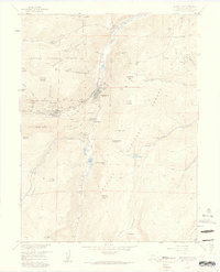
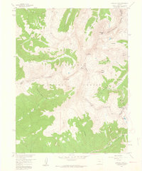
 1958 Empire1960 Print · USGSClear Creek County's mining and mountain landscapes are captured here during the late fifties, showing the alpine settlements before modern expansion. Genealogists and historians can trace local landmarks like Empire Cem, the Conqueror Mines, and the Rainbow Rancho Fish Hatchery.11 unique versions available
 - 1958 Map of Montezuma, 1961 Print
 1958 Montezuma1961 Print · USGSThe Colorado high country in the late fifties was a landscape of shifting industry, where old silver mines met emerging ski resorts. Researchers can trace historic claims like the Saints John Mine and explore high passes from Loveland Pass to Argentine Pass.5 unique versions available
End of results
Showing maps 1-18 of 18
Top cities of Clear Creek County
- Idaho Springs historical maps
- Georgetown historical maps
- Empire historical maps
- Silver Plume historical maps
Frequently asked questions
- What are the different types of historical maps available for Clear Creek County?
- What is the oldest map of Clear Creek County?
- Where can I purchase historical maps of Clear Creek County for my home or office?
- Where can I download high-res historical maps of Clear Creek County?
- Are there historical topographic maps available for Clear Creek County?
- Is there historical aerial imagery available for Clear Creek County?
- Where are historical maps of Clear Creek County sourced from?