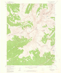
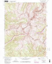
1958 Map of Loveland Pass
USGS Topo · Published 1960About this map
The Continental Divide dictates the high-altitude topography of this 1958 survey, where the headwaters of the Snake River and Clear Creek begin their diverging journeys. This portion of the Arapaho National Forest captures the high-country landscape just as recreational infrastructure began to mark the peaks, noted by the presence of the Loveland Ski Area Ski Lift. The map highlights the intersection of three counties — Grand, Summit, and Clear Creek — along the jagged ridges of the Williams Fork Mountains.
Find a feature on this map
29 named features on this map. Tap any name to fly to it.
Don’t see what you’re looking for? This feature index may not catch every label — zoom into the map to look around manually.
Map Details
Editions of this 1958 Loveland Pass Map
5 editions found
Other maps of this area

1924 · Montezuma
USGS Topo · 1:62,500

1924 · Fraser
USGS Topo · 1:62,500

1926 · Fraser
USGS Topo · 1:62,500

1926 · Montezuma
USGS Topo · 1:62,500

1929 · Dillon
USGS Topo · 1:62,500

1933 · Montezuma
USGS Topo · 1:62,500

1933 · Ute Peak
USGS Topo · 1:62,500

1934 · Dillon
USGS Topo · 1:62,500

1937 · Ute Peak
USGS Topo · 1:62,500

1953 · Denver
USGS Topo · 1:250,000