2020s Maps of Clear Creek County, Colorado
Explore 15 historic maps of Clear Creek County from the 2020s. These maps offer a rare glimpse into what life looked like during the 2020s — showing old roads, neighborhoods, homes, and landmarks that have changed or disappeared over time.
Whether you're researching your family's past, planning a metal detecting trip, or studying how Clear Creek County's landscape evolved across the 2020s, these high-resolution maps are a powerful tool for exploring the history of this region.
- Focus on a specific era: All maps on this page are from the 2020s, giving you a focused view of this time period.
- See what’s changed: Compare century-old streets, trails, and buildings to today's modern landscape using overlays and satellite layers.
- Research with precision: Use these maps for genealogy, historical research, land use analysis, or educational projects.
- View, download, or print: Maps are fully viewable online in high resolution, and can be downloaded or printed for your own records.
Start exploring Clear Creek County's history through authentic maps from the 2020s. This is your window into the past.
Clear Creek County, CO maps
(15)- 2022 Map of Georgetown, 2022 Print
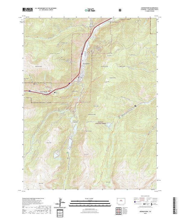 2022 Georgetown2022 Print · USGSHigh in the Clear Creek valley, this recent survey captures the enduring layout of two classic Colorado mining towns. Trace mountain heritage along the Argentine Central Railroad Grade Trl, find the Silver Plume Cem, and locate the Griffin Monument.
 - 2022 Map of Meridian Hill, 2022 Print
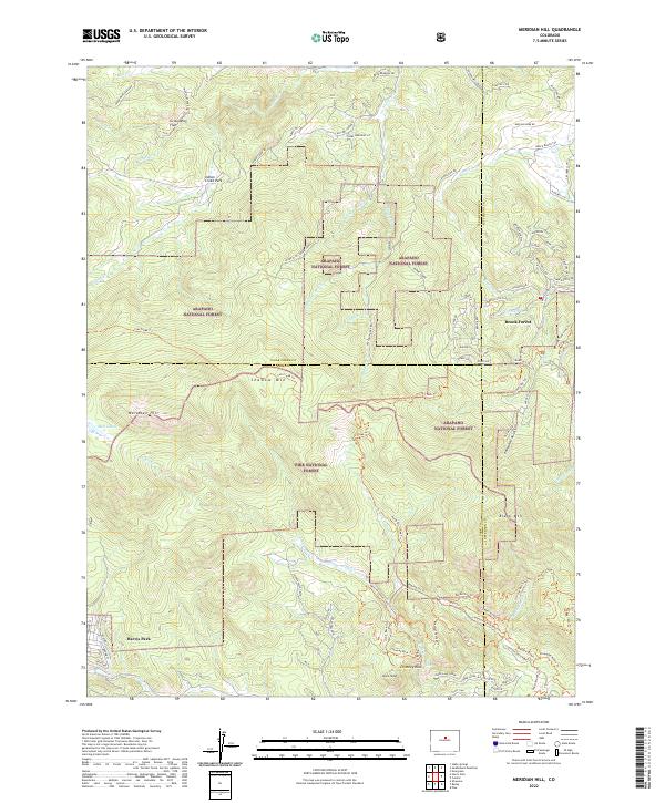 2022 Meridian Hill2022 Print · USGSThe high Front Range near the borders of Clear Creek, Jefferson, and Park counties is shown here during a period of modern forest management and residential growth. Researchers can trace the layout of Harris Park and Brook Forest or locate landmarks like Meridian Hill and Elk Falls.
 - 2022 Map of Byers Peak, 2022 Print
 2022 Byers Peak2022 Print · USGSHigh in the Front Range during the 2020s, this map details the complex drainage and trail systems along the Continental Divide. Researchers can trace the engineering of the August P Gumlick Tunnel and routes like Jones Pass.
 - 2022 Map of Montezuma, 2022 Print
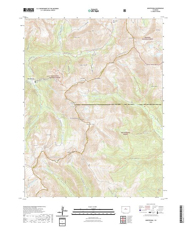 2022 Montezuma2022 Print · USGSMontezuma and the surrounding high peaks of the Continental Divide are captured here in the early twenty-first century. Researchers can trace the alpine mining era legacy through the Saints John Road, Montezuma Cem, and the high crossing at Webster Pass.
 - 2022 Map of Harris Park, 2022 Print
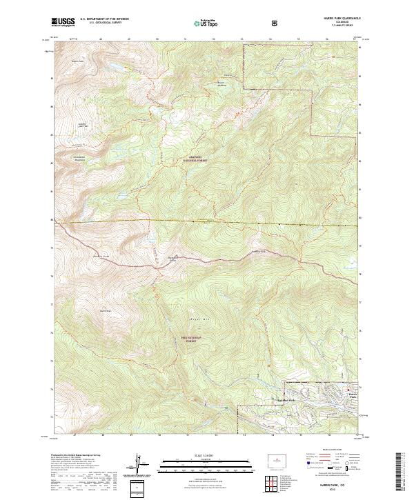 2022 Harris Park2022 Print · USGSThe mountain settlements of Harris Park and Highland Park are shown in high detail during the early 2020s. Hikers and historians can trace the access routes into the Pike National Forest via the Rosalie Trl and identify peaks like Royal Mtn.
 - 2022 Map of Black Hawk, 2022 Print
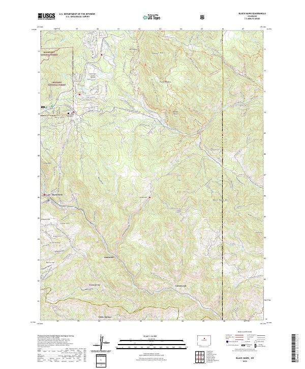 2022 Black Hawk2022 Print · USGSThe mining centers of Black Hawk and Central City are shown at the start of the 2020s amidst the high peaks of the Front Range. Genealogists and researchers can locate the Gilpin County Courthouse, Dory Hill Cem, and named landmarks like Justice Hill.
 - 2022 Map of Berthoud Pass, 2022 Print
 2022 Berthoud Pass2022 Print · USGSHigh in the Colorado Rockies during the early 2020s, this area showcases a landscape defined by winter sports and vital water infrastructure. Trace the Continental Divide National Scenic Trl past landmarks like Berthoud Pass and the August P Gumlick Tunnel.
 - 2022 Map of Central City, 2022 Print
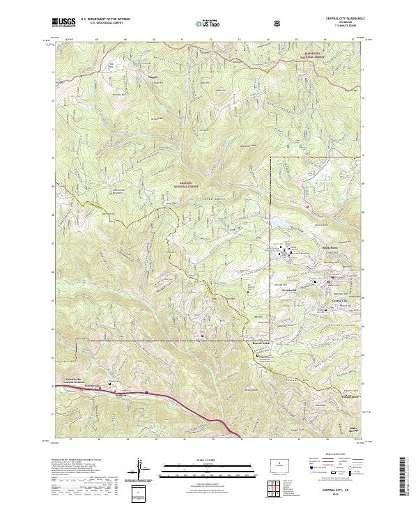 2022 Central City2022 Print · USGSGilpin County's gold-mining heart is preserved here in the mountains above Clear Creek during the early 21st century. Genealogists can locate a significant concentration of historic burial sites such as the Missouri City Cem and Rocky Mountain Independent Order of Oddfellows Lodge Number 2 Cem.
 - 2022 Map of Empire, 2022 Print
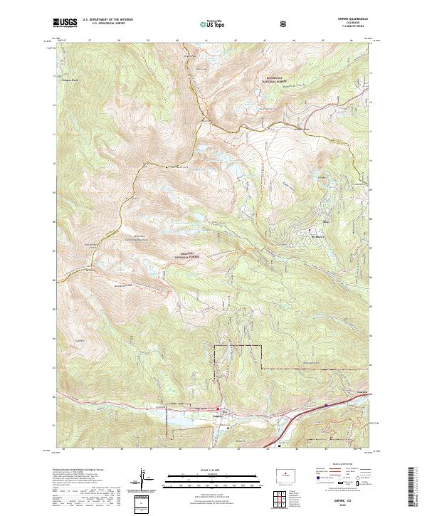 2022 Empire2022 Print · USGSThe high Front Range and the Continental Divide meet near Empire and Winter Park in this recent topographical study. Genealogists and hikers can trace the paths around Alice, find the Empire Cem, or follow the Continental Divide National Scenic Trl past James Peak.
 - 2022 Map of Mount Blue Sky, 2022 Print
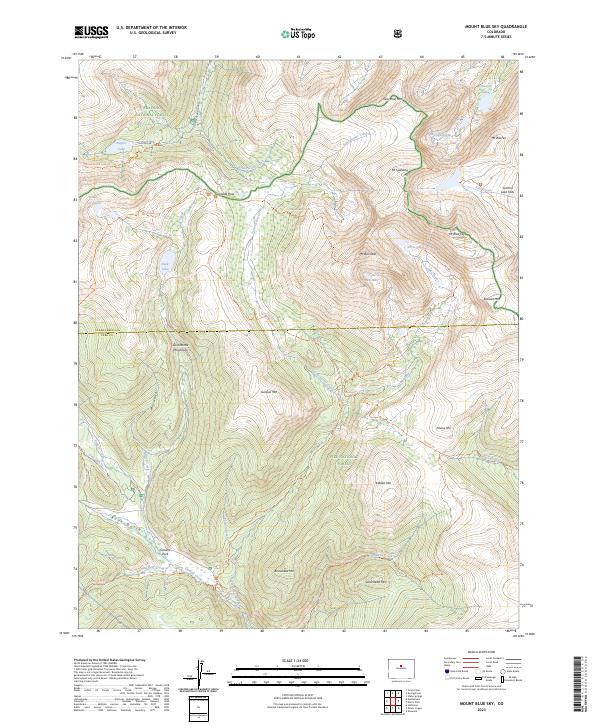
 2022 Mount Blue Sky2022 Print · USGSCovers Clear Creek County, including Bruno Gulch Campground, Park County, and other nearby areas
 - 2022 Map of Grays Peak, 2022 Print
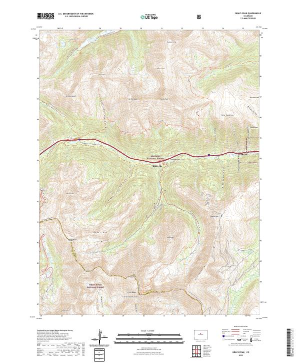 2022 Grays Peak2022 Print · USGSThe high peaks of the Front Range and the Continental Divide are captured here in the early twenty-first century. Researchers can trace the rugged corridor of Clear Cr past Bakerville and find alpine landmarks like Torreys Peak and Mt Sniktau.
 - 2022 Map of Loveland Pass, 2022 Print
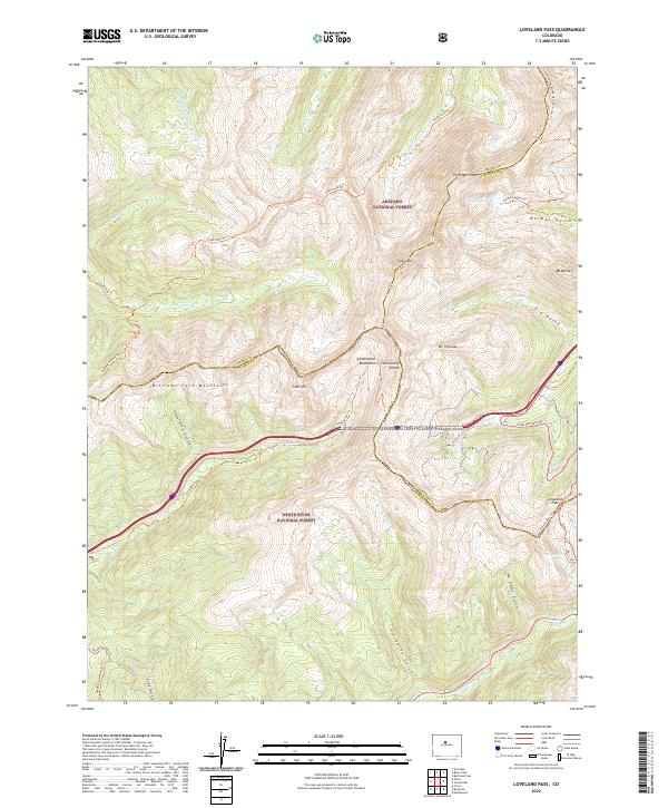 2022 Loveland Pass2022 Print · USGSThe high alpine summits of Summit and Clear Creek counties are shown here in the early twenty-first century. Researchers can trace the path of the Continental Divide National Scenic Trl and identify landmarks like Herman Lake, Loveland Pass, and Snake River Falls.
 - 2023 Map of Idaho Springs, 2023 Print
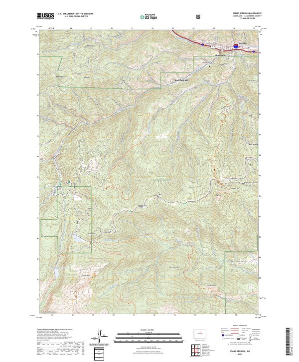 2023 Idaho Springs2023 Print · USGSIdaho Springs and the surrounding Clear Creek high country are shown in the 2020s, highlighting the area's transition from mining hub to mountain gateway. Trace the industrial legacy of the Argo Mill and Black Eagle Mill or locate mountain landmarks like Juniper Pass and Echo Lake.
 - 2023 Map of Saddleback Mountain, 2023 Print
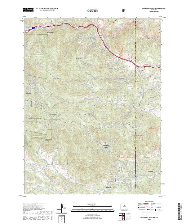 2023 Saddleback Mountain2023 Print · USGSThe Front Range foothills near Idaho Springs come into focus on this recent survey, showcasing the intersection of mountain terrain and modern development. Trace the roads through Floyd Hill and Brookvale or locate landmarks like Saddleback Mtn and Bergen Peak.
 - 2023 Map of Mount Blue Sky, 2023 Print
 2023 Mount Blue Sky2023 Print · USGSThe Front Range summits of Clear Creek County are documented here in recent detail. Researchers can trace the high-altitude Guanella Pass and alpine basins like Chicago Lakes or the settlement at Geneva Park.
End of results
Showing maps 1-15 of 15
Top cities of Clear Creek County
- Idaho Springs historical maps
- Georgetown historical maps
- Empire historical maps
- Silver Plume historical maps
Frequently asked questions
- What are the different types of historical maps available for Clear Creek County?
- What is the oldest map of Clear Creek County?
- Where can I purchase historical maps of Clear Creek County for my home or office?
- Where can I download high-res historical maps of Clear Creek County?
- Are there historical topographic maps available for Clear Creek County?
- Is there historical aerial imagery available for Clear Creek County?
- Where are historical maps of Clear Creek County sourced from?