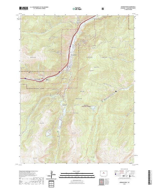
2022 Map of Georgetown
USGS Topo · Published 2022About this map
Georgetown and Silver Plume anchor this survey of the high mountain terrain within the Arapaho National Forest. The landscape is dominated by the steep valley of Clear Creek, where the historic mining and transit heritage of the region is written into the topography. The Argentine Central Railroad Grade Trl traces the complex engineering required to navigate the ascent toward Argentine Pass, while the Silver Plume To Georgetown Express Trl connects the two primary settlements. Local landmarks like the Clear Creek County Courthouse and the Griffin Monument stand alongside evidence of early industry, including the 7:30 Mine Trl and D Mine Rd. Water management is prominent through the Georgetown Reservoir and Upper Cabin Cr Reservoir, servicing the communities tucked beneath peaks like Republican Mtn and Leavenworth Mtn.
Find a feature on this map
109 named features on this map. Tap any name to fly to it.
Don’t see what you’re looking for? This feature index may not catch every label — zoom into the map to look around manually.
Map Details
Editions of this 2022 Georgetown Map
This is the sole edition of this map. No revisions or reprints were ever made.
Other maps of this area

1903 · Georgetown
USGS Topo · 1:62,500

1905 · Central City
USGS Topo · 1:62,500

1905 · Georgetown
USGS Topo · 1:62,500

1910 · Central City
USGS Topo · 1:62,500

1912 · Central City
USGS Topo · 1:62,500

1924 · Montezuma
USGS Topo · 1:62,500

1924 · Fraser
USGS Topo · 1:62,500

1926 · Fraser
USGS Topo · 1:62,500

1926 · Montezuma
USGS Topo · 1:62,500

1933 · Montezuma
USGS Topo · 1:62,500