2020s Maps of Castle Rock, Colorado
Explore 4 historic maps of Castle Rock from the 2020s. These maps offer a rare glimpse into what life looked like during the 2020s — showing old roads, neighborhoods, homes, and landmarks that have changed or disappeared over time.
Whether you're researching your family's past, planning a metal detecting trip, or studying how Castle Rock's landscape evolved across the 2020s, these high-resolution maps are a powerful tool for exploring the history of this region.
- Focus on a specific era: All maps on this page are from the 2020s, giving you a focused view of this time period.
- See what’s changed: Compare century-old streets, trails, and buildings to today's modern landscape using overlays and satellite layers.
- Research with precision: Use these maps for genealogy, historical research, land use analysis, or educational projects.
- View, download, or print: Maps are fully viewable online in high resolution, and can be downloaded or printed for your own records.
Start exploring Castle Rock's history through authentic maps from the 2020s. This is your window into the past.
Castle Rock, CO maps
(4)- 2022 Map of Castle Rock South, 2022 Print
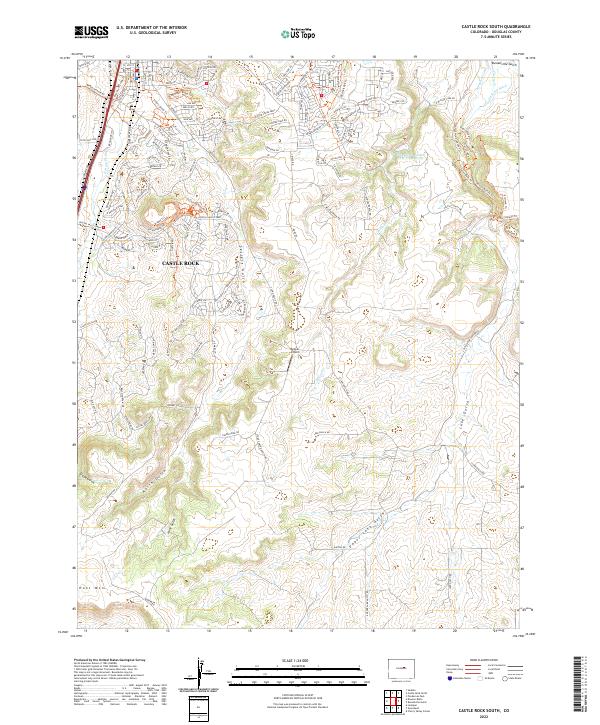 2022 Castle Rock South2022 Print · USGSThe Douglas County landscape south of Castle Rock shows a mix of suburban growth and traditional ranch lands. Researchers can trace the path of Lake Gulch, identify local landmarks like Kelgun Airport, and follow modern trails such as Memmen Ridge Trl.
 - 2022 Map of Sedalia, 2022 Print
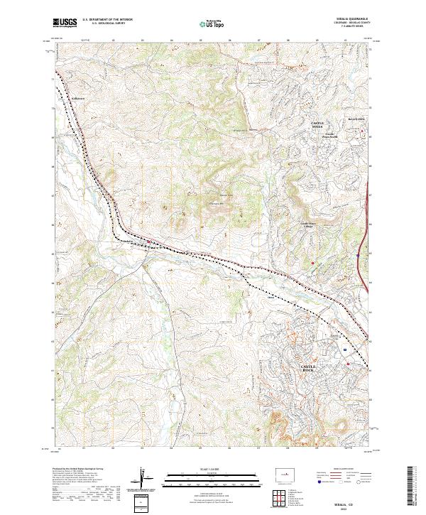 2022 Sedalia2022 Print · USGSDouglas County's northern corridor comes into focus at the start of the 2020s, showcasing the expansion of residential communities near Sedalia. Trace family locations near Kellytown, the Arapahoe Community College campus, and the terrain of Cherokee Mtn.
 - 2022 Map of Dawson Butte, 2022 Print
 2022 Dawson Butte2022 Print · USGSDouglas County’s front range foothills appear in the early 2020s as a blend of residential expansion and managed ranch land. Genealogists and local historians can trace family sites at Glen Grove Cem and follow the old water lines of the Ratcliff Plum Cr Ditch near Perry Park.
 - 2022 Map of Castle Rock North, 2022 Print
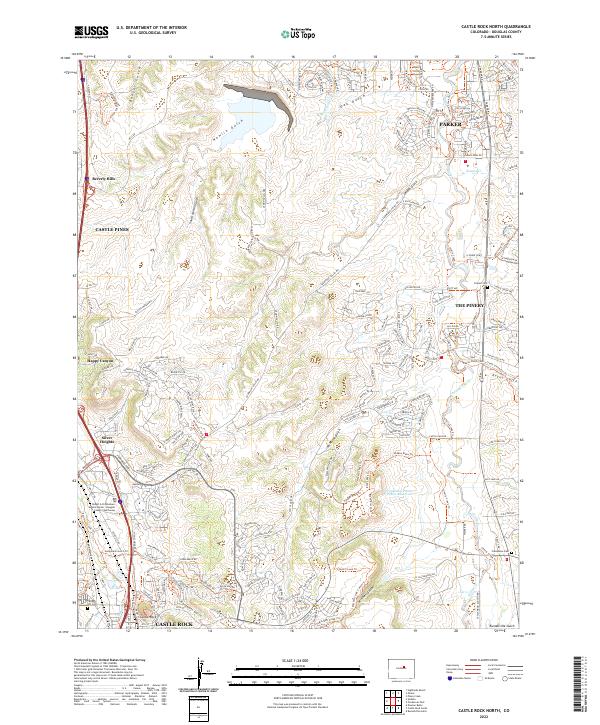 2022 Castle Rock North2022 Print · USGSDouglas County near the turn of the twenty-first century showcases a landscape of rapid suburban expansion balanced with preserved trail networks. Genealogists and local researchers can locate the Fonder Cem, Franktown Cem, and the historic seat at Castle Rock.
End of results
Showing maps 1-4 of 4
Top cities near Castle Rock
- Aurora historical maps
- Highlands Ranch historical maps
- Centennial historical maps
- Parker historical maps
- Littleton historical maps
- Greenwood Village historical maps
See more
Top neighborhoods of Castle Rock
Frequently asked questions
- What are the different types of historical maps available for Castle Rock?
- What is the oldest map of Castle Rock?
- Where can I purchase historical maps of Castle Rock for my home or office?
- Where can I download high-res historical maps of Castle Rock?
- Are there historical topographic maps available for Castle Rock?
- Is there historical aerial imagery available for Castle Rock?
- Where are historical maps of Castle Rock sourced from?