Old Maps of Black Forest, Colorado for Academic Research
Study the evolution of Black Forest with 15 high-resolution historic maps. Whether you're teaching, researching, or modeling changes in land use, these maps provide essential visual documentation of urban, environmental, and geographic change.
- Analyze long-term change: Track patterns in development, transportation, and natural features.
- Ideal for environmental or urban studies: Support academic projects with primary historical map data.
- Use in the classroom or lab: Educators and researchers rely on these maps to bring historical context to life.
These maps are a powerful tool for teaching, research, and visualizing how Black Forest has changed over the decades.
Black Forest, CO maps
(15)- 1894 Map of Castle Rock
 1894 Castle Rock1894 Print · USGSThe Front Range high country in the 1890s reveals a landscape of ranching hubs and competing rail lines. Trace early transit routes like the Denver and Rio Grande Railroad through Castle Rock, Larkspur, and Monument.2 unique versions available
 - 1913 Map of Castle Rock
 1913 Castle Rock1913 Print · USGSThe Colorado front range at the start of the twentieth century was a landscape of high-plains ranching and vital rail junctions. Genealogists can locate family homesteads near dozens of early schools like Rock Ridge School and churches such as Bethel Church.5 unique versions available
 - 1940 Map of Elbert, 1956 Print
 1940 Elbert1956 Print · USGSThe high plains of Elbert and El Paso counties are captured here in the years leading up to the mid-century, where the edge of the Black Forest meets a network of family ranches. Researchers can trace dozens of country landmarks, from the Chicago Rock Island & Pacific railroad to schoolhouses like James Sch and Sidney Sch.2 unique versions available
 - 1944 Map of Elbert
 1944 Elbert1944 Print · USGSRanching and rural education define this Elbert County landscape in the mid-1940s. Genealogists can trace family landmarks like the Ten-Sleep Ranch or locate vanished school sites like James Sch and Sidney Sch.2 unique versions available
 - 1953 Map of Denver, 1964 Print
 1953 Denver1964 Print · USGSDenver and the Colorado Front Range are captured here during a decade of post-war growth and military expansion. Researchers can trace the sprawling rail lines of the Union Pacific, locate the State Capitol, and explore historic mountain mining hubs like Central City.6 unique versions available
 - 1954 Map of Black Forest, 1955 Print
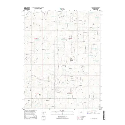
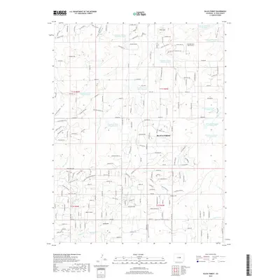
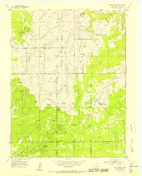 1954 Black Forest1955 Print · USGSBlack Forest was a landscape of ranches and timbered hills in the mid-1950s before suburbanization arrived. Trace the locations of early local anchors like the Black Forest School, Old Bar X Ranch, and the La Foret (Church Camp).8 unique versions available
 - 1957 Map of Denver
 1957 Denver1957 Print · USGSDenver and the Colorado Front Range are seen here during a mid-century period of intense military and urban expansion. Trace the footprints of the Rocky Mountain Arsenal, the early United States Air Force Academy, and the Lowry AF Base.
 - 1958 Map of Denver
 1958 Denver1958 Print · USGSDenver and the Colorado Front Range are captured here during the mid-century suburban boom. Trace the footprints of military installations like Buckley Air Force Base alongside the established rail networks of the Colorado & Southern Ry.
 - 1960 Map of Denver
 1960 Denver1960 Print · USGSDenver and the Colorado Front Range are seen here at a pivotal moment of postwar expansion into the plains and foothills. Researchers can trace the mid-century rail network of the Denver & Rio Grande Western RR and locate historic institutional landmarks like Buckley Field and the Colorado School of Mines.
 - 1983 Map of Castle Rock
 1983 Castle Rock1983 Print · USGSThe Palmer Divide and Front Range foothills come to life in the early eighties as ranching communities and military sites define the landscape. Trace old rail lines like the Chicago Rock Island and Pacific and find landmarks from Monkey Face to Daniels Park.
 - 2010 Map of Black Forest, 2010 Print
 2010 Black Forest2010 Print · USGSCovers Black Forest, including El Paso County, United States, and other nearby areas
 - 2013 Map of Black Forest, 2013 Print
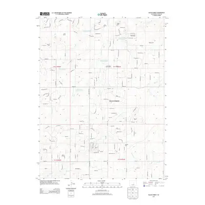 2013 Black Forest2013 Print · USGSCovers Black Forest, including El Paso County, United States, and other nearby areas
 - 2016 Map of Black Forest, 2016 Print
 2016 Black Forest2016 Print · USGSCovers Black Forest, including El Paso County, United States, and other nearby areas
 - 2019 Map of Black Forest, 2019 Print
 2019 Black Forest2019 Print · USGSCovers Black Forest, including El Paso County, United States, and other nearby areas
 - 2022 Map of Black Forest, 2022 Print
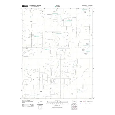
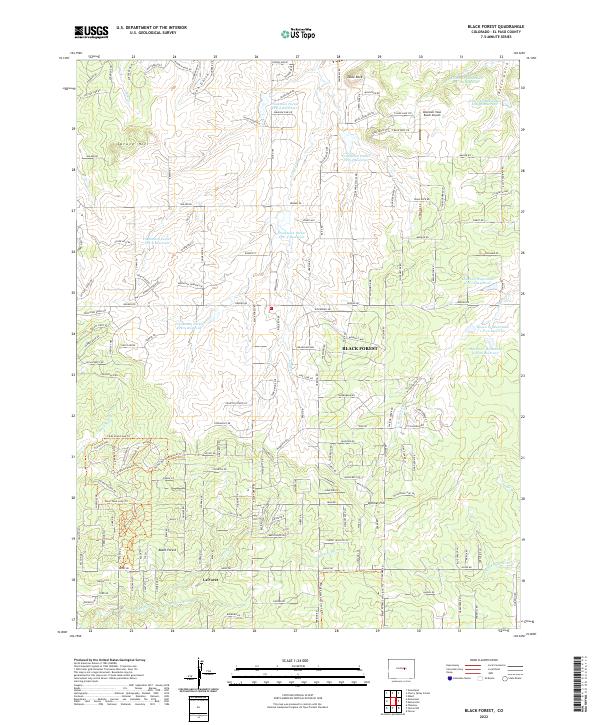 2022 Black Forest2022 Print · USGSThe northern reaches of El Paso County are captured here in the early twenty-first century as rural homesteads and subdivisions expand. Researchers can trace local landmarks like Table Rock, the Mountain View Ranch Airport, and the community of La Foret.
End of results
Showing maps 1-15 of 15
Top cities near Black Forest
- Colorado Springs historical maps
- Manitou Springs historical maps
- Monument historical maps
- Palmer Lake historical maps
- Elbert historical maps
- Larkspur historical maps
Frequently asked questions
- What are the different types of historical maps available for Black Forest?
- What is the oldest map of Black Forest?
- Where can I purchase historical maps of Black Forest for my home or office?
- Where can I download high-res historical maps of Black Forest?
- Are there historical topographic maps available for Black Forest?
- Is there historical aerial imagery available for Black Forest?
- Where are historical maps of Black Forest sourced from?