Old Maps of Fountain, Colorado
Explore 35 old maps of Fountain, spanning from 1893 to today. These high-resolution historic maps reveal how streets, neighborhoods, landmarks, and natural features evolved over time — perfect for genealogy, metal detecting, research, and local history exploration.
What you can do with these maps:
- See how Fountain changed over time: Compare historical maps to modern-day views to trace roads, homesites, rail lines & more.
- View detailed metadata: Each map includes creators, publishers, year, scale, and archive source.
- Overlay maps with satellite & LiDAR: Visualize the past alongside modern tools to explore terrain & human change.
- Trusted historical sources: Maps sourced from the USGS, Library of Congress, and other archives.
- Access maps your way: View online, download high-res files, or order prints for personal or research use.
Start exploring old maps of Fountain to uncover forgotten places, hidden landmarks, and the deep history beneath your feet.
Fountain, CO maps
(35)- 1893 Map of Colorado Springs, 1896 Print
 1893 Colorado Springs1896 Print · USGSEl Paso County at the end of the nineteenth century was a booming intersection of mountain tourism and heavy rail commerce. Researchers can trace early railroad alignments like the Colorado Midland Railroad and locate vanished stops at Franceville Junction or Bierstadt.2 unique versions available
 - 1909 Map of Colorado Springs
 1909 Colorado Springs1909 Print · USGSColorado Springs and the Front Range foothills are shown here at a pivotal era of rail expansion and early tourism. Genealogists and historians can trace defunct rail lines, rural schoolhouse locations like Grandview School, and landmarks such as the Cliff Dwellings and Burial Rocks.5 unique versions available
 - 1942 Map of Colorado Springs
 1942 Colorado Springs1942 Print · USGSColorado Springs and the Front Range appear here in the early years of the Second World War. Genealogists and historians can trace the rail corridors of the Chicago Rock Island and Pacific RR and locate sites like the Printers Home and Glen Eyrie.
 - 1948 Map of Fountain, 1958 Print
 1948 Fountain1958 Print · USGSThe high plains of El Paso County are captured here just after the war, showing the expansion of military lands and rail lines. You can trace the railroad corridors through Fountain and locate local landmarks like Fairview Cemetery and Widefield School.
 - 1948 Map of Falcon, 1960 Print
 1948 Falcon1960 Print · USGSEl Paso County ranching and early aviation come to life in the late 1940s as the high plains expand east of the mountains. Genealogists and researchers can locate family-named landmarks like Banning Lewis Ranch, trace the rail corridor of the Chicago Rock Island and Pacific, and see the early layout of Peterson Field.
 - 1949 Map of Buttes
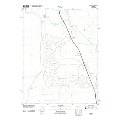
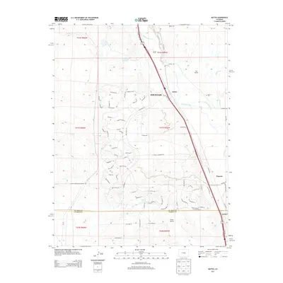
 1949 Buttes1949 Print · USGSEl Paso and Pueblo counties meet along this corridor south of Colorado Springs in the late 1940s. Trace the parallel routes of major western railroads through old ranching settlements like Wigwam, Buttes, and the 7 L Bar Ranch.2 unique versions available
 - 1950 Map of Elsmere
 1950 Elsmere1950 Print · USGSEl Paso County at the dawn of the 1950s shows an area transitioning through military aviation and ranching. Trace the early layout of Peterson Field or find local landmarks like Pikes Peak Speedway and the settlement of Elsmere.2 unique versions available
 - 1950 Map of Fountain
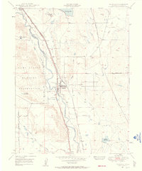
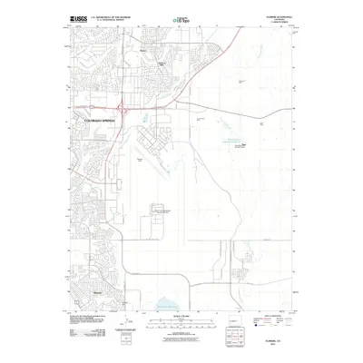
 1950 Fountain1950 Print · USGSEl Paso County at the dawn of the fifties shows a landscape of strategic rail lines and expanding irrigation. Genealogy researchers can trace family landmarks like Fairview Cemetery and the original sites of Widefield School and Fountain Valley School.2 unique versions available
 - 1951 Map of Falcon
 1951 Falcon1951 Print · USGSEastern El Paso County is shown as a thriving ranching and aviation hub in the early fifties. Genealogists and historians can trace numerous family-named landmarks like Banning Lewis Ranch and Wolf Ranch or locate early airfield layouts at Peterson Field.2 unique versions available
 - 1951 Map of Fountain
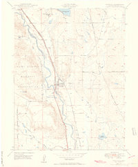
 1951 Fountain1951 Print · USGSThe Fountain valley during the early fifties shows a landscape shaped by military expansion and intensive irrigation. Researchers can trace the dual rail lines through Wigwam and Crews or locate family landmarks like the 7 L Bar Ranch and Wilson Cemetery.2 unique versions available
 - 1954 Map of Pueblo, 1966 Print
 1954 Pueblo1966 Print · USGSMid-century Colorado comes alive in this survey of the Front Range and the high plains as the region expanded after the war. Genealogists and historians can trace family roots through rural landmarks like Hanover Church, Pioneer Cemetery, and the Grandview School.3 unique versions available
 - 1957 Map of Pueblo
 1957 Pueblo1957 Print · USGSMid-century Colorado comes alive as the Front Range urban centers expand alongside massive Cold War military installations. Genealogists and historians can trace the foundations of Stone City, rural sites like Hanover School, and the industrial Canon Imperial Mine.
 - 1958 Map of Pueblo
 1958 Pueblo1958 Print · USGSColorado's Front Range and Arkansas River Valley come alive in the late fifties, showing the transition from historic mining districts to major military and rail hubs. Genealogists and historians can trace family roots in ranching communities and find landmarks like Cripple Creek, Manitou, and the Hanover School.
 - 1961 Map of Buttes, 1963 Print
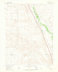 1961 Buttes1963 Print · USGSEl Paso County ranch land and military infrastructure meet along the Fountain Creek corridor in the early sixties. Genealogists and rail historians can trace the twin paths of the Atchison Topeka and Santa Fe Railway and the Denver and Rio Grande Western Railroad past the Wigwam Sch and Midway Ranch.8 unique versions available
 - 1961 Map of Fountain, 1963 Print
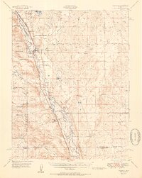
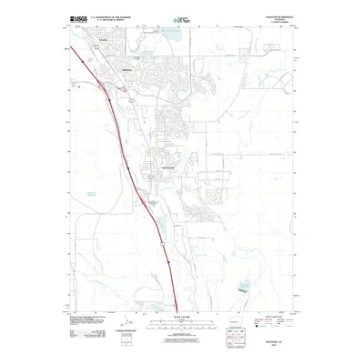
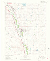 1961 Fountain1963 Print · USGSEl Paso County at the start of the sixties shows a landscape of rapid suburban growth and military presence. Genealogists and historians can trace the early developments of Security and Widefield or locate rail sites like Crews and Holmes.9 unique versions available
 - 1961 Map of Elsmere, 1963 Print
 1961 Elsmere1963 Print · USGSThe high plains of El Paso County are captured here in the early sixties as military aviation and suburban growth begin to transform the landscape. Researchers can trace the development of Security, locate early schools like Sproul Sch, and explore features like Peterson Field and the Pikes Peak Speedway.9 unique versions available
 - 1962 Map of Pueblo
 1962 Pueblo1962 Print · USGSThe Front Range and high plains meet in the early sixties as military installations and industrial mining shape the corridor from Colorado Springs to Pueblo. Genealogists can trace family names through rural landmarks like the Columbine School, Hanover Church, and Fairview Cem.
 - 1966 Map of Pueblo
 1966 Pueblo1966 Print · USGSThe Front Range and Arkansas River Valley are captured here in the mid-1960s, showing a landscape shaped by mining, military expansion, and rail. Researchers can locate numerous country schools and mines, such as the Lytle School, Pioneer Cem, and Empire Zinc Mine.
 - 1981 Map of Colorado Springs
 1981 Colorado Springs1981 Print · USGSColorado Springs and the Front Range were well established by the early eighties, showcasing a mix of military installations and mountain settlements. Genealogists and historians can trace the growth of Security and Widefield or locate remote points like Holtwold Store and Ellicott.2 unique versions available
 - 1989 Map of Pueblo
 1989 Pueblo1989 Print · USGSIn the late eighties, the Colorado Front Range balanced its deep mining history with massive military expansion and water development. Researchers can trace the rail lines of the AT & SF RR or locate remote high-altitude settlements like Rosita and Querida.
 - 2010 Map of Elsmere, 2010 Print
 2010 Elsmere2010 Print · USGSCovers Fountain, including Colorado Springs, Security-Widefield, and other nearby areas
 - 2010 Map of Buttes, 2010 Print
 2010 Buttes2010 Print · USGSCovers Fountain, including Wigwam, Buttes, and other nearby areas
 - 2010 Map of Fountain, 2010 Print
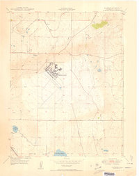
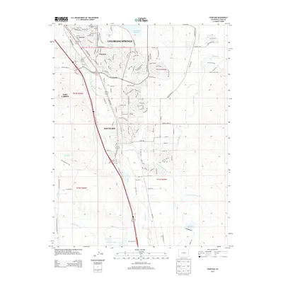
 2010 Fountain2010 Print · USGSCovers Fountain, including Colorado Springs, Security-Widefield, and other nearby areas
 - 2013 Map of Fountain, 2013 Print
 2013 Fountain2013 Print · USGSCovers Fountain, including Colorado Springs, Security-Widefield, and other nearby areas
 - 2013 Map of Buttes, 2013 Print
 2013 Buttes2013 Print · USGSCovers Fountain, including Wigwam, Buttes, and other nearby areas
Showing maps 1-25 of 35
Top cities near Fountain
Frequently asked questions
- What are the different types of historical maps available for Fountain?
- What is the oldest map of Fountain?
- Where can I purchase historical maps of Fountain for my home or office?
- Where can I download high-res historical maps of Fountain?
- Are there historical topographic maps available for Fountain?
- Is there historical aerial imagery available for Fountain?
- Where are historical maps of Fountain sourced from?