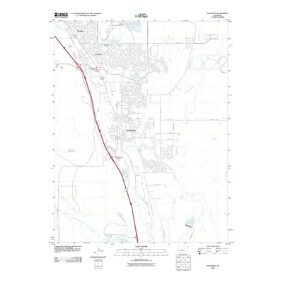
2010 Map of Fountain
USGS Topo · Published 2010About this map
Fountain and its surrounding suburban developments such as Security and Widefield define the landscape south of Colorado Springs in this 2010 survey. The area is characterized by a mix of established residential grids and significant water management infrastructure, including the Big Johnson Reservoir and A McCray Reservoir. Fountain Creek serves as the primary drainage corridor, paralleled by major transportation routes and the Fountain Ditch, reflecting the region's reliance on managed water for its growth and agriculture.
Find a feature on this map
44 named features on this map. Tap any name to fly to it.
Don’t see what you’re looking for? This feature index may not catch every label — zoom into the map to look around manually.
Map Details
Editions of this 2010 Fountain Map
This is the sole edition of this map. No revisions or reprints were ever made.
Other maps of this area

1893 · Colorado Springs
USGS Topo · 1:125,000

1909 · Colorado Springs
USGS Topo · 1:125,000

1942 · Colorado Springs
USGS Topo · 1:125,000

1948 · Timber Mountain
USGS Topo · 1:24,000

1948 · Fountain SE
USGS Topo · 1:24,000

1948 · Colorado Springs
USGS Topo · 1:62,500

1948 · Fountain
USGS Topo · 1:24,000

1948 · Colorado Springs
USGS Topo · 1:24,000

1948 · Cheyenne Mountain
USGS Topo · 1:24,000

1948 · Falcon
USGS Topo · 1:62,500