1900s (20th Century) Maps of Elbert County, Colorado
Explore 78 historic maps of Elbert County from the 1900s (20th Century). These maps offer a rare glimpse into what life looked like during the 1900s — showing old roads, neighborhoods, homes, and landmarks that have changed or disappeared over time.
Whether you're researching your family's past, planning a metal detecting trip, or studying how Elbert County's landscape evolved across the 1900s, these high-resolution maps are a powerful tool for exploring the history of this region.
- Focus on a specific era: All maps on this page are from the 1900s, giving you a focused view of this time period.
- See what’s changed: Compare century-old streets, trails, and buildings to today's modern landscape using overlays and satellite layers.
- Research with precision: Use these maps for genealogy, historical research, land use analysis, or educational projects.
- View, download, or print: Maps are fully viewable online in high resolution, and can be downloaded or printed for your own records.
Start exploring Elbert County's history through authentic maps from the 1900s. This is your window into the past.
Elbert County, CO maps
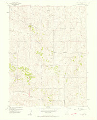
(78)- 1913 Map of Castle Rock
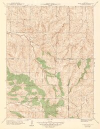
 1913 Castle Rock1913 Print · USGSThe Colorado front range at the start of the twentieth century was a landscape of high-plains ranching and vital rail junctions. Genealogists can locate family homesteads near dozens of early schools like Rock Ridge School and churches such as Bethel Church.5 unique versions available
 - 1939 Map of Elizabeth, 1958 Print
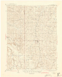
 1939 Elizabeth1958 Print · USGSRanching and early mining history converge on the Elbert County plains in the 1930s. Genealogists and historians can trace the Site of Gold Discovery by Russell and numerous rural schoolhouses like Hilltop Sch and Locust Grove Sch.4 unique versions available
 - 1940 Map of Piney Creek
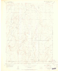
 1940 Piney Creek1940 Print · USGSThe High Plains of the late Depression era come to life here as the tri-county borders of Arapahoe, Douglas, and Elbert converge. Researchers can trace the rugged drainage patterns of Piney Creek, Sulphur Gulch, and Coal Creek before the landscape was altered by modern development.
 - 1940 Map of Elbert, 1956 Print
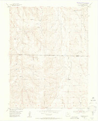
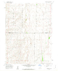
 1940 Elbert1956 Print · USGSThe high plains of Elbert and El Paso counties are captured here in the years leading up to the mid-century, where the edge of the Black Forest meets a network of family ranches. Researchers can trace dozens of country landmarks, from the Chicago Rock Island & Pacific railroad to schoolhouses like James Sch and Sidney Sch.2 unique versions available
 - 1942 Map of Piney Creek
 1942 Piney Creek1942 Print · USGSThe Colorado high plains southeast of Denver appear as a quiet rural landscape in the early 1940s, just as modern infrastructure began to take shape. Genealogists and historians can trace the early drainage and road networks along Piney Creek, Sulphur Gulch, and Coal Creek.2 unique versions available
 - 1944 Map of Elbert
 1944 Elbert1944 Print · USGSRanching and rural education define this Elbert County landscape in the mid-1940s. Genealogists can trace family landmarks like the Ten-Sleep Ranch or locate vanished school sites like James Sch and Sidney Sch.2 unique versions available
 - 1945 Map of Elizabeth
 1945 Elizabeth1945 Print · USGSThe ranching and mining country along the Douglas and Elbert county line comes to life in this mid-century survey. Genealogists can trace family landmarks like the Idelweiss Ranch, Miller Cem, and the notable Site of Gold Discovery by Russell.2 unique versions available
 - 1953 Map of Denver, 1964 Print
 1953 Denver1964 Print · USGSDenver and the Colorado Front Range are captured here during a decade of post-war growth and military expansion. Researchers can trace the sprawling rail lines of the Union Pacific, locate the State Capitol, and explore historic mountain mining hubs like Central City.6 unique versions available
 - 1954 Map of Limon
 1954 Limon1954 Print · USGSThe Eastern Colorado plains and the Kansas borderlands come alive in the mid-fifties, showing the vital rail-and-road corridor through Limon. Genealogists and historians can trace the Chicago Rock Island & Pacific line through Burlington and find remote outposts like Arickaree and Anton.4 unique versions available
 - 1954 Map of Cherry Valley School, 1955 Print
 1954 Cherry Valley School1955 Print · USGSMid-century ranching life at the Douglas and Elbert county line is captured here just as rural school districts were consolidating. Genealogists and historians can trace old homesteads near Cherry Valley School or locate the sites of Cherry Sch (Aband) and Bucks Mountain.6 unique versions available
 - 1954 Map of Lamar, 1964 Print
 1954 Lamar1964 Print · USGSSoutheastern Colorado and the Kansas borderlands appear here in the mid-fifties, dominated by the vital Arkansas River irrigation network. Researchers can trace the development of river towns like Lamar and La Junta alongside the Amity Cemetery and several major reservoirs.3 unique versions available
 - 1954 Map of Pueblo, 1966 Print
 1954 Pueblo1966 Print · USGSMid-century Colorado comes alive in this survey of the Front Range and the high plains as the region expanded after the war. Genealogists and historians can trace family roots through rural landmarks like Hanover Church, Pioneer Cemetery, and the Grandview School.3 unique versions available
 - 1955 Map of Watkins SE, 1956 Print
 1955 Watkins SE1956 Print · USGSThe Arapahoe and Elbert county line in the mid-1950s was a site of significant military operations and shifting rural life. Genealogists and historians can trace the Military Reservation Boundary and find the site of the Sehley Sch (Aban'd) near Box Elder Creek.6 unique versions available
 - 1957 Map of Denver
 1957 Denver1957 Print · USGSDenver and the Colorado Front Range are seen here during a mid-century period of intense military and urban expansion. Trace the footprints of the Rocky Mountain Arsenal, the early United States Air Force Academy, and the Lowry AF Base.
 - 1957 Map of Limon
 1957 Limon1957 Print · USGSThe High Plains of Eastern Colorado and Western Kansas come alive in the mid-1950s, showing the vital rail-and-road connections of the era. You can trace the path of the Chicago Rock Island and Pacific through towns like Limon, Stratton, and Burlington or find the early footprint of Bonny Reservoir.
 - 1957 Map of Pueblo
 1957 Pueblo1957 Print · USGSMid-century Colorado comes alive as the Front Range urban centers expand alongside massive Cold War military installations. Genealogists and historians can trace the foundations of Stone City, rural sites like Hanover School, and the industrial Canon Imperial Mine.
 - 1957 Map of Piney Creek, 1958 Print
 1957 Piney Creek1958 Print · USGSThe high plains southeast of Denver appear here in the mid-fifties, dominated by the Lowry Air Force Base Bombing Range. Researchers can trace the historic Smoky Hill Road and locate a rural Cem near Sulphur Gulch.3 unique versions available
 - 1958 Map of Limon
 1958 Limon1958 Print · USGSEastern Colorado and the Kansas border meet in this late-fifties study of High Plains rail and river systems. Researchers can trace the path of the Chicago Rock Island and Pacific through Limon and Burlington, or locate the Bonny Dam and Bonny Reservoir.
 - 1958 Map of Pueblo
 1958 Pueblo1958 Print · USGSColorado's Front Range and Arkansas River Valley come alive in the late fifties, showing the transition from historic mining districts to major military and rail hubs. Genealogists and historians can trace family roots in ranching communities and find landmarks like Cripple Creek, Manitou, and the Hanover School.
 - 1958 Map of Denver
 1958 Denver1958 Print · USGSDenver and the Colorado Front Range are captured here during the mid-century suburban boom. Trace the footprints of military installations like Buckley Air Force Base alongside the established rail networks of the Colorado & Southern Ry.
 - 1958 Map of Lamar
 1958 Lamar1958 Print · USGSThe High Plains of Eastern Colorado and Western Kansas in the late fifties reveal a landscape tied to the Arkansas River and the rails. Trace the heritage of the river valley through Fort Lyon, the Atchison Topeka and Santa Fe RR, and rural landmarks like Kendrick Church.2 unique versions available
 - 1960 Map of Denver
 1960 Denver1960 Print · USGSDenver and the Colorado Front Range are seen here at a pivotal moment of postwar expansion into the plains and foothills. Researchers can trace the mid-century rail network of the Denver & Rio Grande Western RR and locate historic institutional landmarks like Buckley Field and the Colorado School of Mines.
 - 1961 Map of Strasburg SW, 1962 Print
 1961 Strasburg SW1962 Print · USGSThe high plains of eastern Colorado served as a strategic military zone in the early sixties. Researchers can trace the boundaries of the Lowry Air Force Base Bombing Range and locate points like Bomb and Fuse along Kiowa Creek.5 unique versions available
 - 1962 Map of Pueblo
 1962 Pueblo1962 Print · USGSThe Front Range and high plains meet in the early sixties as military installations and industrial mining shape the corridor from Colorado Springs to Pueblo. Genealogists can trace family names through rural landmarks like the Columbine School, Hanover Church, and Fairview Cem.
 - 1966 Map of Pueblo
 1966 Pueblo1966 Print · USGSThe Front Range and Arkansas River Valley are captured here in the mid-1960s, showing a landscape shaped by mining, military expansion, and rail. Researchers can locate numerous country schools and mines, such as the Lytle School, Pioneer Cem, and Empire Zinc Mine.
Showing maps 1-25 of 78
Top cities of Elbert County
Frequently asked questions
- What are the different types of historical maps available for Elbert County?
- What is the oldest map of Elbert County?
- Where can I purchase historical maps of Elbert County for my home or office?
- Where can I download high-res historical maps of Elbert County?
- Are there historical topographic maps available for Elbert County?
- Is there historical aerial imagery available for Elbert County?
- Where are historical maps of Elbert County sourced from?