1900s (20th Century) Maps of Cañon City, Colorado
Explore 11 historic maps of Cañon City from the 1900s (20th Century). These maps offer a rare glimpse into what life looked like during the 1900s — showing old roads, neighborhoods, homes, and landmarks that have changed or disappeared over time.
Whether you're researching your family's past, planning a metal detecting trip, or studying how Cañon City's landscape evolved across the 1900s, these high-resolution maps are a powerful tool for exploring the history of this region.
- Focus on a specific era: All maps on this page are from the 1900s, giving you a focused view of this time period.
- See what’s changed: Compare century-old streets, trails, and buildings to today's modern landscape using overlays and satellite layers.
- Research with precision: Use these maps for genealogy, historical research, land use analysis, or educational projects.
- View, download, or print: Maps are fully viewable online in high resolution, and can be downloaded or printed for your own records.
Start exploring Cañon City's history through authentic maps from the 1900s. This is your window into the past.
Cañon City, CO maps
(11)- 1954 Map of Pueblo, 1966 Print
 1954 Pueblo1966 Print · USGSMid-century Colorado comes alive in this survey of the Front Range and the high plains as the region expanded after the war. Genealogists and historians can trace family roots through rural landmarks like Hanover Church, Pioneer Cemetery, and the Grandview School.3 unique versions available
 - 1957 Map of Pueblo
 1957 Pueblo1957 Print · USGSMid-century Colorado comes alive as the Front Range urban centers expand alongside massive Cold War military installations. Genealogists and historians can trace the foundations of Stone City, rural sites like Hanover School, and the industrial Canon Imperial Mine.
 - 1958 Map of Pueblo
 1958 Pueblo1958 Print · USGSColorado's Front Range and Arkansas River Valley come alive in the late fifties, showing the transition from historic mining districts to major military and rail hubs. Genealogists and historians can trace family roots in ranching communities and find landmarks like Cripple Creek, Manitou, and the Hanover School.
 - 1959 Map of Canon City, 1961 Print
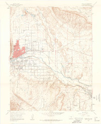 1959 Canon City1961 Print · USGSThe Arkansas River valley in the late fifties was a busy intersection of irrigation, industry, and institutional land. Researchers can trace family history through sites like Lakeside Cemetery or locate landmarks like the State Prison Farm and Abbey.5 unique versions available
 - 1959 Map of Royal Gorge, 1961 Print
 1959 Royal Gorge1961 Print · USGSFremont County's canyon country comes into focus in the late fifties, showcasing the intricate rail lines and early tourist infrastructure around the Royal Gorge. You can trace the Denver & Rio Grande Western RR and locate old homesteads like Griffin Ranch and the former Sunset City.3 unique versions available
 - 1962 Map of Pueblo
 1962 Pueblo1962 Print · USGSThe Front Range and high plains meet in the early sixties as military installations and industrial mining shape the corridor from Colorado Springs to Pueblo. Genealogists can trace family names through rural landmarks like the Columbine School, Hanover Church, and Fairview Cem.
 - 1966 Map of Pueblo
 1966 Pueblo1966 Print · USGSThe Front Range and Arkansas River Valley are captured here in the mid-1960s, showing a landscape shaped by mining, military expansion, and rail. Researchers can locate numerous country schools and mines, such as the Lytle School, Pioneer Cem, and Empire Zinc Mine.
 - 1980 Map of Royal Gorge, 1981 Print
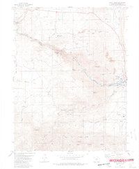 1980 Royal Gorge1981 Print · USGSThe Colorado canyons come into sharp focus in the 1980s as recreation and industry meet along the Arkansas River. Trace the path of the Denver and Rio Grande Western Railroad or locate the landmark Royal Gorge Bridge and the western edge of Canon City.3 unique versions available
 - 1982 Map of Canon City, 1983 Print
 1982 Canon City1983 Print · USGSCentral Colorado in the early eighties shows a landscape shaped by high peaks and river-valley industry. Genealogists can locate family sites near Silver Cliff, Union Highland Cem, or the State Prison Farm.
 - 1989 Map of Pueblo
 1989 Pueblo1989 Print · USGSIn the late eighties, the Colorado Front Range balanced its deep mining history with massive military expansion and water development. Researchers can trace the rail lines of the AT & SF RR or locate remote high-altitude settlements like Rosita and Querida.
 - 1994 Map of Royal Gorge, 1998 Print
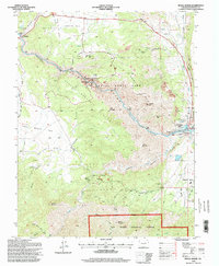 1994 Royal Gorge1998 Print · USGSThe Arkansas River cuts a dramatic path through Fremont County in the mid-1990s, revealing a landscape defined by deep canyons and high peaks. Genealogists and historians can trace the sites of Parkdale and Buckskin Joe alongside the Railroad and Eightmile Park.
End of results
Showing maps 1-11 of 11
Top cities near Cañon City
- Lincoln Park historical maps
- Florence historical maps
- Penrose historical maps
- Williamsburg historical maps
- Rockvale historical maps
- Coal Creek historical maps
See more
Top neighborhoods of Cañon City
Frequently asked questions
- What are the different types of historical maps available for Cañon City?
- What is the oldest map of Cañon City?
- Where can I purchase historical maps of Cañon City for my home or office?
- Where can I download high-res historical maps of Cañon City?
- Are there historical topographic maps available for Cañon City?
- Is there historical aerial imagery available for Cañon City?
- Where are historical maps of Cañon City sourced from?