Old Maps of Kremmling, Colorado
Explore 21 old maps of Kremmling, spanning from 1954 to today. These high-resolution historic maps reveal how streets, neighborhoods, landmarks, and natural features evolved over time — perfect for genealogy, metal detecting, research, and local history exploration.
What you can do with these maps:
- See how Kremmling changed over time: Compare historical maps to modern-day views to trace roads, homesites, rail lines & more.
- View detailed metadata: Each map includes creators, publishers, year, scale, and archive source.
- Overlay maps with satellite & LiDAR: Visualize the past alongside modern tools to explore terrain & human change.
- Trusted historical sources: Maps sourced from the USGS, Library of Congress, and other archives.
- Access maps your way: View online, download high-res files, or order prints for personal or research use.
Start exploring old maps of Kremmling to uncover forgotten places, hidden landmarks, and the deep history beneath your feet.
Kremmling, CO maps
(21)- 1954 Map of Craig, 1973 Print
 1954 Craig1973 Print · USGSNorthwest Colorado and the high mountain parks are captured in the mid-fifties, showing the region's ranching, mining, and timber centers. Genealogists and historians can trace rail corridors like the Denver and Rio Grande Western and old towns such as Axial, Milner, and Coalmont.3 unique versions available
 - 1956 Map of Kremmling, 1958 Print
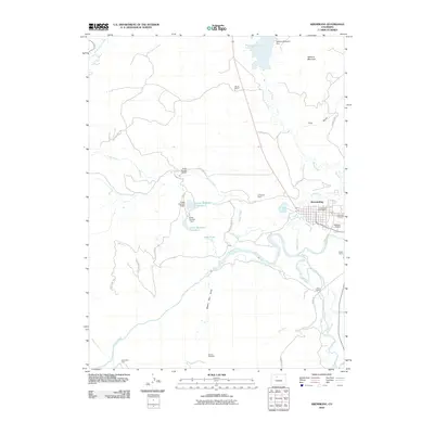
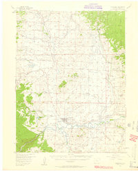 1956 Kremmling1958 Print · USGSMid-century Colorado ranching and river geography converge at the confluence of the Colorado River and Blue River. Genealogists and local historians can trace family-named sites like Taussig Ranch and Ingram Ranch or locate the old Colorow Sch.3 unique versions available
 - 1957 Map of Craig
 1957 Craig1957 Print · USGSNorthwest Colorado in the mid-fifties is a landscape of mountain ranching and rail-dependent river towns. Researchers can trace historic coal mining at the Sudduth Mine, follow the Denver and Rio Grande Western tracks, and locate vanished settlements like Pearl.
 - 1958 Map of Craig
 1958 Craig1958 Print · USGSNorthwest Colorado and the High Rockies are captured here in the mid-fifties, showing a landscape of burgeoning water projects and mountain ranching. Genealogists and historians can trace old homesteads and mountain outposts from Grand Lake to Meeker, alongside industrial landmarks like Uranium Mines and the Denver and Rio Grande Western railroad.
 - 1960 Map of Craig
 1960 Craig1960 Print · USGSNorthwest Colorado in the 1950s is a landscape of mountain summits and industrial growth at the headwaters of the West. Genealogists and historians can trace rail-town development along the Denver and Salt Lake line, while locating Uranium Mines and settlements like Craig, Meeker, and Steamboat Springs.
 - 1962 Map of Craig
 1962 Craig1962 Print · USGSNorthwest Colorado in the early sixties is a land of high-elevation ranching and remote river valleys. Genealogists and historians can trace the Denver and Rio Grande Western rail lines and locate early settlements like Hahns Peak, Meeker, and Juniper Springs.
 - 1964 Map of Craig
 1964 Craig1964 Print · USGSNorthwestern Colorado's high country is captured here during the mid-sixties, from the Yampa River valley to the high peaks of the Park Range. Local researchers can trace the Denver and Rio Grande Western rail line and locate Uranium Mines near Lay.
 - 1965 Map of Craig
 1965 Craig1965 Print · USGSNorthwest Colorado in the mid-sixties is defined by its massive river basins and high mountain ranges flanking the Continental Divide. Trace the routes of the Denver and Rio Grande Western through old settlements like McCoy and Kremmling.
 - 1980 Map of Junction Butte, 1981 Print
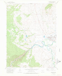
 1980 Junction Butte1981 Print · USGSGrand County ranching and rail history intersect here in the early eighties as the town of Kremmling anchors the valley. Researchers can trace the Denver and Rio Grande railway or locate family-named landmarks like Taussig Reservoir No 1 and Lawson Ridge.2 unique versions available
 - 1980 Map of Steamboat Springs, 1982 Print
 1980 Steamboat Springs1982 Print · USGSNorthwest Colorado's ranching and rail corridors come to life in the early eighties as mountain recreation and resource management began to reshape the region. Researchers can trace the Denver and Rio Grande Western line through Oak Creek or locate local landmarks like Old Homestead and Egeria Park.
 - 1981 Map of Kremmling
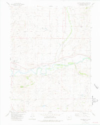
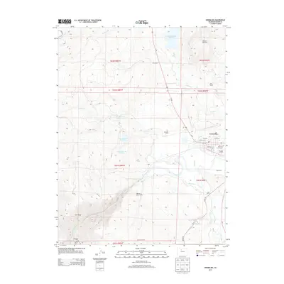
 1981 Kremmling1981 Print · USGSThe river-and-rail hub of Kremmling is captured here in the early eighties at the confluence of the COLORADO RIVER and Blue River. Genealogists and local historians can trace the town's footprint, including the West Grand High Sch and the rail line through Gore Canyon.2 unique versions available
 - 2010 Map of Junction Butte, 2010 Print
 2010 Junction Butte2010 Print · USGSCovers Kremmling, including Troublesome, Grand County, and other nearby areas
 - 2010 Map of Kremmling, 2010 Print
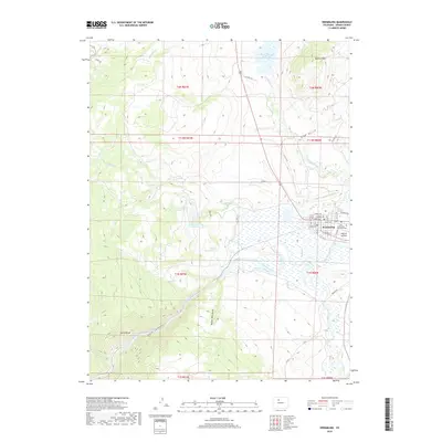
 2010 Kremmling2010 Print · USGSCovers Kremmling, including Grand County, United States, and other nearby areas
 - 2013 Map of Junction Butte, 2013 Print
 2013 Junction Butte2013 Print · USGSCovers Kremmling, including Troublesome, Grand County, and other nearby areas
 - 2013 Map of Kremmling, 2013 Print
 2013 Kremmling2013 Print · USGSCovers Kremmling, including Grand County, United States, and other nearby areas
 - 2016 Map of Kremmling, 2016 Print
 2016 Kremmling2016 Print · USGSCovers Kremmling, including Grand County, United States, and other nearby areas
 - 2016 Map of Junction Butte, 2016 Print
 2016 Junction Butte2016 Print · USGSCovers Kremmling, including Troublesome, Grand County, and other nearby areas
 - 2019 Map of Junction Butte, 2019 Print
 2019 Junction Butte2019 Print · USGSCovers Kremmling, including Troublesome, Grand County, and other nearby areas
 - 2019 Map of Kremmling, 2019 Print
 2019 Kremmling2019 Print · USGSCovers Kremmling, including Grand County, United States, and other nearby areas
 - 2022 Map of Junction Butte, 2022 Print
 2022 Junction Butte2022 Print · USGSGrand County ranchlands and river valleys are captured here in the early 2020s, centered on the confluence of the Colorado River. Genealogists and local historians can trace the streets of Kremmling, the location of McElroy Airfield, and irrigation works like Taussig Reservoir Number 1.
 - 2022 Map of Kremmling, 2022 Print
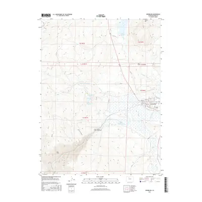
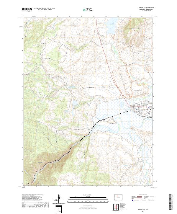 2022 Kremmling2022 Print · USGSKremmling and the surrounding Grand County high country are captured here at the 2020s confluence of the Colorado and Blue Rivers. Researchers can trace the town’s street grid out to McElroy Airfield or explore the vast Wolford Mountain Reservoir and Gore Canyon.
End of results
Showing maps 1-21 of 21
Frequently asked questions
- What are the different types of historical maps available for Kremmling?
- What is the oldest map of Kremmling?
- Where can I purchase historical maps of Kremmling for my home or office?
- Where can I download high-res historical maps of Kremmling?
- Are there historical topographic maps available for Kremmling?
- Is there historical aerial imagery available for Kremmling?
- Where are historical maps of Kremmling sourced from?