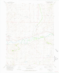
1980 Map of Junction Butte
USGS Topo · Published 1981About this map
The Colorado River meanders through the heart of this high-country landscape, flanked by the Denver and Rio Grande railway which follows its southern bank. The town of Kremmling is the primary settlement, serving as a hub for the surrounding ranching and mining operations that define the area's development. Land management and water rights are evident through an extensive network of irrigation infrastructure, including the Kirtz Ditch, Barger Ditch, and Pheney Ditch, which redirect water from various gulches to support local agriculture.
Find a feature on this map
28 named features on this map. Tap any name to fly to it.
Don’t see what you’re looking for? This feature index may not catch every label — zoom into the map to look around manually.
Map Details
Editions of this 1980 Junction Butte Map
2 editions found
Other maps of this area

1933 · Mt. Powell
USGS Topo · 1:48,000

1933 · Ute Peak
USGS Topo · 1:62,500

1937 · Ute Peak
USGS Topo · 1:62,500

1940 · Mount Powell
USGS Topo · 1:62,500

1954 · Craig
USGS Topo · 1:250,000

1956 · Kremmling
USGS Topo · 1:62,500

1957 · Craig
USGS Topo · 1:250,000

1957 · Hot Sulphur Springs
USGS Topo · 1:62,500

1957 · Leadville
USGS Topo · 1:250,000

1958 · Craig
USGS Topo · 1:250,000