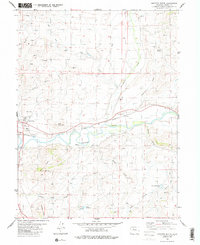
1980 Map of Junction Butte
USGS Topo · Published 1986About this map
Colorado River waters dominate the center of this landscape, winding through a complex network of irrigation infrastructure including the Barger Ditch and Pheney Ditch. The railroad corridor of the Denver and Rio Grande Western follows the river's northern bank, connecting the town of Kremmling with the settlement of Troublesome. To the south, the namesake Junction Butte and Red Mountain provide significant vertical relief above the valley floor. This 1980 survey illustrates a period where agricultural water management was paramount, as evidenced by the numerous reservoirs and canals like the Big Lake Ditch and Taussig Reservoir No 1. Mining activity is also visible through several labeled prospects and a dedicated mine located south of the river near Lawson Ridge.
Find a feature on this map
28 named features on this map. Tap any name to fly to it.
Don’t see what you’re looking for? This feature index may not catch every label — zoom into the map to look around manually.
Map Details
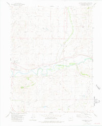
Editions of this 1980 Junction Butte Map
2 editions found
Other maps of this area

1933 · Mt. Powell
USGS Topo · 1:48,000

1933 · Ute Peak
USGS Topo · 1:62,500

1937 · Ute Peak
USGS Topo · 1:62,500

1940 · Mount Powell
USGS Topo · 1:62,500

1954 · Craig
USGS Topo · 1:250,000

1956 · Kremmling
USGS Topo · 1:62,500

1957 · Craig
USGS Topo · 1:250,000

1957 · Hot Sulphur Springs
USGS Topo · 1:62,500

1957 · Leadville
USGS Topo · 1:250,000

1958 · Craig
USGS Topo · 1:250,000