Old Maps of Golden, Colorado for Genealogy
Trace your family roots with 26 historic maps of Golden. These high-res maps reveal old neighborhoods, homesites, landmarks, and streets — helping you uncover where your ancestors lived and how the area evolved over time.
- Explore historic neighborhoods: Identify where your relatives may have lived in the 1800s or 1900s.
- Compare maps over time: Trace the changes in streets, buildings, and landmarks for multi-generational research.
- Perfect for genealogy & ancestry research: Used by family historians and researchers to map out lineage and migration.
These maps are an incredible resource for exploring your personal connection to Golden's past.
Golden, CO maps
(26)- 1899 Map of West Denver
 1899 West Denver1899 Print · USGSThe Denver metropolitan area and its western foothills appear in the late Victorian era as a burgeoning rail and irrigation hub. Researchers can trace the early footprints of Denver, Golden, and Littleton, alongside industrial sites like the Louisville Coal Mine and the grounds of Fort Logan.
 - 1938 Map of Morrison
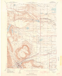
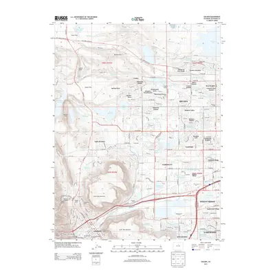
 1938 Morrison1938 Print · USGSThe foothills of Jefferson County are shown in the late 1930s as the Front Range began transitioning toward modern recreation and infrastructure. Researchers can locate Red Rocks Park, the State Reformatory, and the Cody Monument on Lookout Mountain.2 unique versions available
 - 1939 Map of Golden
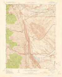
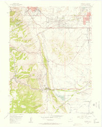
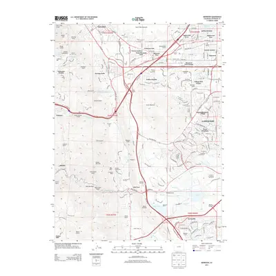
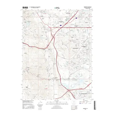
 1939 Golden1939 Print · USGSGolden and its surrounding foothills are captured here in the late 1930s, showing a transition from mining and ranching to a specialized industrial landscape. Researchers can trace the electric Denver and Intermountain Railroad and locate local landmarks like Mount Olivet Cemetery or Leyden Junction.
 - 1942 Map of Morrison
 1942 Morrison1942 Print · USGSThe Jefferson County foothills meet the plains during the early 1940s, revealing a landscape of military camps, schools, and landmark parks. Researchers can trace the development of Golden, locate the Pleasant View Ch, and see the early layout of Red Rocks Park.2 unique versions available
 - 1942 Map of Golden
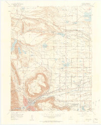
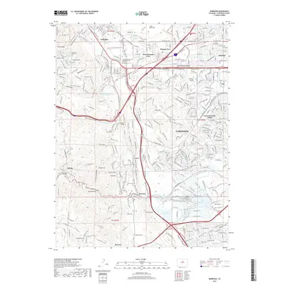
 1942 Golden1942 Print · USGSJefferson County before the post-war suburban boom reveals a landscape of industrial transit and coordinated irrigation. Researchers can trace the path of the Denver and Intermountain (Electric) line or locate rural community hubs like Ralston Ch and Fairmount Sch.
 - 1944 Map of Golden
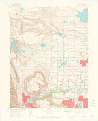
 1944 Golden1944 Print · USGSGolden and the surrounding Jefferson County plains are shown during the early war years, framed by the iconic Table Mountains. Researchers can locate vanished landmarks like the Camp George West and local schools including Fremont Sch and Ralston Sch.
 - 1947 Map of Morrison
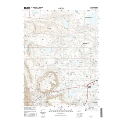
 1947 Morrison1947 Print · USGSThe foothills of Jefferson County are captured in the late 1930s, showing the early infrastructure of Golden and Morrison. Genealogists and historians can trace Golden Cemetery, the Pleasant View Ch, and the landmark Cody Monument.2 unique versions available
 - 1953 Map of Denver, 1964 Print
 1953 Denver1964 Print · USGSDenver and the Colorado Front Range are captured here during a decade of post-war growth and military expansion. Researchers can trace the sprawling rail lines of the Union Pacific, locate the State Capitol, and explore historic mountain mining hubs like Central City.6 unique versions available
 - 1957 Map of Denver
 1957 Denver1957 Print · USGSDenver and the Colorado Front Range are seen here during a mid-century period of intense military and urban expansion. Trace the footprints of the Rocky Mountain Arsenal, the early United States Air Force Academy, and the Lowry AF Base.
 - 1957 Map of Morrison, 1958 Print
 1957 Morrison1958 Print · USGSThe Denver foothills come alive in the late fifties, showing the interplay between expanding residential areas like Pleasant View and the dramatic geology of the Front Range. Researchers can trace historic sites like the Rooney Ranch, the Mother Cabrini Shrine, and the early layout of Red Rocks Park.
 - 1957 Map of Golden, 1958 Print
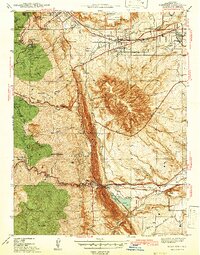
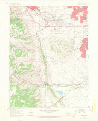
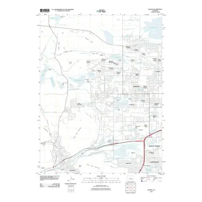
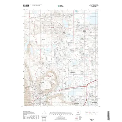
 1957 Golden1958 Print · USGSGolden and its surrounding mesas are shown in the late fifties as the area balanced mining, academia, and military training. Researchers can trace local institutions like the Colorado School of Mines, the extensive Mount Olivet Cemetery, and Camp George West.3 unique versions available
 - 1958 Map of Denver
 1958 Denver1958 Print · USGSDenver and the Colorado Front Range are captured here during the mid-century suburban boom. Trace the footprints of military installations like Buckley Air Force Base alongside the established rail networks of the Colorado & Southern Ry.
 - 1960 Map of Denver
 1960 Denver1960 Print · USGSDenver and the Colorado Front Range are seen here at a pivotal moment of postwar expansion into the plains and foothills. Researchers can trace the mid-century rail network of the Denver & Rio Grande Western RR and locate historic institutional landmarks like Buckley Field and the Colorado School of Mines.
 - 1965 Map of Golden, 1967 Print
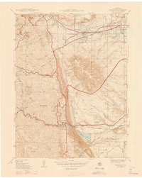
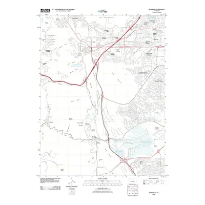
 1965 Golden1967 Print · USGSGolden and Arvada appear here during the mid-sixties, caught between their mining roots and rapid suburban growth. Researchers can trace historic sites like Camp George West, the Colorado School of Mines, and the extensive Mount Olivet Cemetery.10 unique versions available
 - 1965 Map of Morrison, 1967 Print
 1965 Morrison1967 Print · USGSThe foothills of Jefferson County were rapidly evolving in the mid-sixties as suburban growth met the historic Front Range landscape. Trace local history through landmarks like Red Rocks Amphitheater, the Chieftain Mine, and the Golden Hill Cemetery.6 unique versions available
 - 1983 Map of Denver West
 1983 Denver West1983 Print · USGSThe Front Range and Denver's western suburbs meet in the early 1980s, documenting the era's growth from the mountain peaks to the valley floor. Genealogists and historians can trace the foundations of Lakewood and Golden, or locate high-altitude landmarks like the Moffat Tunnel and Mount Olivet Cem.2 unique versions available
 - 2010 Map of Golden, 2010 Print
 2010 Golden2010 Print · USGSCovers Golden, including Lakewood, Arvada, and other nearby areas
 - 2011 Map of Morrison, 2011 Print
 2011 Morrison2011 Print · USGSCovers Golden, including Lakewood, West Pleasant View, and other nearby areas
 - 2013 Map of Morrison, 2013 Print
 2013 Morrison2013 Print · USGSCovers Golden, including Lakewood, West Pleasant View, and other nearby areas
 - 2013 Map of Golden, 2013 Print
 2013 Golden2013 Print · USGSCovers Golden, including Lakewood, Arvada, and other nearby areas
 - 2016 Map of Morrison, 2016 Print
 2016 Morrison2016 Print · USGSCovers Golden, including Lakewood, West Pleasant View, and other nearby areas
 - 2016 Map of Golden, 2016 Print
 2016 Golden2016 Print · USGSCovers Golden, including Lakewood, Arvada, and other nearby areas
 - 2019 Map of Morrison, 2019 Print
 2019 Morrison2019 Print · USGSCovers Golden, including Lakewood, West Pleasant View, and other nearby areas
 - 2019 Map of Golden, 2019 Print
 2019 Golden2019 Print · USGSCovers Golden, including Lakewood, Arvada, and other nearby areas
 - 2022 Map of Morrison, 2022 Print
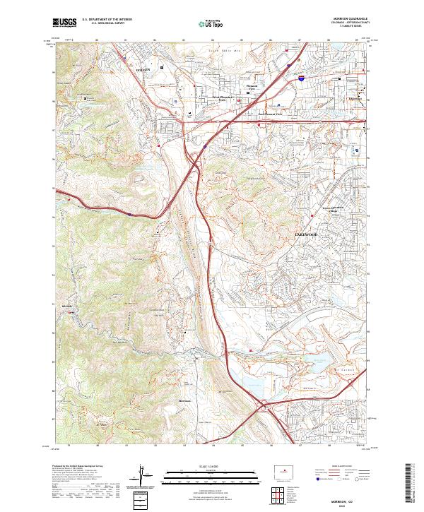 2022 Morrison2022 Print · USGSThe foothills of the Front Range meet the western edge of the Denver metro area in this contemporary survey of the Jefferson County landscape. Genealogists and local historians can locate the William F Cody Grave, Golden Cem, and the old town site of Morrison.
Showing maps 1-25 of 26
Top cities near Golden
- Denver historical maps
- Lakewood historical maps
- Thornton historical maps
- Arvada historical maps
- Westminster historical maps
- Boulder historical maps
See more
Top neighborhoods of Golden
Frequently asked questions
- What are the different types of historical maps available for Golden?
- What is the oldest map of Golden?
- Where can I purchase historical maps of Golden for my home or office?
- Where can I download high-res historical maps of Golden?
- Are there historical topographic maps available for Golden?
- Is there historical aerial imagery available for Golden?
- Where are historical maps of Golden sourced from?