1900s (20th Century) Maps of Kiowa County, Colorado
Explore 46 historic maps of Kiowa County from the 1900s (20th Century). These maps offer a rare glimpse into what life looked like during the 1900s — showing old roads, neighborhoods, homes, and landmarks that have changed or disappeared over time.
Whether you're researching your family's past, planning a metal detecting trip, or studying how Kiowa County's landscape evolved across the 1900s, these high-resolution maps are a powerful tool for exploring the history of this region.
- Focus on a specific era: All maps on this page are from the 1900s, giving you a focused view of this time period.
- See what’s changed: Compare century-old streets, trails, and buildings to today's modern landscape using overlays and satellite layers.
- Research with precision: Use these maps for genealogy, historical research, land use analysis, or educational projects.
- View, download, or print: Maps are fully viewable online in high resolution, and can be downloaded or printed for your own records.
Start exploring Kiowa County's history through authentic maps from the 1900s. This is your window into the past.
Kiowa County, CO maps
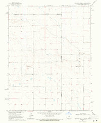
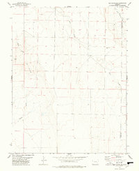
(46)- 1954 Map of Lamar, 1964 Print
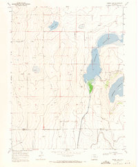
 1954 Lamar1964 Print · USGSSoutheastern Colorado and the Kansas borderlands appear here in the mid-fifties, dominated by the vital Arkansas River irrigation network. Researchers can trace the development of river towns like Lamar and La Junta alongside the Amity Cemetery and several major reservoirs.3 unique versions available
 - 1958 Map of Lamar
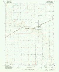
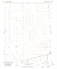
 1958 Lamar1958 Print · USGSThe High Plains of Eastern Colorado and Western Kansas in the late fifties reveal a landscape tied to the Arkansas River and the rails. Trace the heritage of the river valley through Fort Lyon, the Atchison Topeka and Santa Fe RR, and rural landmarks like Kendrick Church.2 unique versions available
 - 1967 Map of Neenoshe Reservoir, 1971 Print
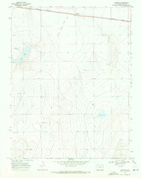
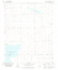
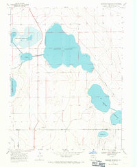 1967 Neenoshe Reservoir1971 Print · USGSSoutheast Colorado water management is on full display in the late sixties as reservoirs and irrigation canals define the Kiowa County landscape. Trace the intricate network of the Neenoshe Reservoir system, the Landing Strip, and the Pawnee Canal.
 - 1968 Map of Stuart, 1970 Print
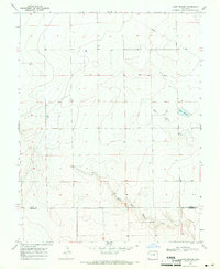
 1968 Stuart1970 Print · USGSKiowa County's high plains are captured in the late sixties as a vital agricultural corridor along the Missouri Pacific railroad. Genealogists and local historians can locate the Plainview Sch, the settlement of Stuart, and the Budde Landing Strip.2 unique versions available
 - 1968 Map of Sheridan Lake, 1971 Print
 1968 Sheridan Lake1971 Print · USGSSheridan Lake and the surrounding High Plains are captured here in the late sixties as a thriving rail-side agricultural community. Researchers can trace the town layout and local landmarks like the Sheridan Lake Cem and the Missouri Pacific rail corridor.
 - 1968 Map of Sheridan Lake SE, 1971 Print
 1968 Sheridan Lake SE1971 Print · USGSEastern Colorado's high plains near the turn of the 1970s reveal a landscape of remote ranching and utility infrastructure. Researchers can trace the Kiowa and Prowers county line and locate water-critical sites like Buffalo Creek and several Water Tanks.
 - 1968 Map of Rose Ranch, 1971 Print
 1968 Rose Ranch1971 Print · USGSRanching life on the Kiowa and Bent county line is documented here in the late sixties. Genealogists and local historians can locate the Prairie Center School and trace water resources like Government Spring and the Aqueduct.
 - 1968 Map of Alkali Lake, 1971 Print
 1968 Alkali Lake1971 Print · USGSRailroads and water sources define the Kiowa County landscape in the late sixties as the MISSOURI PACIFIC line crosses the plains. Genealogists and historians can trace the remote placement of Alkali Lake, Chivington Hill, and several isolated wells.
 - 1968 Map of Chivington SE, 1971 Print
 1968 Chivington SE1971 Print · USGSEastern Colorado in the late sixties shows a landscape defined by water management and resource extraction. Trace the routes of the Comanche Canal and Pawnee Canal or locate local industrial sites like the Gravel Pits.
 - 1968 Map of Brandon, 1971 Print
 1968 Brandon1971 Print · USGSKiowa County life in the late sixties centers on the rail-side settlement of Brandon and the surrounding energy landscape. Researchers can locate family landmarks like the Plainview Cem or trace the Missouri Pacific line past the Brandon Oil Field.
 - 1968 Map of Swede Lake, 1971 Print
 1968 Swede Lake1971 Print · USGSSoutheastern Colorado’s arid plains are transformed by mid-century water engineering and energy exploration across Kiowa and Bent counties. Researchers can trace the path of the Kicking Bird Canal and locate the Abrams Ranch or a local Gas Plant.
 - 1968 Map of Hawkins, 1971 Print
 1968 Hawkins1971 Print · USGSThe high plains of Kiowa County are shown here in the late sixties, where the prairie is defined by the Missouri Pacific rail line. Researchers can trace land use through features like the Old Railroad Grade, Salt Lake, and Hawkins.
 - 1968 Map of Lake Devore, 1971 Print
 1968 Lake Devore1971 Print · USGSThe High Plains of Kiowa County are captured here in the late sixties, showing a landscape defined by water management and prairie drainage. Researchers can trace the path of West Wild Horse Creek or locate landmarks like Lake Devore and the western Water Tank.
 - 1968 Map of Chivington, 1971 Print
 1968 Chivington1971 Print · USGSThe eastern Colorado plains appear in the late sixties as a landscape of rail and water. You can trace the Missouri Pacific line through Chivington or locate the France Cem near the banks of Rush Creek.
 - 1968 Map of Eads, 1971 Print
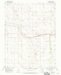
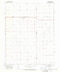
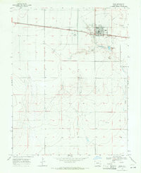 1968 Eads1971 Print · USGSThe Kiowa County seat of Eads is captured in the late sixties as it developed around the Missouri Pacific rail line. Genealogists and local historians can locate the High Sch, the town Cem, and landmarks like the Eads Municipal Airport.
 - 1968 Map of Towner SE, 1971 Print
 1968 Towner SE1971 Print · USGSThe high plains along the Colorado-Kansas border are captured here in the late sixties, showing the vast township divisions of the prairie. Local researchers can trace the course of Wild Horse Creek and locate early infrastructure like the cross-country Pipeline and named tracts like Richland.
 - 1968 Map of Towner, 1971 Print
 1968 Towner1971 Print · USGSThe Colorado-Kansas state line is captured here in the late sixties as a landscape of isolated rail towns and prairie settlements. Genealogists and historians can locate the Towner Cem or trace the path of the Missouri Pacific through Towner and Colokan.
 - 1968 Map of Sheridan Lake SW, 1971 Print
 1968 Sheridan Lake SW1971 Print · USGSThe high plains of the Colorado border country are captured here in the late sixties, showing the rural divide between Kiowa Co and Prowers Co. Genealogists and historians can trace the path of Big Sandy Creek and locate remote landmarks like Lone and Coon Valley.
 - 1969 Map of Cheyenne Wells 4 SE, 1971 Print
 1969 Cheyenne Wells 4 SE1971 Print · USGSHigh plains life at the Colorado and Kansas border is captured here during the late sixties. Genealogists and local historians can trace the rural landscape near Colony, locating the local Cem and the winding path of White Woman Creek.3 unique versions available
 - 1974 Map of Haswell, 1978 Print
 1974 Haswell1978 Print · USGSHaswell at the height of the 1970s is a railroad-centered town on the High Plains. Genealogists and local historians can locate civic landmarks like the Rodeo Ground and Athletic Field along the tracks of the MISSOURI PACIFIC.
 - 1974 Map of Haswell SE, 1978 Print
 1974 Haswell SE1978 Print · USGSThe eastern Colorado plains at the boundary of Kiowa and Bent counties come into focus in the 1970s. Trace the path of the Old Railroad Grade past Potters Lake and the central Radio Tower to see how this landscape was used.
 - 1974 Map of Arlington NE, 1978 Print
 1974 Arlington NE1978 Print · USGSThe high plains of Kiowa County during the mid-1970s are defined by the winding course of Adobe Creek and the diagonal strike of the railroad. Genealogists and historians can trace the vital water sources and early transport infrastructure along the Missouri Pacific and Johns Creek.
 - 1977 Map of The Pinnacles, 1978 Print
 1977 The Pinnacles1978 Print · USGSThe High Plains of the Colorado borderlands are captured here in the late seventies, showing the sparse ranching landscape of the Crowley and Kiowa county line. Genealogists and researchers can locate Sand Arroyo Cem and trace the terrain around Cow Butte and The Pinnacles.
 - 1977 Map of Todd Point, 1978 Print
 1977 Todd Point1978 Print · USGSCrowley County in the mid-1970s reveals a landscape of high plains ranching and vital water management. Genealogists and historians can trace the Missouri Pacific railroad corridor and the layout of local landmarks like Lolita Reservoir and Todd Point Spring.
 - 1978 Map of Long Lake
 1978 Long Lake1978 Print · USGSThe Colorado plains at the Kiowa and Bent county line are documented here during the late 1970s. Local researchers can trace the shoreline of Adobe Creek Reservoir (Blue Lake) and find points of interest like Potters Lake and a remote Drill Hole.
Showing maps 1-25 of 46
Top cities of Kiowa County
- Eads historical maps
- Haswell historical maps
- Haswell historical maps
- Sheridan Lake historical maps
- Brandon historical maps
Frequently asked questions
- What are the different types of historical maps available for Kiowa County?
- What is the oldest map of Kiowa County?
- Where can I purchase historical maps of Kiowa County for my home or office?
- Where can I download high-res historical maps of Kiowa County?
- Are there historical topographic maps available for Kiowa County?
- Is there historical aerial imagery available for Kiowa County?
- Where are historical maps of Kiowa County sourced from?