1970s Maps of Kiowa County, Colorado
Explore 15 historic maps of Kiowa County from the 1970s. These maps offer a rare glimpse into what life looked like during the 1970s — showing old roads, neighborhoods, homes, and landmarks that have changed or disappeared over time.
Whether you're researching your family's past, planning a metal detecting trip, or studying how Kiowa County's landscape evolved across the 1970s, these high-resolution maps are a powerful tool for exploring the history of this region.
- Focus on a specific era: All maps on this page are from the 1970s, giving you a focused view of this time period.
- See what’s changed: Compare century-old streets, trails, and buildings to today's modern landscape using overlays and satellite layers.
- Research with precision: Use these maps for genealogy, historical research, land use analysis, or educational projects.
- View, download, or print: Maps are fully viewable online in high resolution, and can be downloaded or printed for your own records.
Start exploring Kiowa County's history through authentic maps from the 1970s. This is your window into the past.
Kiowa County, CO maps
(15)- 1974 Map of Haswell, 1978 Print
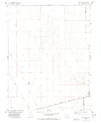
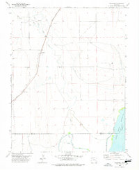
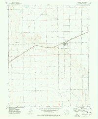 1974 Haswell1978 Print · USGSHaswell at the height of the 1970s is a railroad-centered town on the High Plains. Genealogists and local historians can locate civic landmarks like the Rodeo Ground and Athletic Field along the tracks of the MISSOURI PACIFIC.
 - 1974 Map of Haswell SE, 1978 Print
 1974 Haswell SE1978 Print · USGSThe eastern Colorado plains at the boundary of Kiowa and Bent counties come into focus in the 1970s. Trace the path of the Old Railroad Grade past Potters Lake and the central Radio Tower to see how this landscape was used.
 - 1974 Map of Arlington NE, 1978 Print
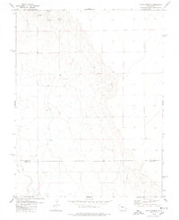
 1974 Arlington NE1978 Print · USGSThe high plains of Kiowa County during the mid-1970s are defined by the winding course of Adobe Creek and the diagonal strike of the railroad. Genealogists and historians can trace the vital water sources and early transport infrastructure along the Missouri Pacific and Johns Creek.
 - 1977 Map of The Pinnacles, 1978 Print
 1977 The Pinnacles1978 Print · USGSThe High Plains of the Colorado borderlands are captured here in the late seventies, showing the sparse ranching landscape of the Crowley and Kiowa county line. Genealogists and researchers can locate Sand Arroyo Cem and trace the terrain around Cow Butte and The Pinnacles.
 - 1977 Map of Todd Point, 1978 Print
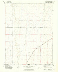
 1977 Todd Point1978 Print · USGSCrowley County in the mid-1970s reveals a landscape of high plains ranching and vital water management. Genealogists and historians can trace the Missouri Pacific railroad corridor and the layout of local landmarks like Lolita Reservoir and Todd Point Spring.
 - 1978 Map of Long Lake
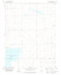 1978 Long Lake1978 Print · USGSThe Colorado plains at the Kiowa and Bent county line are documented here during the late 1970s. Local researchers can trace the shoreline of Adobe Creek Reservoir (Blue Lake) and find points of interest like Potters Lake and a remote Drill Hole.
 - 1978 Map of Haswell NE
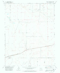
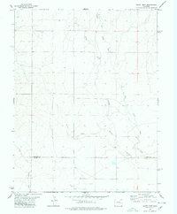
 1978 Haswell NE1978 Print · USGSKiowa County, Colorado, is captured in the late seventies as a landscape defined by its rail history and sparse prairie outposts. Researchers can trace the path of the Missouri Pacific and the Old Railroad Grade past points like Milan and Salt Lake.
 - 1978 Map of Metz Springs
 1978 Metz Springs1978 Print · USGSThe high plains of eastern Colorado at the end of the seventies show a landscape defined by ranching and vital water sources. Researchers can trace the drainages of Sand Arroyo and North Fork Mustang Creek or locate landmarks like Metz Springs and Wild Horse Point.
 - 1978 Map of Arlington
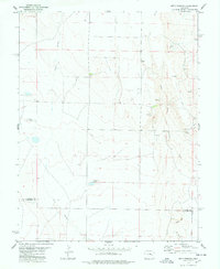
 1978 Arlington1978 Print · USGSArlington was a rail-side hub on the Colorado plains during the late seventies, defined by its complex irrigation networks. Genealogists and historians can trace the Arlington Cem, the Missouri Pacific railroad, and the massive Adobe Creek Reservoir.
 - 1978 Map of Galatea SW
 1978 Galatea SW1978 Print · USGSThe high plains of eastern Colorado meet in the late seventies at a unique juncture of three counties. Genealogists and land researchers can trace the intersection of Lincoln Co Kiowa Co and Lincoln Co Cheyenne Co, locating remote landmarks like Well and BM 4575.
 - 1978 Map of Trimble Lake
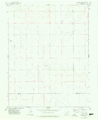
 1978 Trimble Lake1978 Print · USGSKiowa County's high plains ranching country is captured here in the late seventies. Genealogists and historians can trace the paths of Mustang Creek and Sand Arroyo or locate isolated water sources like Trimble Lake.
 - 1978 Map of Houston Lakes
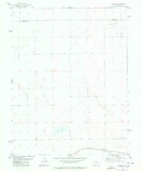
 1978 Houston Lakes1978 Print · USGSSoutheastern Colorado's high plains are mapped during the 1970s, showing a landscape defined by ranching and rail. Genealogists can trace the settlement at Heath and the Missouri Pacific railroad as it crosses the Kiowa and Otero county lines.2 unique versions available
 - 1978 Map of Bluff Spring
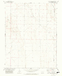
 1978 Bluff Spring1978 Print · USGSThe high plains of eastern Colorado are documented here in the late seventies, showing the vital water sources along the Lincoln and Kiowa County line. Researchers can trace rural development through the locations of Bluff Spring, several remote Wells, and a Gravel Pit.
 - 1978 Map of Galatea
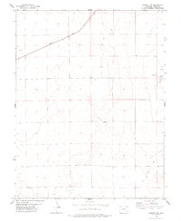
 1978 Galatea1978 Print · USGSKiowa County during the late 1970s reveals a quiet agricultural landscape centered on the Missouri Pacific railroad. Genealogists and historians can locate the community of Galatea, the local Cem, and rural water features like Red Lake.
 - 1978 Map of Scott Draw
 1978 Scott Draw1978 Print · USGSThe high plains of the Colorado borderlands are captured here in the late seventies, showing the sparse ranching landscape of Lincoln and Kiowa Counties. Genealogists and historians can trace the paths of Adobe Creek and find rural infrastructure like the Landing Strip.
End of results
Showing maps 1-15 of 15
Top cities of Kiowa County
- Eads historical maps
- Haswell historical maps
- Haswell historical maps
- Sheridan Lake historical maps
- Brandon historical maps
Frequently asked questions
- What are the different types of historical maps available for Kiowa County?
- What is the oldest map of Kiowa County?
- Where can I purchase historical maps of Kiowa County for my home or office?
- Where can I download high-res historical maps of Kiowa County?
- Are there historical topographic maps available for Kiowa County?
- Is there historical aerial imagery available for Kiowa County?
- Where are historical maps of Kiowa County sourced from?