Old Maps of Kline, Colorado for Academic Research
Study the evolution of Kline with 13 high-resolution historic maps. Whether you're teaching, researching, or modeling changes in land use, these maps provide essential visual documentation of urban, environmental, and geographic change.
- Analyze long-term change: Track patterns in development, transportation, and natural features.
- Ideal for environmental or urban studies: Support academic projects with primary historical map data.
- Use in the classroom or lab: Educators and researchers rely on these maps to bring historical context to life.
These maps are a powerful tool for teaching, research, and visualizing how Kline has changed over the decades.
Kline, CO maps
(13)- 1913 Map of Red Mesa
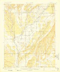 1913 Red Mesa1913 Print · USGSLa Plata County's high mesa country is captured here shortly after the turn of the century, showing a landscape of early homesteads and irrigation ditches. Researchers can locate the Mormon Church, several early schools like Rockville School, and the tracks of the Rio Grande Southern RR.4 unique versions available
 - 1956 Map of Cortez, 1972 Print
 1956 Cortez1972 Print · USGSThe Four Corners region comes alive in this mid-century study of the high plateaus and deep canyons surrounding Cortez. Trace the development of desert outposts like Towaoc or follow the historic Laramie Trail across a landscape dotted with ancient sites at Mesa Verde National Park.2 unique versions available
 - 1958 Map of Cortez
 1958 Cortez1958 Print · USGSThe Four Corners region comes alive in the late fifties, showing the interplay between expanding mountain settlements and ancient archeological sites. Trace the layout of Cortez, Monticello, and Blanding alongside landmarks like Mesa Verde National Park and Fort Lewis A&M College.
 - 1959 Map of Cortez
 1959 Cortez1959 Print · USGSThe Four Corners region in the late fifties was a landscape of ancestral sites and isolated ranching outposts. Genealogists and historians can trace the early footprints of Cortez, Towaoc, and Mexican Hat alongside the canyons of the San Juan River.2 unique versions available
 - 1962 Map of Cortez
 1962 Cortez1962 Print · USGSThe Four Corners region comes alive in the early sixties, showing a landscape defined by reservation lands and federal forests. Trace the route of the Rio Grande Southern RR or locate the Uranium and vanadium mines near Monticello.
 - 1966 Map of Cortez
 1966 Cortez1966 Print · USGSThe Four Corners region in the mid-sixties reveals a landscape of high mesas, tribal lands, and archaeological preserves. Researchers can trace the ancient sites at Hovenweep National Monument, follow the Denver & Rio Grande Western Railroad, or locate old settlements like Ginger Hill and Yellow Jacket.
 - 1968 Map of Kline, 1971 Print
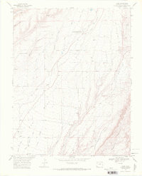 1968 Kline1971 Print · USGSLa Plata County in the late sixties shows a landscape of mesa-top settlements and agricultural research along the Southern Ute Indian Reservation Boundary. Genealogists and historians can trace the Old Railroad Grade and locate local landmarks like Ft Lewis Mesa Sch and the Dunn Mine.3 unique versions available
 - 1982 Map of Cortez, 1992 Print
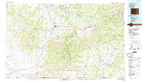 1982 Cortez1992 Print · USGSMontezuma County at the start of the eighties shows a landscape defined by federal and tribal lands, from the archaeological sites of Mesa Verde National Park to the Ute Mountain Indian Reservation. Trace local history through small settlements like Lebanon and Marvel or follow the path of an Old Railroad Grade.
 - 2010 Map of Kline, 2010 Print
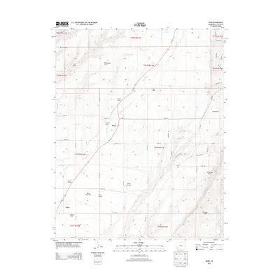
 2010 Kline2010 Print · USGSCovers Kline, including Breen, La Plata County, and other nearby areas
 - 2013 Map of Kline, 2013 Print
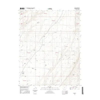
 2013 Kline2013 Print · USGSCovers Kline, including Breen, La Plata County, and other nearby areas
 - 2016 Map of Kline, 2016 Print
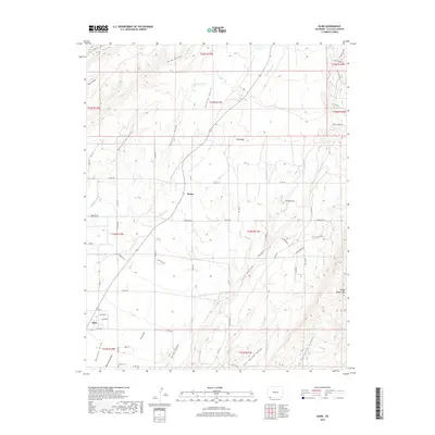
 2016 Kline2016 Print · USGSCovers Kline, including Breen, La Plata County, and other nearby areas
 - 2019 Map of Kline, 2019 Print
 2019 Kline2019 Print · USGSCovers Kline, including Breen, La Plata County, and other nearby areas
 - 2022 Map of Kline, 2022 Print
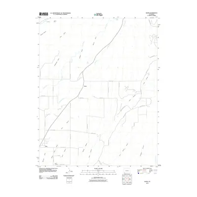
 2022 Kline2022 Print · USGSLa Plata County ranching country is shown here in the early 2020s, defined by the deep incisions of Long Hollow and Fortyfour Canyon. Researchers can trace local lineage near Marvel Cem or explore the settlements of Breen and Kline.
End of results
Showing maps 1-13 of 13
Top cities near Kline
Frequently asked questions
- What are the different types of historical maps available for Kline?
- What is the oldest map of Kline?
- Where can I purchase historical maps of Kline for my home or office?
- Where can I download high-res historical maps of Kline?
- Are there historical topographic maps available for Kline?
- Is there historical aerial imagery available for Kline?
- Where are historical maps of Kline sourced from?