Old Maps of Wellington, Colorado for Academic Research
Study the evolution of Wellington with 26 high-resolution historic maps. Whether you're teaching, researching, or modeling changes in land use, these maps provide essential visual documentation of urban, environmental, and geographic change.
- Analyze long-term change: Track patterns in development, transportation, and natural features.
- Ideal for environmental or urban studies: Support academic projects with primary historical map data.
- Use in the classroom or lab: Educators and researchers rely on these maps to bring historical context to life.
These maps are a powerful tool for teaching, research, and visualizing how Wellington has changed over the decades.
Wellington, CO maps
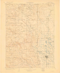
(26)- 1906 Map of Fort Collins, 1955 Print
 1906 Fort Collins1955 Print · USGSFort Collins and its surrounding ranchlands are shown at the start of the century as irrigation systems began to reshape the Larimer County plains. Researchers can trace early rail spurs like the Wellington Branch and find old landmarks like the Empire Mine and Colorado State Agricultural College.4 unique versions available
 - 1907 Map of Livermore, 1954 Print
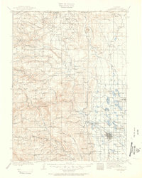 1907 Livermore1954 Print · USGSLarimer County at the turn of the century shows a frontier landscape transitioning into a settled ranching and rail corridor. Genealogists and historians can trace family-named sites like Maxwell Ranch alongside early landmarks like the Forks Hotel and Campbell Grove School.2 unique versions available
 - 1908 Map of Fort Collins
 1908 Fort Collins1908 Print · USGSNorthern Colorado at the turn of the century reveals a landscape transformed by water engineering and rail. Genealogists and historians can trace the early footprints of Fort Collins, the Colorado State Agricultural College, and local industry at the Empire Mine.4 unique versions available
 - 1908 Map of Eaton, 1957 Print
 1908 Eaton1957 Print · USGSWeld and Larimer counties are seen here in the early twentieth century as irrigation and rail lines transformed the high plains. Researchers can trace the development of agricultural hubs like Pierce and Severance alongside rural landmarks like Albert School and the Indian Springs Coal Mine.
 - 1909 Map of Livermore
 1909 Livermore1909 Print · USGSNorthern Colorado at the turn of the century shows a landscape of developing irrigation and early mountain industry. Trace the early streets of Fort Collins or find the remote Forks Hotel and Empire Mine among the foothills.4 unique versions available
 - 1910 Map of Eaton
 1910 Eaton1910 Print · USGSNorthern Colorado at the turn of the century shows a landscape transformed by railroads and early irrigation projects. Genealogists can locate many family-named landmarks like Slaxton Ranch and rural schoolhouses including Abbot School and Birch School.3 unique versions available
 - 1954 Map of Greeley, 1966 Print
 1954 Greeley1966 Print · USGSNorthern Colorado transitions from high-alpine peaks to the irrigated South Platte valley during this mid-century period of growth. Genealogists and historians can trace rail-connected hubs like Greeley and Longmont alongside landmarks like Horsetooth Reservoir and Estes Park.3 unique versions available
 - 1957 Map of Greeley
 1957 Greeley1957 Print · USGSNorthern Colorado in the mid-fifties is captured here as the agricultural plains of Weld County meet the high peaks of the Front Range. Genealogists and historians can trace rail-linked towns like Keenesburg and Roggen or locate early water features such as Boyd Lake and Fossil Creek Reservoir.
 - 1958 Map of Greeley
 1958 Greeley1958 Print · USGSNorthern Colorado and the high peaks of the Front Range appear here in the mid-fifties as the region's agricultural and rail networks were fully established. Genealogists can locate family homes near Virginia Dale, Waverly, or Kuner, and trace the path of the Union Pacific Railroad through Greeley.
 - 1960 Map of Cobb Lake, 1962 Print
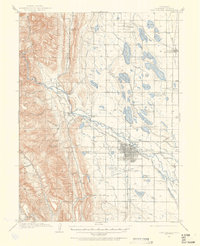
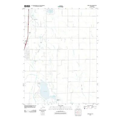
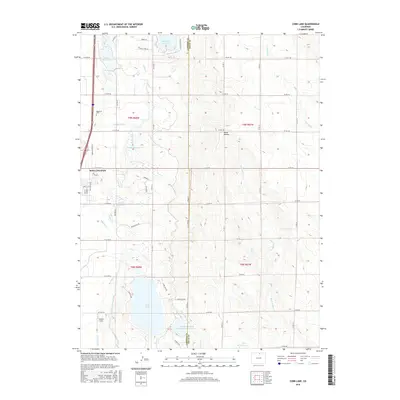
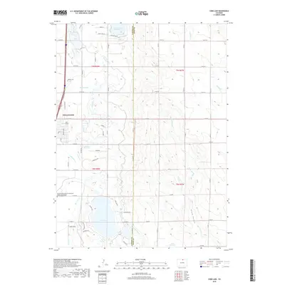
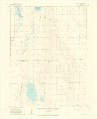 1960 Cobb Lake1962 Print · USGSWellington and the surrounding High Plains of Colorado are captured here in the early sixties, showing a landscape defined by vital water systems. Researchers can trace the Windsor Ditch, locate the Highland Cem, and explore the contours of Cactus Hill.5 unique versions available
 - 1960 Map of Wellington, 1963 Print
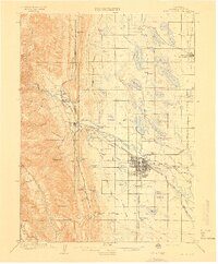
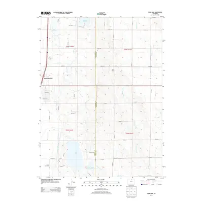
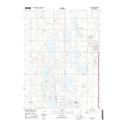
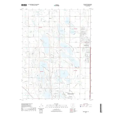
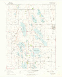 1960 Wellington1963 Print · USGSNorth of Fort Collins in the early sixties, this region reveals a complex system of high-plains water management and rail commerce. Trace the local history of Wellington and Waverly, and locate rural landmarks like Rocky Ridge Sch and Meyers Corner.6 unique versions available
 - 1961 Map of Greeley
 1961 Greeley1961 Print · USGSNorthern Colorado's transition from high mountain peaks to irrigated plains is captured here just as the post-war population boom reached the Front Range. Researchers can trace early water infrastructure and rail lines like the Great Western RR connecting sugar beet hubs from Fort Collins to Greeley.
 - 1964 Map of Greeley
 1964 Greeley1964 Print · USGSThe Front Range corridor and high peaks of the Rockies appear here in the mid-1960s, showing the intersection of mountain wilderness and plains agriculture. Trace the rail routes of the Great Western RR or locate landmarks like Longs Peak and Horsetooth Reservoir.
 - 1965 Map of Greeley
 1965 Greeley1965 Print · USGSNorthern Colorado in the mid-sixties shows a landscape defined by high mountain summits and the growing irrigation networks of the plains. Genealogists and historians can trace rail-side towns like Wellington or follow the early tracks of the Union Pacific Railroad past Longs Peak.
 - 1980 Map of Fort Collins, 1981 Print
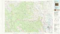 1980 Fort Collins1981 Print · USGSThe Front Range and high Rockies meet in Larimer County during the early 1980s. Local researchers can trace the growth of Fort Collins, the irrigation network around Wellington, and high-country outposts like Red Feather Lakes or the scenic canyon settlement of Mishawaka.
 - 1982 Map of Eaton
 1982 Eaton1982 Print · USGSNorthern Colorado and the Wyoming borderlands are captured here in the early eighties, showcasing a vast agricultural and rail landscape. Trace family roots and vanished infrastructure through Chalk Bluffs, the Great Western railroad, and Keota.2 unique versions available
 - 2010 Map of Cobb Lake, 2010 Print
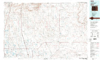
 2010 Cobb Lake2010 Print · USGSCovers Wellington, including Larimer County, Weld County, and other nearby areas
 - 2010 Map of Wellington, 2010 Print
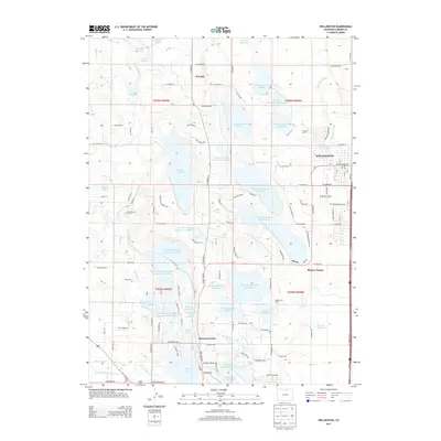
 2010 Wellington2010 Print · USGSCovers Wellington, including Fort Collins, Waverly, and other nearby areas
 - 2013 Map of Cobb Lake, 2013 Print
 2013 Cobb Lake2013 Print · USGSCovers Wellington, including Larimer County, Weld County, and other nearby areas
 - 2013 Map of Wellington, 2013 Print
 2013 Wellington2013 Print · USGSCovers Wellington, including Fort Collins, Waverly, and other nearby areas
 - 2016 Map of Cobb Lake, 2016 Print
 2016 Cobb Lake2016 Print · USGSCovers Wellington, including Larimer County, Weld County, and other nearby areas
 - 2016 Map of Wellington, 2016 Print
 2016 Wellington2016 Print · USGSCovers Wellington, including Fort Collins, Waverly, and other nearby areas
 - 2019 Map of Wellington, 2019 Print
 2019 Wellington2019 Print · USGSCovers Wellington, including Fort Collins, Waverly, and other nearby areas
 - 2019 Map of Cobb Lake, 2019 Print
 2019 Cobb Lake2019 Print · USGSCovers Wellington, including Larimer County, Weld County, and other nearby areas
 - 2022 Map of Cobb Lake, 2022 Print
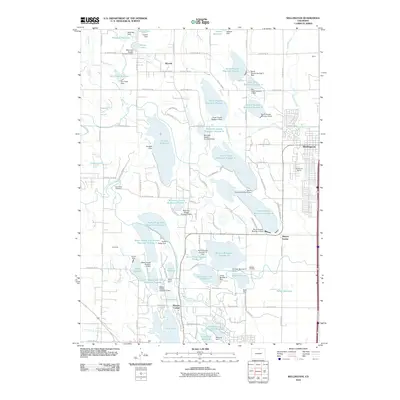
 2022 Cobb Lake2022 Print · USGSWellington and the surrounding agricultural research lands are shown in detail as they appeared recently. Genealogists and researchers can locate Highland Cem, the Colorado State University Agricultural Research Development and Education Center, and local reservoirs like Cobb Lake.
Showing maps 1-25 of 26
Top cities near Wellington
- Fort Collins historical maps
- Greeley historical maps
- Windsor historical maps
- Severance historical maps
- Nunn historical maps
- Timnath historical maps
Top neighborhoods of Wellington
- Wellington historical maps
- Wellington Village Condominiums historical maps
- Park Meadows historical maps
Frequently asked questions
- What are the different types of historical maps available for Wellington?
- What is the oldest map of Wellington?
- Where can I purchase historical maps of Wellington for my home or office?
- Where can I download high-res historical maps of Wellington?
- Are there historical topographic maps available for Wellington?
- Is there historical aerial imagery available for Wellington?
- Where are historical maps of Wellington sourced from?