2020s Maps of Fowler, Colorado
Explore 2 historic maps of Fowler from the 2020s. These maps offer a rare glimpse into what life looked like during the 2020s — showing old roads, neighborhoods, homes, and landmarks that have changed or disappeared over time.
Whether you're researching your family's past, planning a metal detecting trip, or studying how Fowler's landscape evolved across the 2020s, these high-resolution maps are a powerful tool for exploring the history of this region.
- Focus on a specific era: All maps on this page are from the 2020s, giving you a focused view of this time period.
- See what’s changed: Compare century-old streets, trails, and buildings to today's modern landscape using overlays and satellite layers.
- Research with precision: Use these maps for genealogy, historical research, land use analysis, or educational projects.
- View, download, or print: Maps are fully viewable online in high resolution, and can be downloaded or printed for your own records.
Start exploring Fowler's history through authentic maps from the 2020s. This is your window into the past.
Fowler, CO maps
(2)- 2022 Map of Hardesty Reservoir, 2022 Print
 2022 Hardesty Reservoir2022 Print · USGSThe Pueblo and Otero county line comes alive in the early twenty-first century, showcasing a landscape shaped by the Apishapa River and vital irrigation works. Researchers can trace the paths of the Oxford Farmers Ditch, find Fowler Airport, and locate Hungerford Lake.
 - 2022 Map of Fowler, 2022 Print
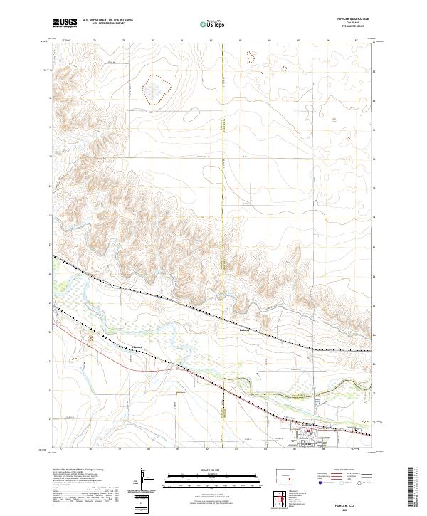 2022 Fowler2022 Print · USGSThe Arkansas River valley at the border of Pueblo and Otero Counties comes alive in this modern survey of its irrigation and rail corridors. Researchers can trace the layout of Fowler, locate the Fowler Cem, and follow the paths of the Colorado Canal and Hamlet.
End of results
Showing maps 1-2 of 2
Top cities near Fowler
Frequently asked questions
- What are the different types of historical maps available for Fowler?
- What is the oldest map of Fowler?
- Where can I purchase historical maps of Fowler for my home or office?
- Where can I download high-res historical maps of Fowler?
- Are there historical topographic maps available for Fowler?
- Is there historical aerial imagery available for Fowler?
- Where are historical maps of Fowler sourced from?