1960s Maps of Prowers County, Colorado
Explore 19 historic maps of Prowers County from the 1960s. These maps offer a rare glimpse into what life looked like during the 1960s — showing old roads, neighborhoods, homes, and landmarks that have changed or disappeared over time.
Whether you're researching your family's past, planning a metal detecting trip, or studying how Prowers County's landscape evolved across the 1960s, these high-resolution maps are a powerful tool for exploring the history of this region.
- Focus on a specific era: All maps on this page are from the 1960s, giving you a focused view of this time period.
- See what’s changed: Compare century-old streets, trails, and buildings to today's modern landscape using overlays and satellite layers.
- Research with precision: Use these maps for genealogy, historical research, land use analysis, or educational projects.
- View, download, or print: Maps are fully viewable online in high resolution, and can be downloaded or printed for your own records.
Start exploring Prowers County's history through authentic maps from the 1960s. This is your window into the past.
Prowers County, CO maps
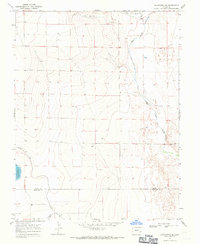
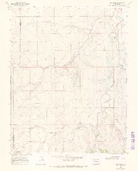
(19)- 1966 Map of Durkee Creek NE, 1967 Print
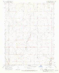
 1966 Durkee Creek NE1967 Print · USGSThe high plains of the Prowers and Hamilton county line appear in the mid-1960s, showing the quiet landscape along the Colorado-Kansas border. Researchers can trace land use patterns through the Canal system, the flow of Bear Creek, and numerous rural wells.
 - 1966 Map of Two Butte Springs, 1967 Print
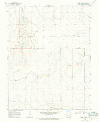
 1966 Two Butte Springs1967 Print · USGSProwers County in the mid-1960s reveals a quiet landscape of high plains drainage and vital water sources. Researchers can trace land use through field lines and locate the important Two Butte Springs, Two Butte Creek, and Plum Creek.2 unique versions available
 - 1966 Map of Durkee Creek NW, 1967 Print
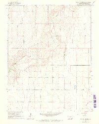
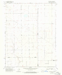
 1966 Durkee Creek NW1967 Print · USGSSoutheast Colorado rangeland comes into focus in the mid-1960s, showing a landscape defined by seasonal water and shifting terrain. Researchers can trace the path of Two Butte Creek, locate the Lamar Canal, and study the vast areas of Shifting Sand near Plum Creek.
 - 1966 Map of Durkee Creek SE, 1967 Print
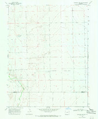
 1966 Durkee Creek SE1967 Print · USGSThe Colorado-Kansas state line at the edge of Prowers and Hamilton counties is captured here in the mid-1960s. Genealogists and researchers can trace the drainages of Bear Creek and Dry Creek or locate the remote Garder Cem and various landmark Wells.
 - 1967 Map of Neenoshe Reservoir, 1971 Print
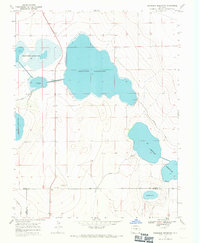 1967 Neenoshe Reservoir1971 Print · USGSSoutheast Colorado water management is on full display in the late sixties as reservoirs and irrigation canals define the Kiowa County landscape. Trace the intricate network of the Neenoshe Reservoir system, the Landing Strip, and the Pawnee Canal.
 - 1968 Map of La Junta
 1968 La Junta1968 Print · USGSSoutheastern Colorado and the high plains appear in remarkable detail during the late 1960s, showing the intersection of irrigation, ranching, and rail. Genealogists can trace family footprints at the Lycan Post Office, Konantz Cem, and across numerous named cattle ranches.
 - 1968 Map of Sheridan Lake SE, 1971 Print
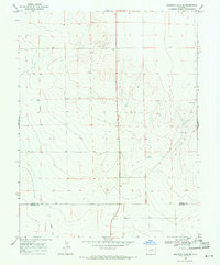 1968 Sheridan Lake SE1971 Print · USGSEastern Colorado's high plains near the turn of the 1970s reveal a landscape of remote ranching and utility infrastructure. Researchers can trace the Kiowa and Prowers county line and locate water-critical sites like Buffalo Creek and several Water Tanks.
 - 1968 Map of Chivington SE, 1971 Print
 1968 Chivington SE1971 Print · USGSEastern Colorado in the late sixties shows a landscape defined by water management and resource extraction. Trace the routes of the Comanche Canal and Pawnee Canal or locate local industrial sites like the Gravel Pits.
 - 1968 Map of North Plum Creek NE, 1971 Print
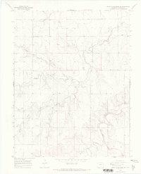
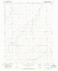 1968 North Plum Creek NE1971 Print · USGSProwers County's high plains terrain is documented here in the late sixties, showcasing the transit corridors of Eastern Colorado. Researchers can trace the path of the Santa Fe Granada Trail or locate features like Durkee and the Plum Creek drainage.
 - 1968 Map of Cat Creek NE, 1971 Print
 1968 Cat Creek NE1971 Print · USGSSoutheast Colorado in the late sixties reveals a landscape of high plains commerce and vital water management. Genealogists and historians can locate the Clay Creek Store and trace the paths of Horse Creek and the local Aqueduct.
 - 1968 Map of Lake Devore, 1971 Print
 1968 Lake Devore1971 Print · USGSThe High Plains of Kiowa County are captured here in the late sixties, showing a landscape defined by water management and prairie drainage. Researchers can trace the path of West Wild Horse Creek or locate landmarks like Lake Devore and the western Water Tank.
 - 1968 Map of Cat Creek, 1971 Print
 1968 Cat Creek1971 Print · USGSThe high plains of the Prowers and Bent county line are captured here in the late sixties, showing a landscape shaped by ranching and utility infrastructure. Researchers can locate the Flying W Ranch, the Springfield Landing Strip, and early Borrow Pits along Clay Creek.2 unique versions available
 - 1968 Map of North Plum Creek SE, 1971 Print
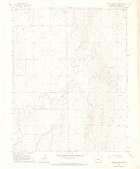
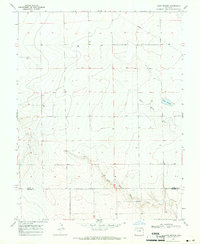
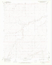
 1968 North Plum Creek SE1971 Print · USGSProwers County ranching country is captured here in the late sixties, showcasing a landscape shaped by the Plum Creek drainage system. Genealogists and researchers can locate landmarks like Union Sch or the Flowing Well among the creek forks.
 - 1968 Map of North Plum Creek NW, 1971 Print
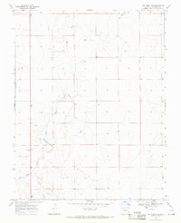
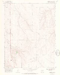
 1968 North Plum Creek NW1971 Print · USGSProwers County in the late sixties remains a landscape defined by its historical transit routes and sparse water sources. Genealogists and historians can trace the path of the Santa Fe Trail as it crosses the drainages of Wolf Creek and Granada Creek.
 - 1968 Map of Gobblers Knob, 1971 Print
 1968 Gobblers Knob1971 Print · USGSProwers County high plains are captured here in the late sixties, showing a landscape defined by historic transit and natural drainages. Trace the route of the Granada Santa Fe Wagon Trail or locate landmarks like Gobblers Knob and Horse Creek.2 unique versions available
 - 1968 Map of Cat Creek NW, 1971 Print
 1968 Cat Creek NW1971 Print · USGSThe border between Bent and Prowers counties appears in the late 1960s as a landscape of natural drainages and quiet prairie. Researchers can trace the path of Willow Creek or locate the reliable water at Willow Springs and Clay Creek.
 - 1968 Map of Barrel Spring, 1971 Print
 1968 Barrel Spring1971 Print · USGSProwers County high plains are captured here in the late sixties, showing the enduring path of the Santa Fe Trail. Local historians can trace the geography of early settlement through the Bethel Cem and water sources like Barrel Spring.
 - 1968 Map of Towner SE, 1971 Print
 1968 Towner SE1971 Print · USGSThe high plains along the Colorado-Kansas border are captured here in the late sixties, showing the vast township divisions of the prairie. Local researchers can trace the course of Wild Horse Creek and locate early infrastructure like the cross-country Pipeline and named tracts like Richland.
 - 1968 Map of Sheridan Lake SW, 1971 Print
 1968 Sheridan Lake SW1971 Print · USGSThe high plains of the Colorado border country are captured here in the late sixties, showing the rural divide between Kiowa Co and Prowers Co. Genealogists and historians can trace the path of Big Sandy Creek and locate remote landmarks like Lone and Coon Valley.
End of results
Showing maps 1-19 of 19
Top cities of Prowers County
- Lamar historical maps
- Holly historical maps
- Granada historical maps
- Wiley historical maps
- Hartman historical maps
Frequently asked questions
- What are the different types of historical maps available for Prowers County?
- What is the oldest map of Prowers County?
- Where can I purchase historical maps of Prowers County for my home or office?
- Where can I download high-res historical maps of Prowers County?
- Are there historical topographic maps available for Prowers County?
- Is there historical aerial imagery available for Prowers County?
- Where are historical maps of Prowers County sourced from?