Old Maps of Prowers County, Colorado for Genealogy
Trace your family roots with 232 historic maps of Prowers County. These high-res maps reveal old neighborhoods, homesites, landmarks, and streets — helping you uncover where your ancestors lived and how the area evolved over time.
- Explore historic neighborhoods: Identify where your relatives may have lived in the 1800s or 1900s.
- Compare maps over time: Trace the changes in streets, buildings, and landmarks for multi-generational research.
- Perfect for genealogy & ancestry research: Used by family historians and researchers to map out lineage and migration.
These maps are an incredible resource for exploring your personal connection to Prowers County's past.
Prowers County, CO maps
(232)- 1890 Map of Granada, 1962 Print
 1890 Granada1962 Print · USGSSoutheast Colorado at the close of the nineteenth century was a landscape of expanding steel and water. Researchers can trace early railroad developments along the Missouri Pacific Railroad and locate pioneer outposts like Ellis Ranch or Granada.
 - 1891 Map of Albany
 1891 Albany1891 Print · USGSThe Colorado-Kansas borderlands were a crossroads of historic transit in the early 1890s. Genealogists and historians can trace the paths of the Santa Fe Trail and Texas Trail past frontier outposts like Albany and Kline Ranche.
 - 1892 Map of Lamar
 1892 Lamar1892 Print · USGSSoutheastern Colorado in the early 1890s shows the pivotal arrival of the rail-and-river economy across the High Plains. Researchers can trace the development of early irrigation systems and rail stops like Lamar, Chivington, and Graveyard Creek.7 unique versions available
 - 1892 Map of Granada
 1892 Granada1892 Print · USGSThe high plains of eastern Colorado and western Kansas meet here in the late nineteenth century during a period of rapid railroad expansion. Researchers can trace the dual tracks of the Missouri Pacific Railroad and the Arkansas River route, locating early ranching landmarks like Ellis Rancho and Watsons Rancho.
 - 1892 Map of Two Butte
 1892 Two Butte1892 Print · USGSSoutheastern Colorado appears here in the early 1890s, when ranching outposts and pioneer trails defined the high plains. Researchers can trace the original Santa Fe Trail and locate early settlements such as Brookfield, Mulvane, and the Longshore Ranch.
 - 1893 Map of Two Butte
 1893 Two Butte1893 Print · USGSSoutheastern Colorado appears here in the early 1890s, where high plains ranching and the legendary Santa Fe Trail met. Genealogists can trace early outposts like Brookfield, Atlanta, and the remote Longshore Ranch.5 unique versions available
 - 1893 Map of Albany
 1893 Albany1893 Print · USGSThe high plains of the Colorado-Kansas border are documented here in the early 1890s, when overland travel routes still shaped the land. Local historians can trace the paths of the Santa Fe Trail and Texas Trail past early settlements like Albany and Kline Ranche.5 unique versions available
 - 1894 Map of Granada
 1894 Granada1894 Print · USGSSoutheast Colorado and the Kansas borderlands appear here in the 1890s as the railroad and river systems reshaped the plains. Genealogists and historians can trace early holdings like Ellis Ranch and vanished rail stops from Arden to Adana.4 unique versions available
 - 1952 Map of Lamar West, 1954 Print
 1952 Lamar West1954 Print · USGSThe river valley west of Lamar was a vital corridor for both historic wagon routes and modern irrigation during the early fifties. Genealogists and historians can trace the Old Santa Fe Trail alongside local landmarks like Dry Creek School and Crawford Cem.4 unique versions available
 - 1952 Map of Carlton, 1954 Print
 1952 Carlton1954 Print · USGSThe Arkansas River valley in Prowers County was a vital agricultural and transport corridor in the early fifties. Genealogists can locate family landmarks like Center Farm, the Carlton School, and the path of the Old Santa Fe Trail.
 - 1953 Map of Holly West, 1954 Print
 1953 Holly West1954 Print · USGSSoutheast Colorado in the early fifties shows a landscape shaped by the Arkansas River and the legacy of the western frontier. Trace the Old Santa Fe Trail as it passes through Amity, locate the Hartman Cemetery, and see the rail-side Grain Elevator at Hartman.4 unique versions available
 - 1953 Map of Granada, 1954 Print
 1953 Granada1954 Print · USGSThe High Plains of Prowers County are shown in the early fifties, detailing a landscape defined by irrigation and railroad transit. Researchers can find Camp Amache (Aband), the Granada Cem, and small railroad sidings like Koen and Warwick.3 unique versions available
 - 1953 Map of Lamar East, 1954 Print
 1953 Lamar East1954 Print · USGSThe Arkansas River valley in the early fifties shows a landscape of vital irrigation and railroad history. Trace the route of the Santa Fe Trail and find local landmarks like Riverside Cemetery, Clay Creek School, and the Lamar city limits.5 unique versions available
 - 1953 Map of Holly East, 1954 Print
 1953 Holly East1954 Print · USGSThe Arkansas River valley at the Colorado-Kansas border was a vital transit corridor in the early fifties. Historians can trace the Old Santa Fe Trail past the Site of Old Trail City and the rail-side towns of Holly and Coolidge.4 unique versions available
 - 1954 Map of Lamar, 1964 Print
 1954 Lamar1964 Print · USGSSoutheastern Colorado and the Kansas borderlands appear here in the mid-fifties, dominated by the vital Arkansas River irrigation network. Researchers can trace the development of river towns like Lamar and La Junta alongside the Amity Cemetery and several major reservoirs.3 unique versions available
 - 1955 Map of Holly NE, 1956 Print
 1955 Holly NE1956 Print · USGSThe Colorado-Kansas state line is captured here in the mid-1950s, showing a high-plains landscape shaped by vital irrigation. Genealogists and researchers can trace the path of the Amity Canal, locate a School (Aband), and explore the terrain of Coolidge Ridge.3 unique versions available
 - 1955 Map of Granada NW, 1956 Print
 1955 Granada NW1956 Print · USGSThe Prowers County high plains in the mid-1950s show an environment defined by irrigation and early aviation. Researchers can trace the water systems of the Amity Canal and find local landmarks like Tenmile Point and the Goodale Sch.2 unique versions available
 - 1955 Map of Granada NE, 1956 Print
 1955 Granada NE1956 Print · USGSSoutheast Colorado at the height of the post-war ranching era reveals a landscape shaped by irrigation and rail. Genealogists and historians can locate the Sunnyslope Cemetery, the settlement of Bristol, and the route of the Atchison Topeka and Santa Fe railroad.3 unique versions available
 - 1955 Map of Holly NW, 1956 Print
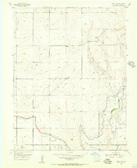 1955 Holly NW1956 Print · USGSSoutheast Colorado at mid-century reveals a landscape defined by ranching and an expansive irrigation network. Genealogists and historians can trace the Klama Ranch, the Cramblet Ranch, and the path of the Amity Canal through the prairie.2 unique versions available
 - 1955 Map of May Valley, 1956 Print
 1955 May Valley1956 Print · USGSThe High Plains of Prowers County appear here at a mid-century peak of rural development, dominated by a sophisticated network of irrigation canals and local rail stops. Researchers can trace the heritage of vanished school districts like Hopewell Sch and the rail-side community at Kornman.
 - 1955 Map of Wiley, 1956 Print
 1955 Wiley1956 Print · USGSIn the mid-1950s, the irrigation-dependent plains of Prowers and Bent Counties centered on the railroad town of Wiley. Researchers can trace the development of the region's water rights and schools like Cactus View Sch (Aban'd) and West Riverview Sch.2 unique versions available
 - 1955 Map of La Junta, 1966 Print
 1955 La Junta1966 Print · USGSSoutheastern Colorado during the mid-fifties is captured here as a sprawling network of ranching outposts and rail sidings. Researchers can locate vanished landmarks like the Sunderland School, trace the isolated Lycan Post Office, or find the Bomb target (abandoned) on the western plains.3 unique versions available
 - 1958 Map of La Junta
 1958 La Junta1958 Print · USGSSoutheast Colorado and the Kansas borderlands appear in the late fifties as a landscape of isolated ranching outposts and vital rail junctions. Researchers can trace the lineage of vanished post offices and rural school sites like the Lycan Post Office and Sunderland School.2 unique versions available
 - 1958 Map of Lamar
 1958 Lamar1958 Print · USGSThe High Plains of Eastern Colorado and Western Kansas in the late fifties reveal a landscape tied to the Arkansas River and the rails. Trace the heritage of the river valley through Fort Lyon, the Atchison Topeka and Santa Fe RR, and rural landmarks like Kendrick Church.2 unique versions available
 - 1966 Map of Durkee Creek NE, 1967 Print
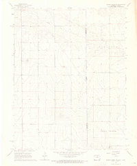 1966 Durkee Creek NE1967 Print · USGSThe high plains of the Prowers and Hamilton county line appear in the mid-1960s, showing the quiet landscape along the Colorado-Kansas border. Researchers can trace land use patterns through the Canal system, the flow of Bear Creek, and numerous rural wells.
Showing maps 1-25 of 232
Top cities of Prowers County
- Lamar historical maps
- Holly historical maps
- Granada historical maps
- Wiley historical maps
- Hartman historical maps
Frequently asked questions
- What are the different types of historical maps available for Prowers County?
- What is the oldest map of Prowers County?
- Where can I purchase historical maps of Prowers County for my home or office?
- Where can I download high-res historical maps of Prowers County?
- Are there historical topographic maps available for Prowers County?
- Is there historical aerial imagery available for Prowers County?
- Where are historical maps of Prowers County sourced from?