Old Maps of Boone, Colorado for Genealogy
Trace your family roots with 22 historic maps of Boone. These high-res maps reveal old neighborhoods, homesites, landmarks, and streets — helping you uncover where your ancestors lived and how the area evolved over time.
- Explore historic neighborhoods: Identify where your relatives may have lived in the 1800s or 1900s.
- Compare maps over time: Trace the changes in streets, buildings, and landmarks for multi-generational research.
- Perfect for genealogy & ancestry research: Used by family historians and researchers to map out lineage and migration.
These maps are an incredible resource for exploring your personal connection to Boone's past.
Boone, CO maps
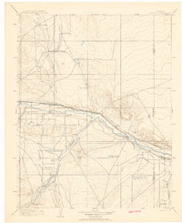
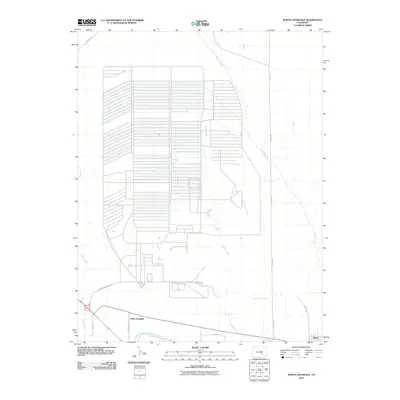
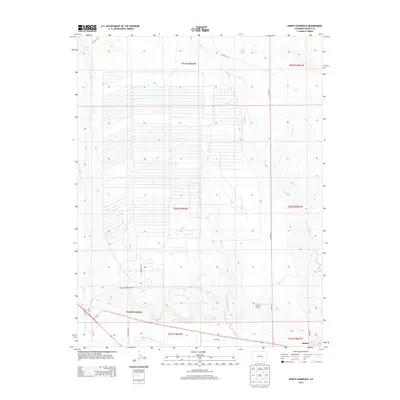
(22)- 1891 Map of Nepesta
 1891 Nepesta1891 Print · USGSSoutheast Colorado at the close of the 1880s reveals a landscape defined by the arrival of the rails along the Arkansas River. Researchers can trace early ranching sites like Skinner & Tabor Ranch and follow the competing paths of the Atchison Topeka and Santa Fe Railroad and the Missouri Pacific Railroad.
 - 1893 Map of Nepesta
 1893 Nepesta1893 Print · USGSSoutheast Colorado at the close of the nineteenth century is defined here by the arrival of the rails along the Arkansas River. Researchers can trace the early cattle and transit economy through the Skinner & Tabor Ranch, Chico Station, and the village of Nepesta.2 unique versions available
 - 1904 Map of Nepesta
 1904 Nepesta1904 Print · USGSEastern Colorado at the turn of the century shows a landscape transformed by water and rail. Trace the irrigation network of Excelsior Ditch and the lineage of family outposts like Skinner and Tabor Ranch and Tolle Ranch.3 unique versions available
 - 1954 Map of Pueblo, 1966 Print
 1954 Pueblo1966 Print · USGSMid-century Colorado comes alive in this survey of the Front Range and the high plains as the region expanded after the war. Genealogists and historians can trace family roots through rural landmarks like Hanover Church, Pioneer Cemetery, and the Grandview School.3 unique versions available
 - 1957 Map of Pueblo
 1957 Pueblo1957 Print · USGSMid-century Colorado comes alive as the Front Range urban centers expand alongside massive Cold War military installations. Genealogists and historians can trace the foundations of Stone City, rural sites like Hanover School, and the industrial Canon Imperial Mine.
 - 1958 Map of Pueblo
 1958 Pueblo1958 Print · USGSColorado's Front Range and Arkansas River Valley come alive in the late fifties, showing the transition from historic mining districts to major military and rail hubs. Genealogists and historians can trace family roots in ranching communities and find landmarks like Cripple Creek, Manitou, and the Hanover School.
 - 1960 Map of Avondale, 1962 Print
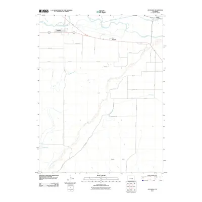
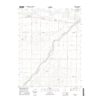
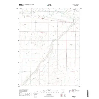
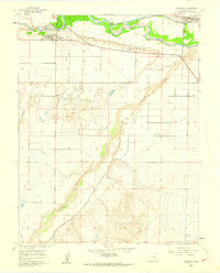 1960 Avondale1962 Print · USGSPueblo County's agricultural heartland is captured here in the early sixties, showing the vital irrigation network around Avondale and Boone. Genealogists and historians can trace the local landscape through the San Jose Ch, the historic grounds of Fort Reynolds, and the winding Huerfano River.4 unique versions available
 - 1960 Map of North Avondale, 1963 Print
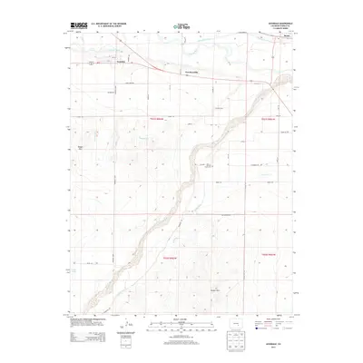
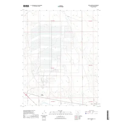
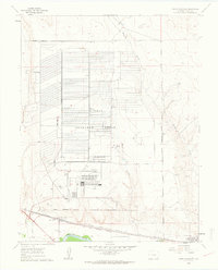 1960 North Avondale1963 Print · USGSEastern Pueblo County at the start of the sixties is defined by the massive Pueblo Ordnance Depot and the bustling rail lines south of the river. Researchers can trace the layout of the depot's bunkers or locate local landmarks like North Avondale, Boone, and the Excelsior Sch.5 unique versions available
 - 1962 Map of Pueblo
 1962 Pueblo1962 Print · USGSThe Front Range and high plains meet in the early sixties as military installations and industrial mining shape the corridor from Colorado Springs to Pueblo. Genealogists can trace family names through rural landmarks like the Columbine School, Hanover Church, and Fairview Cem.
 - 1966 Map of Pueblo
 1966 Pueblo1966 Print · USGSThe Front Range and Arkansas River Valley are captured here in the mid-1960s, showing a landscape shaped by mining, military expansion, and rail. Researchers can locate numerous country schools and mines, such as the Lytle School, Pioneer Cem, and Empire Zinc Mine.
 - 1981 Map of Pueblo
 1981 Pueblo1981 Print · USGSThe Arkansas River valley comes into sharp focus during the early eighties, showing the expansion of Pueblo and its rail networks. Researchers can trace historic sites like Fort Reynolds, explore the Pueblo Ordnance Depot, and locate family burial plots in Roselawn Cemetery.
 - 1989 Map of Pueblo
 1989 Pueblo1989 Print · USGSIn the late eighties, the Colorado Front Range balanced its deep mining history with massive military expansion and water development. Researchers can trace the rail lines of the AT & SF RR or locate remote high-altitude settlements like Rosita and Querida.
 - 2010 Map of North Avondale, 2010 Print
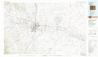
 2010 North Avondale2010 Print · USGSCovers Boone, including North Avondale, Pueblo County, and other nearby areas
 - 2010 Map of Avondale, 2010 Print
 2010 Avondale2010 Print · USGSCovers Boone, including Avondale, Fort Reynolds, and other nearby areas
 - 2013 Map of Avondale, 2013 Print
 2013 Avondale2013 Print · USGSCovers Boone, including Avondale, Fort Reynolds, and other nearby areas
 - 2013 Map of North Avondale, 2013 Print
 2013 North Avondale2013 Print · USGSCovers Boone, including North Avondale, Pueblo County, and other nearby areas
 - 2016 Map of North Avondale, 2016 Print
 2016 North Avondale2016 Print · USGSCovers Boone, including North Avondale, Pueblo County, and other nearby areas
 - 2016 Map of Avondale, 2016 Print
 2016 Avondale2016 Print · USGSCovers Boone, including Avondale, Fort Reynolds, and other nearby areas
 - 2019 Map of Avondale, 2019 Print
 2019 Avondale2019 Print · USGSCovers Boone, including Avondale, Fort Reynolds, and other nearby areas
 - 2019 Map of North Avondale, 2019 Print
 2019 North Avondale2019 Print · USGSCovers Boone, including North Avondale, Pueblo County, and other nearby areas
 - 2022 Map of Avondale, 2022 Print
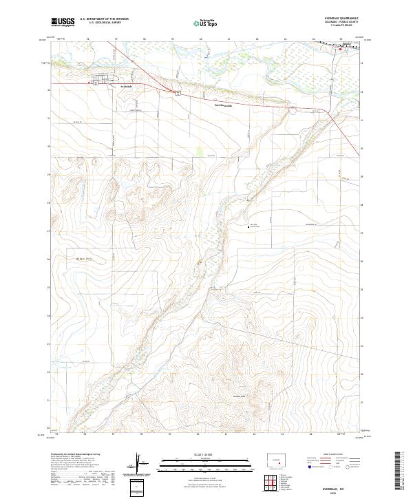 2022 Avondale2022 Print · USGSThe Arkansas River valley east of Pueblo is captured in this modern survey, showing a landscape defined by century-old irrigation and agriculture. Researchers can trace the paths of the Colorado Canal and Bessemer Ditch or locate the historic San Jose Church Cem.
 - 2022 Map of North Avondale, 2022 Print
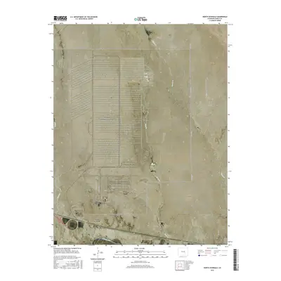
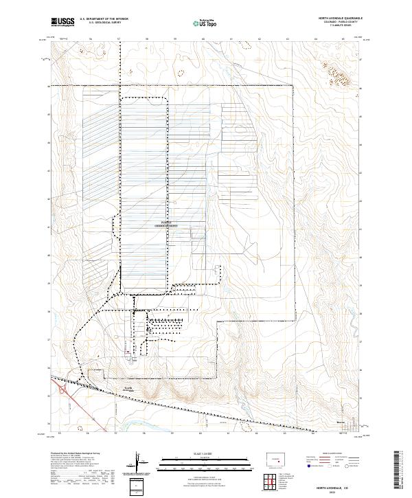 2022 North Avondale2022 Print · USGSThe Arkansas River valley near North Avondale comes into focus in this recent survey, showcasing the area's mix of industrial grids and riverfront settlements. Researchers can trace the developed corridors along Plant Rd and Ordnance Ln or locate the community of Boone at the river's edge.
End of results
Showing maps 1-22 of 22
Top cities near Boone
Frequently asked questions
- What are the different types of historical maps available for Boone?
- What is the oldest map of Boone?
- Where can I purchase historical maps of Boone for my home or office?
- Where can I download high-res historical maps of Boone?
- Are there historical topographic maps available for Boone?
- Is there historical aerial imagery available for Boone?
- Where are historical maps of Boone sourced from?