Old Maps of Pueblo County, Colorado
Explore 408 old maps of Pueblo County, spanning from 1889 to today. These high-resolution historic maps reveal how streets, neighborhoods, landmarks, and natural features evolved over time — perfect for genealogy, metal detecting, research, and local history exploration.
What you can do with these maps:
- See how Pueblo County changed over time: Compare historical maps to modern-day views to trace roads, homesites, rail lines & more.
- View detailed metadata: Each map includes creators, publishers, year, scale, and archive source.
- Overlay maps with satellite & LiDAR: Visualize the past alongside modern tools to explore terrain & human change.
- Trusted historical sources: Maps sourced from the USGS, Library of Congress, and other archives.
- Access maps your way: View online, download high-res files, or order prints for personal or research use.
Start exploring old maps of Pueblo County to uncover forgotten places, hidden landmarks, and the deep history beneath your feet.
Pueblo County, CO maps
(408)- 1889 Map of Canon City
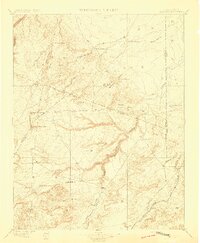
 1889 Canon City1889 Print · USGSFremont and Custer counties appear here during the peak of the Colorado silver boom, when mining and rail expansion transformed the valley. Genealogists can trace family roots in early settlements like Silver Cliff, Rosita, and the coal camps of Rockvale.2 unique versions available
 - 1889 Map of Huerfano Park, 1961 Print
 1889 Huerfano Park1961 Print · USGSHuerfano County and the high peaks of the Sangre de Cristos are captured here in the late nineteenth century. Trace the early tracks of the Denver and Rio Grande Railroad and locate vanished outposts like Sharpsdale and Malachite.
 - 1891 Map of Walsenburg
 1891 Walsenburg1891 Print · USGSHuerfano County in the early 1890s was a landscape shaped by coal and steam as the Denver and Rio Grande Railroad expanded through the region. Genealogists and historians can trace early settlements and junctions like Walsenburg, Rouse, and Cuchara Junction.
 - 1891 Map of Pueblo
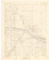
 1891 Pueblo1891 Print · USGSPueblo and the Arkansas River valley are shown here in the late nineteenth century as the region's rail and industrial power surged. Local historians can trace the early footprints of Bessemer, the extensive rail yards of the Missouri Pacific Railroad, and rural landmarks like the Three R Ranch.
 - 1891 Map of Nepesta
 1891 Nepesta1891 Print · USGSSoutheast Colorado at the close of the 1880s reveals a landscape defined by the arrival of the rails along the Arkansas River. Researchers can trace early ranching sites like Skinner & Tabor Ranch and follow the competing paths of the Atchison Topeka and Santa Fe Railroad and the Missouri Pacific Railroad.
 - 1891 Map of Apishapa
 1891 Apishapa1891 Print · USGSSoutheastern Colorado was a land of high mesas and vital rail connections in the 1890s. Genealogists and historians can trace early rail stops like Thatcher and Delhi along the Atchison Topeka and Santa Fe Railroad.
 - 1892 Map of Huerfano Park
 1892 Huerfano Park1892 Print · USGSSouthern Colorado mountain life is captured here in the late nineteenth century, showing the early settlements and rail lines of the Huerfano region. Researchers can trace the path of the Denver and Rio Grande Railroad and locate vanished stops at Malachite, Sharpsdale, and Placer.5 unique versions available
 - 1892 Map of Canon City
 1892 Canon City1892 Print · USGSThe mining camps of Custer and Fremont counties were in their prime during the 1890s silver and coal boom. Genealogists and historians can trace the early rail networks and locate hard-rock operations like the Bassick Mine or settlements such as Silver Cliff and Querida.8 unique versions available
 - 1893 Map of Nepesta
 1893 Nepesta1893 Print · USGSSoutheast Colorado at the close of the nineteenth century is defined here by the arrival of the rails along the Arkansas River. Researchers can trace the early cattle and transit economy through the Skinner & Tabor Ranch, Chico Station, and the village of Nepesta.2 unique versions available
 - 1893 Map of Apishapa
 1893 Apishapa1893 Print · USGSThe Colorado high plains of the 1890s are defined here by the winding Apishapa River and the arrival of steam power. Trace the early rail stops at Thatcher and Delhi or locate the distinctive volcanic landmarks of the Rattlesnake Buttes.
 - 1893 Map of Big Springs
 1893 Big Springs1893 Print · USGSEastern Colorado ranching country is documented here in the late nineteenth century, showing the early homesteads and water sources of the high plains. Researchers can locate the early holdings of Galloway Ranch and Hancock Ranch or trace the drainage of Black Squirrel Creek.5 unique versions available
 - 1893 Map of Colorado Springs, 1896 Print
 1893 Colorado Springs1896 Print · USGSEl Paso County at the end of the nineteenth century was a booming intersection of mountain tourism and heavy rail commerce. Researchers can trace early railroad alignments like the Colorado Midland Railroad and locate vanished stops at Franceville Junction or Bierstadt.2 unique versions available
 - 1894 Map of Walsenburg
 1894 Walsenburg1894 Print · USGSWalsenburg and the surrounding coal country are captured in the late nineteenth century as the rail network expanded. Map collectors and genealogists can trace early railroad settlements like Cuchara Junction and industrial sites including the Rouse Mines and Tioga.
 - 1894 Map of Pueblo, 1957 Print
 1894 Pueblo1957 Print · USGSPueblo and the Arkansas River valley are captured here at a pivotal moment of late-century industrial growth. Researchers can trace early rail corridors and vanished rural landmarks like Three R Ranch, Bessemer Junction, and Glendale.2 unique versions available
 - 1896 Map of Pueblo
 1896 Pueblo1896 Print · USGSPueblo and its surrounding mesas are shown here in the 1890s as a thriving rail and irrigation hub. Genealogists and historians can trace the early layouts of Bessemer Junction, follow the Trinidad Line, or locate the family-owned Three R Ranch near the Hogback Mt.
 - 1897 Map of Pueblo
 1897 Pueblo1897 Print · USGSPueblo and its surrounding plains were a bustling railroad and industrial crossroads in the late nineteenth century. Genealogists and historians can trace the early footprints of Bessemer Junction, the intricate Bessemer Ditch, and family landmarks like the Three R Ranch.4 unique versions available
 - 1897 Map of Walsenburg
 1897 Walsenburg1897 Print · USGSSouthern Colorado at the close of the century reveals a landscape of expanding railroads and coal settlements. Genealogists and historians can trace the early rail stops and mining camps of Walsenburg, Pictou, and Rouse along the DENVER AND RIO GRANDE R. R. network.4 unique versions available
 - 1897 Map of Apishapa
 1897 Apishapa1897 Print · USGSSoutheastern Colorado appears here during the cattle-ranching era of the late nineteenth century. Researchers can trace the legacy of early western transit along the Santa Fe Trail or locate family landmarks like the Baca Ranch and Thatcher.4 unique versions available
 - 1900 Map of Walsenburg
 1900 Walsenburg1900 Print · USGSSouthern Colorado at the turn of the century shows a landscape being transformed by the arrival of the Denver and Rio Grande RR. Genealogists and historians can trace early settlements and transit points like Huerfano Sta. (Ute P.O.), the coal town of Rouse, and the landmark Huerfano Butte.
 - 1904 Map of Nepesta
 1904 Nepesta1904 Print · USGSEastern Colorado at the turn of the century shows a landscape transformed by water and rail. Trace the irrigation network of Excelsior Ditch and the lineage of family outposts like Skinner and Tabor Ranch and Tolle Ranch.3 unique versions available
 - 1909 Map of Colorado Springs
 1909 Colorado Springs1909 Print · USGSColorado Springs and the Front Range foothills are shown here at a pivotal era of rail expansion and early tourism. Genealogists and historians can trace defunct rail lines, rural schoolhouse locations like Grandview School, and landmarks such as the Cliff Dwellings and Burial Rocks.5 unique versions available
 - 1942 Map of Colorado Springs
 1942 Colorado Springs1942 Print · USGSColorado Springs and the Front Range appear here in the early years of the Second World War. Genealogists and historians can trace the rail corridors of the Chicago Rock Island and Pacific RR and locate sites like the Printers Home and Glen Eyrie.
 - 1948 Map of Mount Pittsburg, 1956 Print
 1948 Mount Pittsburg1956 Print · USGSSouthern Colorado ranching country is captured here just after the war, showing the foothills at the convergence of three counties. Local historians can locate early family-named sites like Fords Mountaindale Ranch and the Red Creek School.
 - 1948 Map of Timber Mountain, 1956 Print
 1948 Timber Mountain1956 Print · USGSThe foothills of the Front Range come alive in the late 1940s, showing a landscape shared by massive military installations and traditional ranching. Genealogists can locate specific family sites like Earley Ranch and Avery Ranch or the historic Lytle Sch.
 - 1948 Map of Fountain SE, 1957 Print
 1948 Fountain SE1957 Print · USGSEl Paso and Pueblo counties are captured here in the late 1940s, highlighting a quiet landscape of high-plains ranching and essential rail transport. Genealogists and historians can trace local family landholdings like Hammer Ranch, Paige Ranch, and the Kaufman Place.
Showing maps 1-25 of 408
Top cities of Pueblo County
- Pueblo historical maps
- Pueblo West historical maps
- Colorado City historical maps
- Blende historical maps
- Avondale historical maps
- Salt Creek historical maps
See more
Frequently asked questions
- What are the different types of historical maps available for Pueblo County?
- What is the oldest map of Pueblo County?
- Where can I purchase historical maps of Pueblo County for my home or office?
- Where can I download high-res historical maps of Pueblo County?
- Are there historical topographic maps available for Pueblo County?
- Is there historical aerial imagery available for Pueblo County?
- Where are historical maps of Pueblo County sourced from?