1970s Maps of Pueblo County, Colorado
Explore 20 historic maps of Pueblo County from the 1970s. These maps offer a rare glimpse into what life looked like during the 1970s — showing old roads, neighborhoods, homes, and landmarks that have changed or disappeared over time.
Whether you're researching your family's past, planning a metal detecting trip, or studying how Pueblo County's landscape evolved across the 1970s, these high-resolution maps are a powerful tool for exploring the history of this region.
- Focus on a specific era: All maps on this page are from the 1970s, giving you a focused view of this time period.
- See what’s changed: Compare century-old streets, trails, and buildings to today's modern landscape using overlays and satellite layers.
- Research with precision: Use these maps for genealogy, historical research, land use analysis, or educational projects.
- View, download, or print: Maps are fully viewable online in high resolution, and can be downloaded or printed for your own records.
Start exploring Pueblo County's history through authentic maps from the 1970s. This is your window into the past.
Pueblo County, CO maps
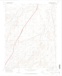
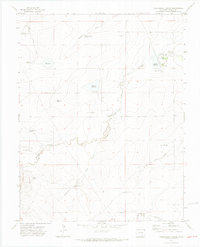
(20)- 1970 Map of Hog Ranch Canyon, 1973 Print
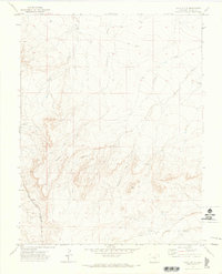
 1970 Hog Ranch Canyon1973 Print · USGSPueblo County's arid canyons and early land grants are detailed in the 1970s, showing a landscape shaped by water scarcity and ranching. Researchers can trace family-named sites such as Finn Cem, Gallegos Reservoir, and Mc Elhaney Canyon across the high plains terrain.
 - 1970 Map of Red Top Ranch, 1973 Print
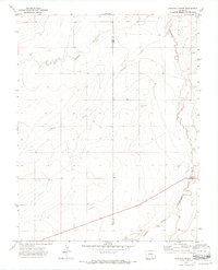
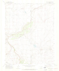
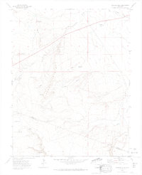
 1970 Red Top Ranch1973 Print · USGSPueblo County ranching country is mapped here during the early seventies, detailing the vital water infrastructure of the Colorado high plains. Researchers can trace land management through numerous family-named sites like Studebaker Reservoir, McElhaney Canyon, and Freds Camp.2 unique versions available
 - 1970 Map of Verde School, 1973 Print
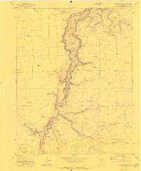
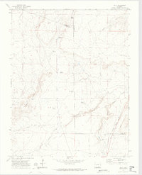
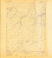
 1970 Verde School1973 Print · USGSSouthern Colorado's high plains near Pueblo are captured here in the early seventies, showing a landscape of ranching and early irrigation. Genealogists and historians can trace local life through sites like the Verde Sch, Verde Cem, and the Nolan settlement.
 - 1970 Map of Apishapa Bridge, 1973 Print
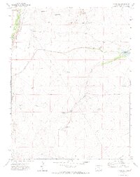
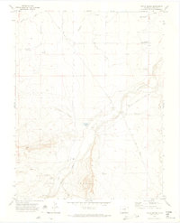
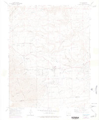
 1970 Apishapa Bridge1973 Print · USGSSoutheastern Colorado ranching country is captured here during the 1970s, where the high plains meet the winding Apishapa River. Genealogists and historians can trace the remote settlement of Whiterock and the historic crossing at Apishapa Bridge.3 unique versions available
 - 1970 Map of Graneros Flats, 1973 Print
 1970 Graneros Flats1973 Print · USGSThe Colorado high plains near the Huerfano and Pueblo county line come into focus during the early 1970s. Trace rural life and rail history through the locations of the Graneros Sch, the Evergreen Cem, and the winding Denver and Rio Grande Western Railroad.2 unique versions available
 - 1970 Map of Capps Springs, 1973 Print
 1970 Capps Springs1973 Print · USGSSoutheastern Colorado ranching country is mapped here during the early seventies, where the Cucharas River winds between Pueblo and Huerfano counties. Genealogists and researchers can locate family-named landmarks like Kenner Ranch, Jake Vigil Spring, and Starbuck Lakes.2 unique versions available
 - 1970 Map of Chicos Well, 1973 Print
 1970 Chicos Well1973 Print · USGSPueblo County is documented here in the early 1970s, showcasing an intricate network of irrigation ditches and reservoirs essential for high-plains ranching. Researchers can locate specific water improvements like Chicos Well and historical markers such as a lone Grave near the Hooker Hills.2 unique versions available
 - 1970 Map of Goat Butte, 1973 Print
 1970 Goat Butte1973 Print · USGSSouthern Colorado ranching and rail infrastructure are captured here in the early seventies, centered on the prominent Goat Butte. Researchers can locate isolated landmarks like Blake Ranch, the Marnell settlement, and the Denver and Rio Grande Western railroad line.
 - 1970 Map of Snowden Lake, 1974 Print
 1970 Snowden Lake1974 Print · USGSPueblo and Otero counties meet along the Apishapa River in this early 1970s survey of the Colorado high plains. Genealogists and historians can trace essential water landmarks like Snowden Lake, Kitch Spring, and the Bull Pasture Windmill.4 unique versions available
 - 1970 Map of Delhi, 1974 Print
 1970 Delhi1974 Print · USGSSoutheast Colorado ranching country is captured here just as the modern era reached these high plains. Genealogists and historians can trace family-named sites like Hall Windmills and Barbee Windmill along the path of the Santa Fe Trail.2 unique versions available
 - 1970 Map of Doyle Bridge, 1974 Print
 1970 Doyle Bridge1974 Print · USGSSoutheast of Pueblo in the 1970s, the Huerfano River valley reveals a landscape of irrigation ditches and family ranches. Trace local history through the Doyle Cem, Undercliff Community Center, and the old Doyle Bridge crossing.
 - 1970 Map of Cedarwood, 1974 Print
 1970 Cedarwood1974 Print · USGSThe Pueblo County rangelands come alive in the early 1970s as a hub for dual rail lines and vital water resources. Local researchers can trace the routes of the Colorado and Southern railroad or locate remote landmarks like Poleline Camp and Claypit.
 - 1970 Map of Yellowbank Creek, 1974 Print
 1970 Yellowbank Creek1974 Print · USGSPueblo County's ranching landscape is captured here in the early seventies, detailing a terrain defined by critical water management and named family landmarks. Researchers can trace historic grazing infrastructure through features like Bombing Range Reservoir, Weinegar Windmill, and Altman Reservoir.4 unique versions available
 - 1970 Map of Myers Canyon, 1974 Print
 1970 Myers Canyon1974 Print · USGSSoutheast Colorado ranching country is captured here in the early seventies, detailing the intersection of Pueblo, Las Animas, and Huerfano counties. Genealogists and historians can locate family holdings like Spurlock Ranch and trace water sources like Big Flannery Res and Cactus Flat Windmill.
 - 1970 Map of Sanford Hills, 1974 Print
 1970 Sanford Hills1974 Print · USGSThe high plains of the Pueblo and Las Animas county line are captured here during the early 1970s. Researchers can locate remote cattle operations and water sources like English Camp, Jacobs Ranch, and the isolated Cem near the Apishapa River.4 unique versions available
 - 1971 Map of North Rattlesnake Butte, 1973 Print
 1971 North Rattlesnake Butte1973 Print · USGSHuerfano and Pueblo counties are documented here in the early 1970s as a landscape of remote ranching and essential water rights. Researchers can find old cattle country landmarks like North Butte Sch, Machatten Wells, and Hans Reservoir.2 unique versions available
 - 1973 Map of Truckton SE, 1975 Print
 1973 Truckton SE1975 Print · USGSThe high plains of eastern Colorado meet at a four-county junction in the early 1970s. Researchers can trace rural family routes like Whittemore Road and Rasner Road past several isolated Water Tanks and fence lines.2 unique versions available
 - 1973 Map of Hanover SE, 1975 Print
 1973 Hanover SE1975 Print · USGSEastern El Paso County during the early 1970s shows a landscape transitioning from rural ranching to large-scale federal testing. Researchers can trace the layout of the High Speed Ground Test Center and locate the historic Squirrel Creek School.
 - 1973 Map of Edison School, 1975 Print
 1973 Edison School1975 Print · USGSThe Colorado high plains near the El Paso and Pueblo county line are documented here during the early 1970s. Researchers can trace the rural infrastructure of the era through sites like Edison School, Leader Church, and the isolated Dry Camp settlement.
 - 1975 Map of Rye, 1977 Print
 1975 Rye1977 Print · USGSThe foothills of the Sangre de Cristo Mountains come into focus in the mid-seventies, showing the growth of Rye and Colorado City. You can trace the Standard Ditch, find the Brookside Cem, and locate the Fish Hatchery near Greenhorn Creek.
End of results
Showing maps 1-20 of 20
Top cities of Pueblo County
- Pueblo historical maps
- Pueblo West historical maps
- Colorado City historical maps
- Blende historical maps
- Avondale historical maps
- Salt Creek historical maps
See more
Frequently asked questions
- What are the different types of historical maps available for Pueblo County?
- What is the oldest map of Pueblo County?
- Where can I purchase historical maps of Pueblo County for my home or office?
- Where can I download high-res historical maps of Pueblo County?
- Are there historical topographic maps available for Pueblo County?
- Is there historical aerial imagery available for Pueblo County?
- Where are historical maps of Pueblo County sourced from?