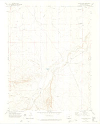
1970 Map of Doyle Bridge
USGS Topo · Published 1974About this map
The Huerfano River carves a path through this Colorado landscape, defining the agricultural and water management patterns south of Pueblo during the early 1970s. The settlement of Doyle Bridge and the nearby Undercliff Community Center serve as focal points for a rural community shaped by irrigation infrastructure like the Nepesta Farmers Ditch and Vertrees Reservoir. These features, along with several gravel pits, indicate a landscape utilized for both ranching and local resource extraction. To the south, the terrain rises into the Vigil And St Vrain area, where Goat Butte and Iron Spring highlight the shift from river valley to higher desert topography. Genealogists and local historians can trace family-named locations such as Butler Ranch and find evidence of early burials at the Doyle Cem, located just off Doyle Road.
Find a feature on this map
24 named features on this map. Tap any name to fly to it.
Don’t see what you’re looking for? This feature index may not catch every label — zoom into the map to look around manually.
Map Details
Editions of this 1970 Doyle Bridge Map
This is the sole edition of this map. No revisions or reprints were ever made.
Other maps of this area

1891 · Walsenburg
USGS Topo · 1:125,000

1891 · Pueblo
USGS Topo · 1:125,000

1891 · Nepesta
USGS Topo · 1:125,000

1891 · Apishapa
USGS Topo · 1:125,000

1893 · Nepesta
USGS Topo · 1:125,000

1893 · Apishapa
USGS Topo · 1:125,000

1894 · Walsenburg
USGS Topo · 1:125,000

1894 · Pueblo
USGS Topo · 1:125,000

1896 · Pueblo
USGS Topo · 1:125,000

1897 · Pueblo
USGS Topo · 1:125,000