1990s Maps of Pueblo County, Colorado
Explore 10 historic maps of Pueblo County from the 1990s. These maps offer a rare glimpse into what life looked like during the 1990s — showing old roads, neighborhoods, homes, and landmarks that have changed or disappeared over time.
Whether you're researching your family's past, planning a metal detecting trip, or studying how Pueblo County's landscape evolved across the 1990s, these high-resolution maps are a powerful tool for exploring the history of this region.
- Focus on a specific era: All maps on this page are from the 1990s, giving you a focused view of this time period.
- See what’s changed: Compare century-old streets, trails, and buildings to today's modern landscape using overlays and satellite layers.
- Research with precision: Use these maps for genealogy, historical research, land use analysis, or educational projects.
- View, download, or print: Maps are fully viewable online in high resolution, and can be downloaded or printed for your own records.
Start exploring Pueblo County's history through authentic maps from the 1990s. This is your window into the past.
Pueblo County, CO maps
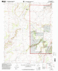
(10)- 1993 Map of Delhi
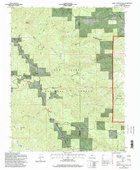
 1993 Delhi1993 Print · USGSThe high plains of the Colorado borderlands are captured here in the early 1990s, where the Santa Fe railroad meets the Comanche National Grassland. Researchers can trace old ranching infrastructure through local landmarks like Barbee Windmill, Hixon Spring, and the small settlement of Delhi.
 - 1994 Map of Beulah, 1998 Print
 1994 Beulah1998 Print · USGSPueblo County at the end of the twentieth century shows a landscape of mountain ranching and forest management. Genealogists and hikers can trace the roads through Beulah, find the Beulah Cem, or locate landmarks like Three R Ranch and Mt Signal.2 unique versions available
 - 1994 Map of Saint Charles Peak, 1998 Print
 1994 Saint Charles Peak1998 Print · USGSThe high country of the Wet Mountains comes into focus in the mid-1990s, where the San Isabel National Forest meets the Pueblo county line. Researchers can trace the Frontier Historic Trail and locate sites like Fairview, Silver Circle, and Saint Charles Peak.
 - 1994 Map of San Isabel, 1998 Print
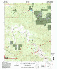 1994 San Isabel1998 Print · USGSThe high Sangre de Cristo foothills and the San Isabel National Forest appear here in the mid-1990s. Researchers can trace the drainage of Greenhorn Creek, locate Rooster Spring, or find early recreational sites like Lazy Acres Camp and Lake Isabel.
 - 1994 Map of Rye, 1998 Print
 1994 Rye1998 Print · USGSRye and Colorado City are shown at the end of the twentieth century as the high plains transition into the Rockies. Genealogists and historians can trace local landmarks like Brookside Cem, the Fish Hatchery, and the Old San Isabel Road.2 unique versions available
 - 1994 Map of Wetmore, 1998 Print
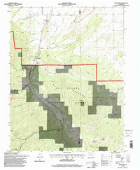 1994 Wetmore1998 Print · USGSThe high country around Wetmore and Greenwood is captured in the mid-nineties as the area transitioned toward modern conservation. Genealogists and researchers can locate Don K Ranch and trace the many forks of Hardscrabble Creek.
 - 1994 Map of Owl Canyon, 1998 Print
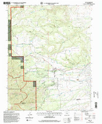
 1994 Owl Canyon1998 Print · USGSThe foothills of the Front Range come into sharp focus in the mid-1990s as the U.S. Forest Service updates the maps of the Colorado high country. Researchers can trace the winding route of Siloam Road and locate remote mines near Owl Canyon.
 - 1996 Map of Snowden Lake, 2000 Print
 1996 Snowden Lake2000 Print · USGSPueblo and Otero counties meet in the mid-1990s within the sprawling ranchlands of the Comanche National Grassland. Researchers can trace vital water infrastructure across this landscape, from the Snowden Lake reservoir to family-named landmarks like North Hixon Well and Kitch Spring.
 - 1996 Map of Delhi, 2000 Print
 1996 Delhi2000 Print · USGSThe high plains of Las Animas County come into focus during the mid-nineties, showing the intersection of ranching infrastructure and historic western routes. Trace the path of the Santa Fe Historic Trail near Delhi and locate family-named landmarks like the Barbee Windmill and Deal Windmill.
 - 1998 Map of Southwest Pueblo, 1999 Print
 1998 Southwest Pueblo1999 Print · USGSThe outskirts of Pueblo at the end of the century reveal a city expanding into the high plains. Genealogists and local historians can locate Mountain View Cemetery and trace landmarks like Beulah Heights Sch and the Old Railroad Grade.2 unique versions available
End of results
Showing maps 1-10 of 10
Top cities of Pueblo County
- Pueblo historical maps
- Pueblo West historical maps
- Colorado City historical maps
- Blende historical maps
- Avondale historical maps
- Salt Creek historical maps
See more
Frequently asked questions
- What are the different types of historical maps available for Pueblo County?
- What is the oldest map of Pueblo County?
- Where can I purchase historical maps of Pueblo County for my home or office?
- Where can I download high-res historical maps of Pueblo County?
- Are there historical topographic maps available for Pueblo County?
- Is there historical aerial imagery available for Pueblo County?
- Where are historical maps of Pueblo County sourced from?