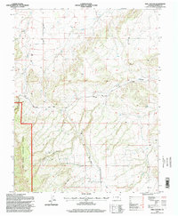
1994 Map of Owl Canyon
USGS Topo · Published 1998About this map
San Isabel National Forest dominates the southwestern portion of this landscape, where the terrain breaks into the dramatic relief of Owl Canyon. This 1994 revision by the U.S. Forest Service reflects a mid-1990s view of the Pueblo and Colorado Springs hinterlands, showing a complex network of seasonal drainages including Red Creek, Rush Creek, and Peck Creek. The map documents early land use through scattered mines and the established path of Siloam Road.
Find a feature on this map
12 named features on this map. Tap any name to fly to it.
Don’t see what you’re looking for? This feature index may not catch every label — zoom into the map to look around manually.
Map Details
Editions of this 1994 Owl Canyon Map
This is the sole edition of this map. No revisions or reprints were ever made.
Other maps of this area

1889 · Canon City
USGS Topo · 1:125,000

1891 · Pueblo
USGS Topo · 1:125,000

1892 · Canon City
USGS Topo · 1:125,000

1894 · Pueblo
USGS Topo · 1:125,000

1896 · Pueblo
USGS Topo · 1:125,000

1897 · Pueblo
USGS Topo · 1:125,000

1954 · Pueblo
USGS Topo · 1:250,000

1957 · Pueblo
USGS Topo · 1:250,000

1958 · Pueblo
USGS Topo · 1:250,000
1959 · Florence SE
USGS Topo · 1:24,000