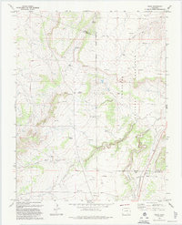
1993 Map of Delhi
USGS Topo · Published 1993About this map
The settlement of Delhi sits along the Santa Fe rail line in a landscape defined by the expansive Comanche National Grassland. This high plains region, straddling the Otero Co Las Animas Co boundary, reflects a ranching and transit economy where water management is paramount. Numerous windmills and reservoirs, such as the Deal Windmill and Lyons Reservoir, are scattered across the terrain to support life in this semi-arid environment. The drainage network of Poitrey Arroyo and Poitrey Canyon cuts through the plains, eventually feeding into Timpas Creek. These natural features, combined with markers like the Radio Tower and various corrals, illustrate the intersection of traditional land use and modern infrastructure at the end of the twentieth century.
Find a feature on this map
24 named features on this map. Tap any name to fly to it.
Don’t see what you’re looking for? This feature index may not catch every label — zoom into the map to look around manually.
Map Details
Editions of this 1993 Delhi Map
This is the sole edition of this map. No revisions or reprints were ever made.
Other maps of this area

1891 · Timpas
USGS Topo · 1:125,000

1891 · Apishapa
USGS Topo · 1:125,000

1893 · Apishapa
USGS Topo · 1:125,000

1894 · Timpas
USGS Topo · 1:125,000

1897 · Apishapa
USGS Topo · 1:125,000

1954 · Trinidad
USGS Topo · 1:250,000

1955 · La Junta
USGS Topo · 1:250,000

1955 · Trinidad
USGS Topo · 1:250,000

1958 · La Junta
USGS Topo · 1:250,000

1958 · Trinidad
USGS Topo · 1:250,000