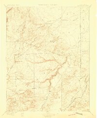
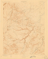
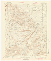
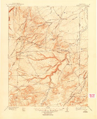
1897 Map of Apishapa
USGS Topo · Published 1897About this map
The Apishapa River carves a deep path through the southeastern Colorado high plains in this late 19th-century survey. The landscape is defined by its early ranching economy, with isolated outposts like the Yellowbank Ranch and Bonito Cordova Ranch marking the vast, arroyo-scored terrain. This era showcases the critical intersection of ancient and modern transit corridors; the legendary Santa Fe Trail and the newer Atchison Topeka and Santa Fe RR both cut through the southern portion of the sheet near the settlement of Thatcher.
Find a feature on this map
38 named features on this map. Tap any name to fly to it.
Don’t see what you’re looking for? This feature index may not catch every label — zoom into the map to look around manually.
Map Details
Editions of this 1897 Apishapa Map
4 editions found
Other maps of this area

1891 · Walsenburg
USGS Topo · 1:125,000

1891 · Catlin
USGS Topo · 1:125,000

1891 · Pueblo
USGS Topo · 1:125,000

1891 · Spanish Peaks
USGS Topo · 1:125,000

1891 · Timpas
USGS Topo · 1:125,000

1891 · Nepesta
USGS Topo · 1:125,000

1891 · Apishapa
USGS Topo · 1:125,000

1891 · Mesa De Maya
USGS Topo · 1:125,000

1892 · Elmoro
USGS Topo · 1:125,000

1893 · Nepesta
USGS Topo · 1:125,000