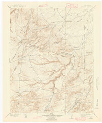
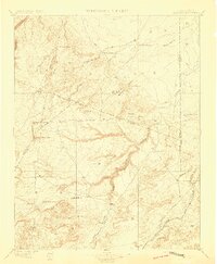
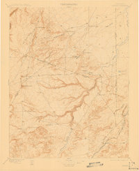
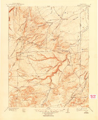
1897 Map of Apishapa
USGS Topo · Published 1941About this map
The Apishapa River carves a deep, winding path through this corner of Southern Colorado, where the transition from high plains to canyon country defined early settlement patterns. Surveyed in the late nineteenth century, the map reveals a landscape dominated by large ranching operations such as the Bonito Cordova Ranch, Yellowbank Ranch, and Juan Baca Ranch. These holdings are scattered among a complex network of arroyos and canyons, including Almagre Canyon and Mustang Creek.
Find a feature on this map
72 named features on this map. Tap any name to fly to it.
Don’t see what you’re looking for? This feature index may not catch every label — zoom into the map to look around manually.
Map Details
Editions of this 1897 Apishapa Map
4 editions found
Other maps of this area

1891 · Walsenburg
USGS Topo · 1:125,000

1891 · Catlin
USGS Topo · 1:125,000

1891 · Pueblo
USGS Topo · 1:125,000

1891 · Spanish Peaks
USGS Topo · 1:125,000

1891 · Timpas
USGS Topo · 1:125,000

1891 · Nepesta
USGS Topo · 1:125,000

1891 · Apishapa
USGS Topo · 1:125,000

1891 · Mesa De Maya
USGS Topo · 1:125,000

1892 · Elmoro
USGS Topo · 1:125,000

1893 · Nepesta
USGS Topo · 1:125,000