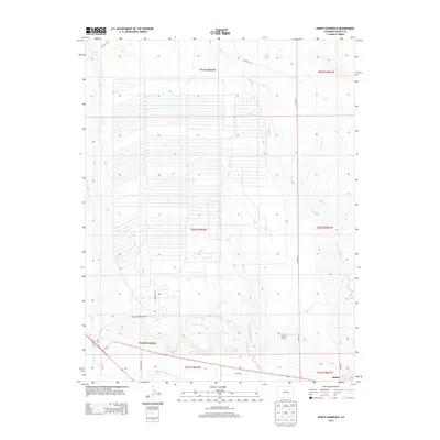
2013 Map of North Avondale
USGS Topo · Published 2013About this map
The Pueblo Ordnance Depot dominates the northern expanse of this quadrangle, its extensive network of storage structures and access roads like Ordnance Ln and Dot Test Rd illustrating the area's significant military logistical footprint. To the south, the landscape transitions to the river valley where the Arkansas River flows near the settlements of North Avondale and Boone. This 2013 survey shows the intersection of high-security government facilities with the local agricultural and aviation infrastructure, exemplified by the small Youtsey Airport situated near the drainage of Boone Cr. Local transportation is defined by long, straight ranch and service roads such as Il Ranch Rd and Avondale Blvd, which provide access through the arid terrain between Haynes Cr and Chico Cr.
Find a feature on this map
22 named features on this map. Tap any name to fly to it.
Don’t see what you’re looking for? This feature index may not catch every label — zoom into the map to look around manually.
Map Details
Editions of this 2013 North Avondale Map
This is the sole edition of this map. No revisions or reprints were ever made.
Other maps of this area

1891 · Nepesta
USGS Topo · 1:125,000

1893 · Nepesta
USGS Topo · 1:125,000

1904 · Nepesta
USGS Topo · 1:125,000

1954 · Pueblo
USGS Topo · 1:250,000

1957 · Pueblo
USGS Topo · 1:250,000

1958 · Pueblo
USGS Topo · 1:250,000

1959 · Highlands Church
USGS Topo · 1:24,000

1959 · North Avondale NE
USGS Topo · 1:24,000
1960 · Nepesta
USGS Topo · 1:24,000
1960 · Boone Hill
USGS Topo · 1:24,000