Old Maps of Pueblo, Colorado for Metal Detecting
Plan your next treasure hunt with 45 historic maps of Pueblo. Find old homesites, ghost towns, trails, and gathering spots that may be lost to time — perfect for identifying promising metal detecting locations.
- Locate forgotten sites: Uncover places like long-lost settlements, abandoned rail lines, or gathering spots.
- Plan better hunts: Use map overlays combined with LiDAR or satellite views to narrow in on historically rich areas.
- Made for detectorists: Thousands of hobbyists use these maps to discover relics, coins, and hidden history.
Use these historic maps to boost your research and find new opportunities beneath the surface of Pueblo.
Pueblo, CO maps
(45)- 1891 Map of Pueblo
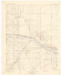
 1891 Pueblo1891 Print · USGSPueblo and the Arkansas River valley are shown here in the late nineteenth century as the region's rail and industrial power surged. Local historians can trace the early footprints of Bessemer, the extensive rail yards of the Missouri Pacific Railroad, and rural landmarks like the Three R Ranch.
 - 1891 Map of Nepesta
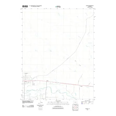
 1891 Nepesta1891 Print · USGSSoutheast Colorado at the close of the 1880s reveals a landscape defined by the arrival of the rails along the Arkansas River. Researchers can trace early ranching sites like Skinner & Tabor Ranch and follow the competing paths of the Atchison Topeka and Santa Fe Railroad and the Missouri Pacific Railroad.
 - 1893 Map of Nepesta
 1893 Nepesta1893 Print · USGSSoutheast Colorado at the close of the nineteenth century is defined here by the arrival of the rails along the Arkansas River. Researchers can trace the early cattle and transit economy through the Skinner & Tabor Ranch, Chico Station, and the village of Nepesta.2 unique versions available
 - 1894 Map of Pueblo, 1957 Print
 1894 Pueblo1957 Print · USGSPueblo and the Arkansas River valley are captured here at a pivotal moment of late-century industrial growth. Researchers can trace early rail corridors and vanished rural landmarks like Three R Ranch, Bessemer Junction, and Glendale.2 unique versions available
 - 1896 Map of Pueblo
 1896 Pueblo1896 Print · USGSPueblo and its surrounding mesas are shown here in the 1890s as a thriving rail and irrigation hub. Genealogists and historians can trace the early layouts of Bessemer Junction, follow the Trinidad Line, or locate the family-owned Three R Ranch near the Hogback Mt.
 - 1897 Map of Pueblo
 1897 Pueblo1897 Print · USGSPueblo and its surrounding plains were a bustling railroad and industrial crossroads in the late nineteenth century. Genealogists and historians can trace the early footprints of Bessemer Junction, the intricate Bessemer Ditch, and family landmarks like the Three R Ranch.4 unique versions available
 - 1904 Map of Nepesta
 1904 Nepesta1904 Print · USGSEastern Colorado at the turn of the century shows a landscape transformed by water and rail. Trace the irrigation network of Excelsior Ditch and the lineage of family outposts like Skinner and Tabor Ranch and Tolle Ranch.3 unique versions available
 - 1954 Map of Pueblo, 1966 Print
 1954 Pueblo1966 Print · USGSMid-century Colorado comes alive in this survey of the Front Range and the high plains as the region expanded after the war. Genealogists and historians can trace family roots through rural landmarks like Hanover Church, Pioneer Cemetery, and the Grandview School.3 unique versions available
 - 1957 Map of Pueblo
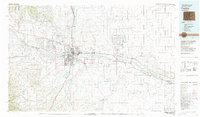
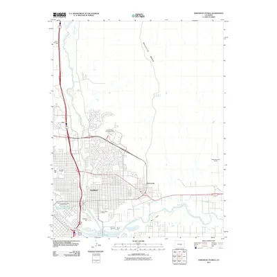
 1957 Pueblo1957 Print · USGSMid-century Colorado comes alive as the Front Range urban centers expand alongside massive Cold War military installations. Genealogists and historians can trace the foundations of Stone City, rural sites like Hanover School, and the industrial Canon Imperial Mine.
 - 1958 Map of Pueblo
 1958 Pueblo1958 Print · USGSColorado's Front Range and Arkansas River Valley come alive in the late fifties, showing the transition from historic mining districts to major military and rail hubs. Genealogists and historians can trace family roots in ranching communities and find landmarks like Cripple Creek, Manitou, and the Hanover School.
 - 1960 Map of Devine, 1963 Print
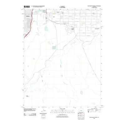
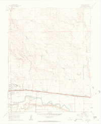 1960 Devine1963 Print · USGSThe Pueblo County desert meets the industrial rail corridor of the early 1960s, centered on the Arkansas River. Researchers can trace old railway alignments through Baxter and Devine or locate the sprawling grounds of the Pueblo Ordnance Depot.5 unique versions available
 - 1960 Map of Southeast Pueblo, 1963 Print
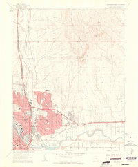
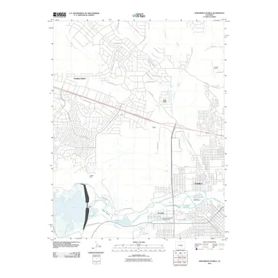
 1960 Southeast Pueblo1963 Print · USGSSoutheastern Pueblo is shown during a period of significant suburban and industrial growth in the early sixties. Researchers can trace the rail lines of the D & R G W or locate specific landmarks like Roselawn Cemetery and the community of Lombard Village.6 unique versions available
 - 1961 Map of Northwest Pueblo, 1962 Print
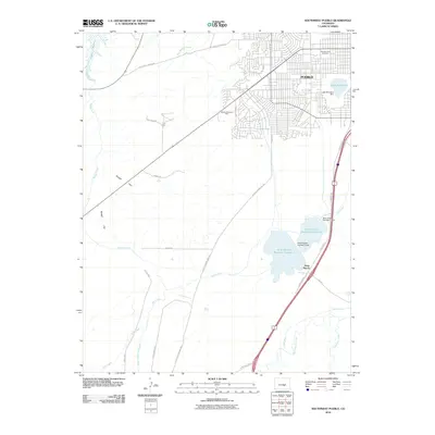
 1961 Northwest Pueblo1962 Print · USGSPueblo and its western outskirts are captured here in the early sixties as the city expanded along the river. Genealogists and local historians can trace the neighborhood footprints of Goodnight, the grounds of the State Fairground, and numerous local schools like Morton Sch.11 unique versions available
 - 1961 Map of Southwest Pueblo, 1963 Print
 1961 Southwest Pueblo1963 Print · USGSThe southwestern edge of Pueblo is captured here during the early sixties as suburban neighborhoods pushed into the high plains. Local historians can trace the foundations of the community through the State Fairgrounds, the Mountain View Cemetery, and the Old Railroad Grade.7 unique versions available
 - 1961 Map of Northeast Pueblo, 1963 Print
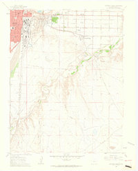
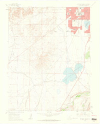
 1961 Northeast Pueblo1963 Print · USGSPueblo was entering a decade of significant growth when this survey recorded its shifting industrial and residential borders. Trace the city's mid-century expansion through names like Belmont, Fearnowville, and the grounds of the Pueblo Memorial Airport.7 unique versions available
 - 1962 Map of Pueblo
 1962 Pueblo1962 Print · USGSThe Front Range and high plains meet in the early sixties as military installations and industrial mining shape the corridor from Colorado Springs to Pueblo. Genealogists can trace family names through rural landmarks like the Columbine School, Hanover Church, and Fairview Cem.
 - 1966 Map of Pueblo
 1966 Pueblo1966 Print · USGSThe Front Range and Arkansas River Valley are captured here in the mid-1960s, showing a landscape shaped by mining, military expansion, and rail. Researchers can locate numerous country schools and mines, such as the Lytle School, Pioneer Cem, and Empire Zinc Mine.
 - 1981 Map of Pueblo
 1981 Pueblo1981 Print · USGSThe Arkansas River valley comes into sharp focus during the early eighties, showing the expansion of Pueblo and its rail networks. Researchers can trace historic sites like Fort Reynolds, explore the Pueblo Ordnance Depot, and locate family burial plots in Roselawn Cemetery.
 - 1989 Map of Pueblo
 1989 Pueblo1989 Print · USGSIn the late eighties, the Colorado Front Range balanced its deep mining history with massive military expansion and water development. Researchers can trace the rail lines of the AT & SF RR or locate remote high-altitude settlements like Rosita and Querida.
 - 1998 Map of Southwest Pueblo, 1999 Print
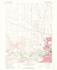
 1998 Southwest Pueblo1999 Print · USGSThe outskirts of Pueblo at the end of the century reveal a city expanding into the high plains. Genealogists and local historians can locate Mountain View Cemetery and trace landmarks like Beulah Heights Sch and the Old Railroad Grade.2 unique versions available
 - 2010 Map of Southeast Pueblo, 2010 Print
 2010 Southeast Pueblo2010 Print · USGSCovers Pueblo, including Blende, Salt Creek, and other nearby areas
 - 2010 Map of Northwest Pueblo, 2010 Print
 2010 Northwest Pueblo2010 Print · USGSCovers Pueblo, including Pueblo West, Wild Horse, and other nearby areas
 - 2010 Map of Devine, 2010 Print
 2010 Devine2010 Print · USGSCovers Pueblo, including Baxter, Nyberg, and other nearby areas
 - 2010 Map of Southwest Pueblo, 2010 Print
 2010 Southwest Pueblo2010 Print · USGSCovers Pueblo, including Stem Beach, Pueblo County, and other nearby areas
 - 2010 Map of Northeast Pueblo, 2010 Print
 2010 Northeast Pueblo2010 Print · USGSCovers Pueblo, including Eden, Fearnowville, and other nearby areas
Showing maps 1-25 of 45
Top cities near Pueblo
Top neighborhoods of Pueblo
- Eden historical maps
- Fearnowville historical maps
- Baxter historical maps
- Northside historical maps
- Sunnyheights historical maps
- Aberdeen historical maps
See more
Frequently asked questions
- What are the different types of historical maps available for Pueblo?
- What is the oldest map of Pueblo?
- Where can I purchase historical maps of Pueblo for my home or office?
- Where can I download high-res historical maps of Pueblo?
- Are there historical topographic maps available for Pueblo?
- Is there historical aerial imagery available for Pueblo?
- Where are historical maps of Pueblo sourced from?